Newfoundland
Landing at Gander, Deer Lake or St. John's?
Newfoundland, on Canada's Atlantic coast — three airports, the far two 3h 56m apart. Tap yours, or tap what you came for.
Plan on a rental car. 70 routes measured, 66 from a terminal door, checked August 27, 2026.
Where the road ends, the trip begins
Six picks to start, three from each door. Touch any filter and this list becomes the map: every matching route, wearing the same number as its dot, shortest first.
- 55 min · from Deer Lake
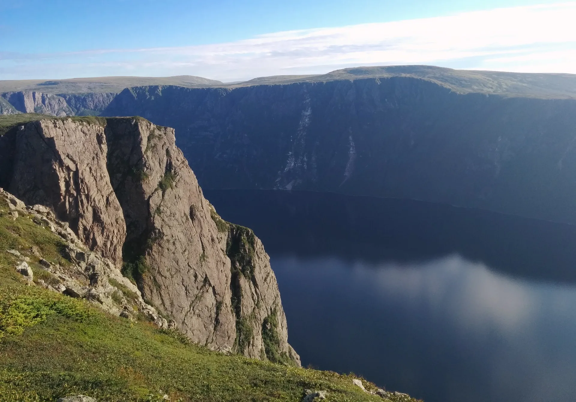 FreeDoum · CC BY-SA 4.0
Gros Morne (Rocky Harbour)
A fjord sealed into the mountains, and bare orange rock that used to be the Earth's mantle. UNESCO-listed, and nearly empty by any park's standards.
- 1h 21m + ferry · from Gander
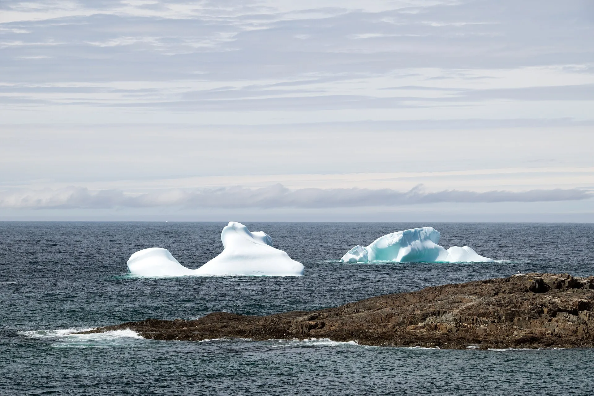 Paul Asman and Jill Lenoble · CC BY 2.0
Fogo Island
A ferry, an island of artists and fishing crews, and a headland the Flat Earth Society calls one of the four corners of the Earth.
- 58 min · from Deer Lake
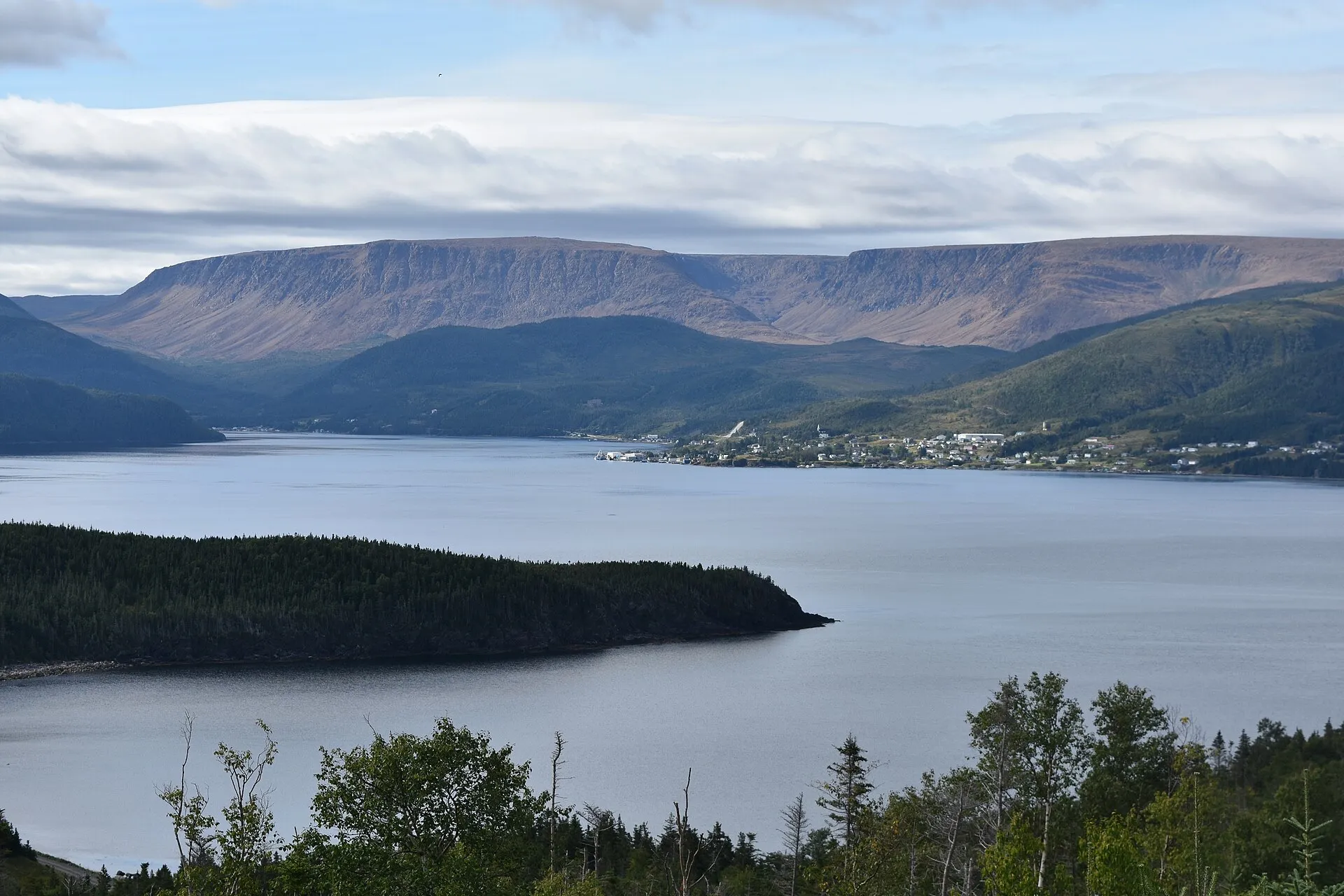 Adavyd · CC BY-SA 4.0
Woody Point
A heritage waterfront looking across Bonne Bay at the Tablelands — the far side of Gros Morne most visitors miss.
- 1h 21m + ferry · from Gander
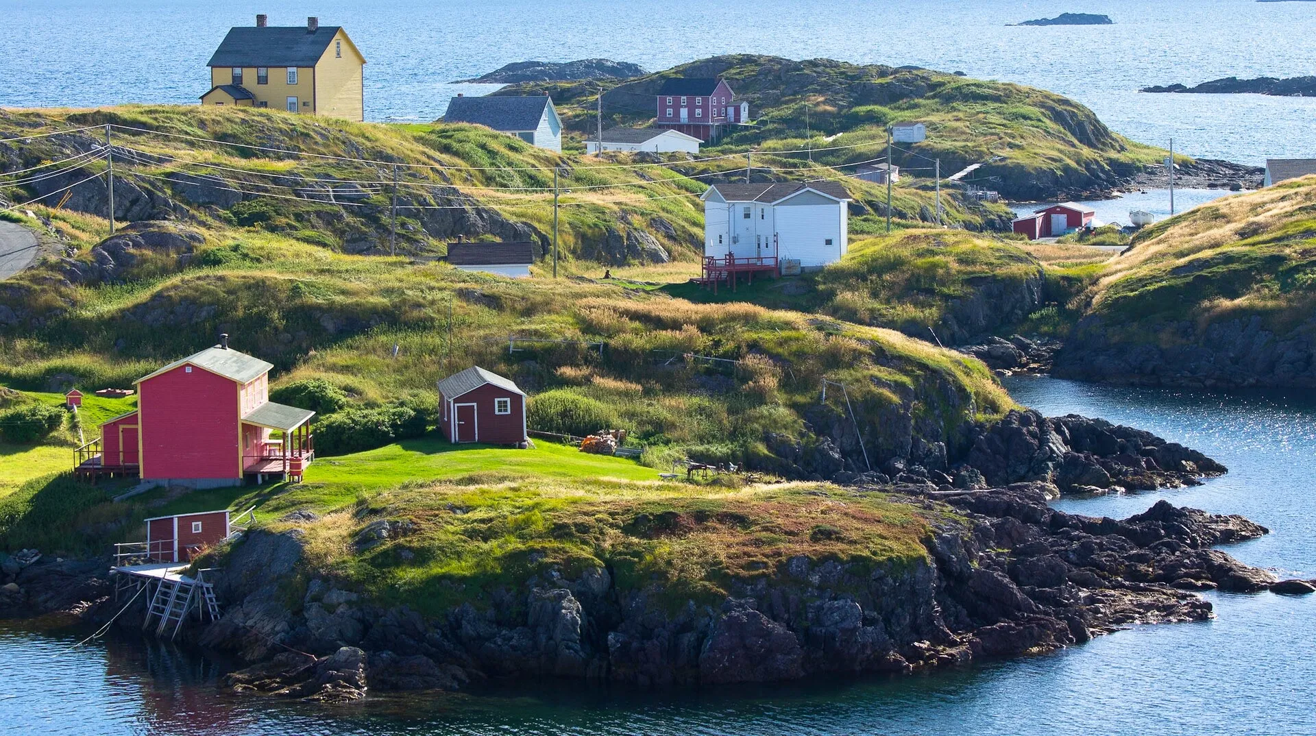 Stephen Booth · CC0 1.0
Change Islands
The outport as it was: saltboxes, stages, wooden boats, and a pony sanctuary keeping the island's own breed alive.
- 3h 1m · from Deer Lake
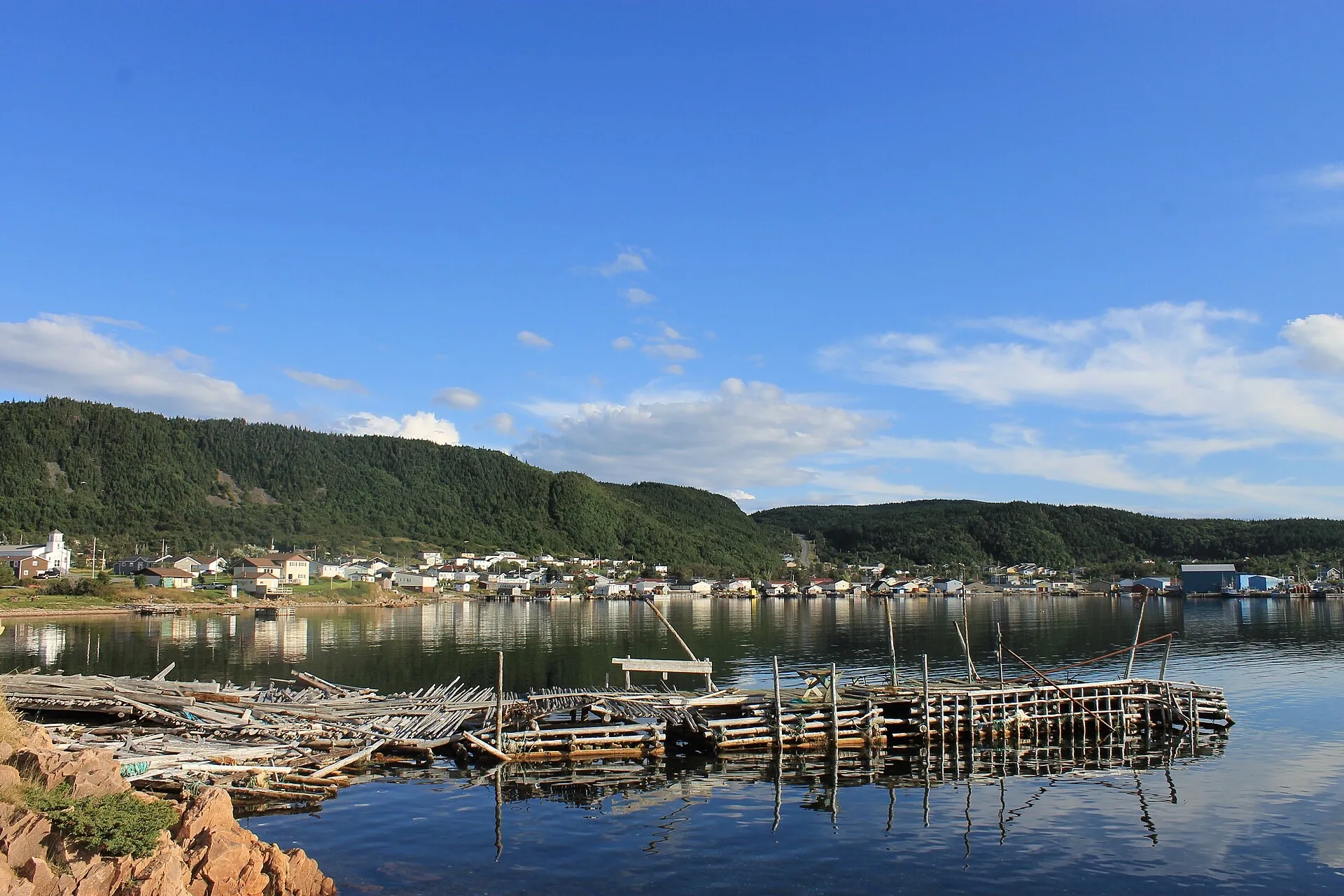 Scio c · CC BY-SA 4.0
La Scie
The end of Route 414: a harbour town on the open Atlantic, and one of the iceberg-viewing spots the province names.
- 1h 48m · from Gander
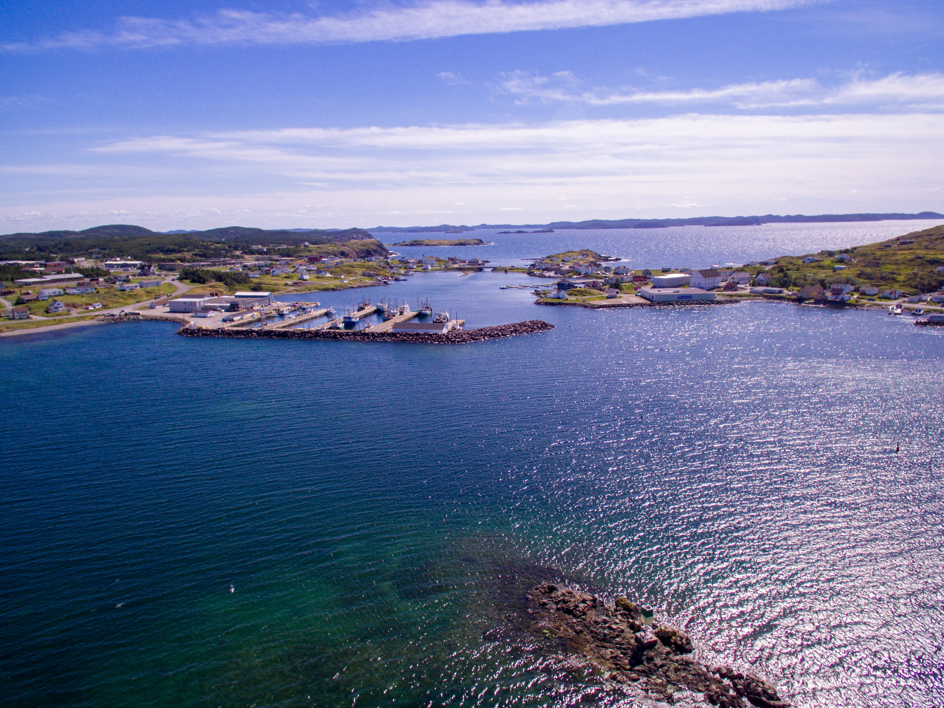 Shhewitt · CC BY-SA 4.0
Twillingate
Iceberg Alley's front-row town — glacial ice off the headlands in spring, the province's count of ten thousand humpbacks behind it.
Portugal Cove ferry terminal
15 min + ferry · from St. John's
Portugal Cove ferry terminal, for the Bell Island ferry, is 10.6 km and about 15 minutes from St. John's airport via Route 40.
Codroy Valley
34 min · from Port aux Basques
Off the boat at Port aux Basques, the Codroy Valley is 40 km and about 34 minutes on the Trans-Canada and Route 407 — the one short drive from that dock.
Cape Spear
34 min · from St. John's
St. John's Airport to Cape Spear: 23.5 km and 34 minutes on Routes 40 and 11, out to the National Historic Site on Canada's most easterly point of land.
Marble Mountain
39 min · from Deer Lake
You land at Deer Lake and Marble Mountain is 47 km southwest. 39 minutes on the Trans-Canada down the Humber Valley to the base lodge at Steady Brook.
Witless Bay
46 min · from St. John's
St. John's airport to Witless Bay: 45.6 km and about 46 min, on Routes 40, 2, 3 and 10 down the Southern Shore Highway.
Corner Brook
47 min · from Deer Lake
You land at Deer Lake and Corner Brook is 57 km southwest. About 47 minutes down the Humber Valley to the west coast's city and Captain Cook's lookout.
Lewisporte
53 min · from Gander
You land at Gander and Lewisporte is 63 km north-west. About 53 minutes: the Trans-Canada west, then Routes 340 and 341 north to the bay.
Salmonier Nature Park
57 min · from St. John's
Salmonier Nature Park is a 57-minute, 68 km drive from St. John's airport: Route 40, the Trans-Canada southwest, then Route 90, the Salmonier Line.
Terra Nova
1h 3m · from Gander
A national park an hour from Gander: 77.8 km, straight down the Trans-Canada, with no ferry and no season to plan around.
Lewisporte
1h 9m
Off the Fogo and Change Islands ferry, Lewisporte is 74 km and about 1h09 on Routes 335, 331, 340 and 341 — the road home from the boat.
Brigus
1h 9m · from St. John's
St. John's Airport to Brigus is 75 km and 69 minutes on Routes 40, 1, 2 and 60 — a short Avalon drive to a National Historic Site town.
Cape St. Mary's
1h 13m · from Argentia
Off the boat at Argentia, Cape St. Mary's is 71 km and about 1h13 straight down Route 100 — less than half the drive from the nearest airport.
Botwood
1h 15m · from Gander
92.1 km and about 1h15 to the town where the transatlantic flying boats landed — the other half of the story Gander airport is famous for.
Dover
1h 15m · from Gander
You land at Gander and Dover is 73 km northeast. About 1h15 via Routes 1 and 320 to the mapped fault line where two ancient continents meet.
Grand Falls-Windsor
1h 17m · from Gander
98.3 km and about 1h17 straight down the Trans-Canada — the largest town between the two airports, and the one with everything open.
St. Brendan's
1h 19m + ferry · from Gander
94.3 km and about 1h19 to the Burnside wharf — nearer than Twillingate — then an hour on the water to an island almost nobody plans for.
Salvage
1h 21m · from Gander
You land at Gander and Salvage is 97 km southeast. About 1h21 via Routes 1 and 310 — through the Eastport beaches to one of the oldest fishing villages on the coast.
Ferryland
1h 24m · from St. John's
St. John's airport to Ferryland: 86 km and about 1h24, on Routes 40, 2, 3 and 10 down the Irish Loop to the Colony of Avalon.
Harbour Grace
1h 24m · from St. John's
The drive from St. John's airport to Harbour Grace is 107.5 km, about 84 minutes, on Routes 40, 1, 75 and 70 around Conception Bay.
Musgrave Harbour
1h 25m · from Gander
You land at Gander and the Straight Shore is 91 km northeast. About 1h25 on Route 330 — one road, no turns to argue about, and kilometres of mapped beach at the end.
Cow Head
1h 36m · from Deer Lake
You land at Deer Lake and Cow Head is 119 km north. About 1h36 up Route 430 through Gros Morne to the park's quieter northern shore and Shallow Bay's sand.
Placentia
1h 43m · from St. John's
St. John's Airport to Placentia is 132 km and about 1h43, on Routes 40, 1 and 100 — to the old French and English capital of Newfoundland.
King's Point
1h 45m · from Deer Lake
132.7 km and about 1h45 from Deer Lake — the closest call between the two airports on this site, and where the coast's best-known trail is.
Heart's Content
1h 49m · from St. John's
Heart's Content is 132 km and about 1h49 from St. John's Airport, via the Trans-Canada then Routes 75, 70, 74 and 80 up the west side of Conception Bay.
New-Wes-Valley
1h 56m · from Gander
You land at Gander and New-Wes-Valley is 119 km northeast. About 1h56 via Routes 1 and 320 to Wesleyville's amalgamated coast, with the Newtown spur beyond.
Clarenville
1h 57m · from Gander
Clarenville is 147 km and about 1h57 from Gander on Routes 330 and 1 — Gander is the closest of the three airport doors.
White Hills
2h · from Gander
Gander to the White Hills ski resort at Clarenville: 148 km and about 2 hours on the Trans-Canada, and the nearest airport door to the hill.
Greenspond
2h 6m · from Gander
You land at Gander and Greenspond is 124 km northeast. About 2h06 via Routes 1 and 320 to an island outport joined to the coast by causeway.
Leading Tickles
2h 10m · from Gander
You land at Gander and Leading Tickles is 148 km northwest. About 2h10 on the Trans-Canada and Route 350, up the peninsula that walls the Bay of Exploits.
Baie Verte
2h 16m · from Deer Lake
Baie Verte is 159 km from Deer Lake, about 2h16 on the Trans-Canada and Route 410 — and an hour and a half closer than flying into Gander.
Mistaken Point
2h 17m · from St. John's
St. John's airport to Mistaken Point is 144 km and about 2h17, on Routes 40, 2, 3 and 10 — the last of them the Irish Loop Drive.
Long Island
2h 22m + ferry · from Deer Lake
171 km and about 2h22 from Deer Lake to the Pilley's Island wharf, then a short crossing to Long Island on a sixteen-car boat.
Triton
2h 24m · from Deer Lake
You land at Deer Lake and Triton is 174 km northeast. About 2h24 on the Trans-Canada and Route 380, island-hopping by causeway into the middle of Green Bay.
Clarenville
2h 28m · from St. John's
From St. John's Airport, Clarenville is 191 km and about 2h28 on Route 40 then the Trans-Canada (Route 1) — the one destination on this site where Gander is the closer door.
Trepassey
2h 28m · from St. John's
Trepassey is 155.9 km and about 2h28 south of St. John's Airport: Routes 40, 2 and 3 out of the city, then Route 10, the Irish Loop Drive.
Cape St. George
2h 42m · from Deer Lake
You land at Deer Lake and Cape St. George is 188 km southwest. About 2h 42m through Stephenville to the island's French Shore — the peninsula where Newfoundland speaks French and the cliffs face Quebec.
King's Point
2h 42m · from Gander
King's Point is 207 km and 162 minutes from Gander via the Trans-Canada (1) and Routes 390 and 391 to Green Bay.
Grand Falls-Windsor
2h 45m · from Deer Lake
212.8 km and about 2h45 east on the Trans-Canada (Route 1) — Gander is far closer for this town.
Cape St. Mary's Ecological Reserve
2h 47m · from St. John's
Cape St. Mary's is 176 km and about 2h47 southwest of St. John's airport — Route 40 to the Trans-Canada, then 90, 91, 92 and 100 down the Cape Shore.
Trinity (Trinity Bay)
2h 50m · from Gander
You land at Gander and Trinity is 200 km southeast. About 2h50 via Routes 1, 230 and 239 to the saltbox town everyone tells you to see — and they're right.
Pilley's Island
2h 59m · from Gander
220 km and about 2h59 from Gander to the Pilley's Island ferry terminal, via the Trans-Canada and Routes 380 and 382.
Port au Choix
3h 3m · from Deer Lake
You land at Deer Lake and Port au Choix is 236 km north. About 3h 3m up the Viking Trail to six thousand years of archaeology on one limestone point — with The Arches' sea-carved rock on the way.
Triton
3h 3m · from Gander
Triton is 224 km from Gander airport, about 183 minutes west on the Trans-Canada (Route 1) then north on Route 380.
Botwood
3h 9m · from Deer Lake
Botwood sits across the island from Deer Lake — about 3h09 east on the Trans-Canada, then Route 350 north. From Gander it is far closer.
St. Alban's
3h 27m · from Gander
You land at Gander and the south coast is 235 km away. About 3h27 on the Trans-Canada and Route 360 — the long road to Bay d'Espoir, and the only door this site has to the south.
Port aux Basques
3h 28m + ferry · from Deer Lake
You land at Deer Lake and Port aux Basques is 271 km southwest. About 3h 28m down the whole west coast — the Codroy Valley's bird wetlands, Wreckhouse's famous wind, and the island's sea door at the end.
Lewisporte
3h 33m · from Deer Lake
Lewisporte sits across the island from Deer Lake — about 3h33 east on the Trans-Canada, then Routes 340 and 341 north. From Gander it is far closer.
Road to the Isles
3h 34m
The Road to the Isles measured as a circuit: 221.8 km and about 3h34 from Notre Dame Junction to Twillingate and back, on Routes 340 and 345.
Cape Bonavista
3h 45m · from Gander
You land at Gander and Cape Bonavista is 248 km east. About 3h45 to the lighthouse at the road's true end — puffins, the Dungeon and five centuries of shore on the way.
Burgeo
3h 48m + ferry · from Deer Lake
You land at Deer Lake and Burgeo is 266 km south. About 3h48, most of it Route 480 through empty country, ending at the Sandbanks' long beaches.
Baccalieu Coastal Drive
3h 53m
The Baccalieu Coastal Drive measured as a circuit: 238.5 km and about 3h53 from Whitbourne around the peninsula between Trinity and Conception Bays.
Hermitage
4h 4m + ferry · from Gander
You land at Gander and Hermitage is 276 km south. About 4h04 via Routes 1, 360 and 364 to the wharf where the Gaultois ferry crosses to a road-free outport.
Harbour Breton
4h 9m · from Gander
You land at Gander and Harbour Breton is 280 km south. About 4h09 via Routes 1 and 360 — the long interior road to the Connaigre coast's principal town.
Irish Loop
4h 18m
The Irish Loop measured as a circuit: 266.3 km and about 4h18 from Bay Bulls round the southern Avalon by Routes 10 and 90, and back.
Discovery Trail
4h 29m
The Discovery Trail measured as a circuit: 252.2 km and about 4h29 from Clarenville out to Trinity, Cape Bonavista and Elliston, and back.
Roddickton
4h 37m · from Deer Lake
Deer Lake to Roddickton: 351 km and about 4h37 by Routes 430, 432 and 433 into Canada Bay — one of the remotest drives measured from either door.
Road to the Shore
4h 50m
The Road to the Shore measured as a circuit: 286.4 km and about 4h50 from Gambo out to Musgrave Harbour, New-Wes-Valley and Greenspond, and back.
Lewisporte
5h 8m · from St. John's
From St. John's Airport, Lewisporte is 395 km and about 5h08 — Route 40, the Trans-Canada, then Routes 340 and 341. Gander is by far the nearer door.
Fortune
5h 28m + ferry · from Gander
You land at Gander and Fortune is 378 km south. About 5h 28m down the Burin Peninsula to the wharf where a ferry leaves Canada for France — with half a billion years of geology at the headland beside it.
L'Anse aux Meadows
5h 51m · from Deer Lake
You land at Deer Lake and L'Anse aux Meadows is 436 km north. About 5h51 up Routes 430 and 436 — the full Viking Trail, past Gros Morne, to the Norse site at the island's tip.
Cobb's Pond Loop
trail · 3.2 km · 0 m climb
trailhead 8 min · from Gander
Edgar Baird Lakeside
trail · 2.1 km · 96 m climb
trailhead 15 min · from Gander
Deadmans Bay Path
trail · 9.8 km · 427 m climb
trailhead 27 min · from St. John's
Eelbrook Hiking
trail · 2.5 km · 74 m climb
trailhead 45 min · from Gander
Spout Path
trail · 15.1 km · 759 m climb
trailhead 45 min · from St. John's
Gros Morne Mountain
trail · 12.1 km · 837 m climb
trailhead 49 min · from Deer Lake
Cardio Climb
trail · 3.8 km · 191 m climb
trailhead 50 min · from Deer Lake
Carmanville Wetlands Main Line
trail · 1.5 km · 0 m climb
trailhead 60 min · from Gander
Woody Point Lookout
trail · 1.1 km · 54 m climb
trailhead 60 min · from Deer Lake
Gill's Point
trail · 4.1 km · 10 m climb
trailhead 62 min · from Gander
Goowiddy Path
trail · 3.8 km · 80 m climb
trailhead 64 min · from Gander
Mount Stamford Look-off
trail · 1.1 km · 99 m climb
trailhead 64 min · from Gander
Tablelands
trail · 2 km · 73 m climb
trailhead 64 min · from Deer Lake
Tablelands Off-Trail (plateau)
trail · 9 km · 501 m climb
trailhead 64 min · from Deer Lake
Outport
trail · 11.9 km · 206 m climb
trailhead 66 min · from Gander
Green Gardens
trail · 4.6 km · 88 m climb
trailhead 70 min · from Deer Lake
High Tide Trail (Eastport)
trail · 1.3 km · 12 m climb
trailhead 71 min · from Gander
Ochre Hill
trail · 2.2 km · 58 m climb
trailhead 73 min · from Gander
Peter's River Hiking
trail · 2.5 km · 28 m climb
trailhead 73 min · from Gander
Eastern Point Trail (Woody Point)
trail · 1.2 km · 47 m climb
trailhead 75 min · from Deer Lake
Snug Harbour
trail · 7.2 km · 88 m climb
trailhead 76 min · from Deer Lake
Trout River Pond
trail · 7 km · 162 m climb
trailhead 76 min · from Deer Lake
Western Brook Pond Rim
trail · 12.1 km · 725 m climb
trailhead 76 min · from Deer Lake
Coastal Ridge
trail · 13.1 km · 531 m climb
trailhead 82 min · from Gander
Purcell's Harbour to Little Harbour
trail · 2.3 km · 96 m climb
trailhead 101 min · from Gander
Alexander Murray
trail · 6.2 km · 345 m climb
trailhead 103 min · from Deer Lake
Lower Little Harbour
trail · 2.4 km · 120 m climb
trailhead 103 min · from Gander
Black Rock Trail (Twillingate)
trail · 1.1 km · 17 m climb
trailhead 104 min · from Gander
Minty's Farm
trail · 2.3 km · 0 m climb
trailhead 105 min · from Gander
Indian Lookout
trail · 1 km · 16 m climb
trailhead 111 min · from Gander
Back Bay
trail · 1.8 km · 75 m climb
trailhead 112 min · from Gander
Caribou
trail · 2.6 km · 54 m climb
trailhead 112 min · from Deer Lake
Shoreline
trail · 5.8 km · 5 m climb
trailhead 114 min · from Gander
Codjacks Cove
trail · 1.6 km · 89 m climb
trailhead 116 min · from Gander
Greenspond Island Walk
trail · 3.7 km · 42 m climb
trailhead 126 min · from Gander
Newtown Boardwalk Walk
trail · 1.7 km · 0 m climb
trailhead 129 min · from Gander
Trail to Morry's Cove
trail · 1.8 km · 95 m climb
trailhead 166 min · from Gander
Waterman's Brook
trail · 4 km · 96 m climb
trailhead 169 min · from Gander
Lion's Den
trail · 4.2 km · 126 m climb
trailhead 172 min · from Gander
Pilley's Island Lookout
trail · 2.3 km · 90 m climb
trailhead 173 min · from Gander
Fogo Head
trail · 2.1 km · 98 m climb
trailhead 175 min · from Gander
MAD Trail (Fogo)
trail · 2.6 km · 36 m climb
trailhead 176 min · from Gander
Joe Batt's Point
trail · 2.3 km · 7 m climb
trailhead 177 min · from Gander
Turpin's Trail West
trail · 5 km · 64 m climb
trailhead 178 min · from Gander
Wild Cove Path (Fogo)
trail · 3.2 km · 36 m climb
trailhead 179 min · from Gander
Oliver's Cove
trail · 2.8 km · 13 m climb
trailhead 181 min · from Gander
Starlight
trail · 2.4 km · 320 m climb
trailhead 182 min · from Deer Lake
Smokey Cape
trail · 1.2 km · 20 m climb
trailhead 202 min · from Deer Lake
Harvey's
trail · 2.9 km · 22 m climb
trailhead 223 min · from Deer Lake
Aaron's Arm
trail · 2.6 km · 72 m climb
trailhead 225 min · from Deer Lake
Sandbanks Beaches Loop
trail · 4.5 km · 16 m climb
trailhead 236 min · from Deer Lake
Traditional Trail to Piccaire
trail · 2.2 km · 61 m climb
trailhead 236 min · from Gander
Hermitage-Sandyville Walking
trail · 1.5 km · 23 m climb
trailhead 245 min · from Gander
Dead Man's Cove
trail · 3.1 km · 57 m climb
trailhead 250 min · from Gander
Grand Bank Cape
trail · 3.7 km · 90 m climb
trailhead 325 min · from Gander
Lighthouse Coastal
trail · 1.6 km · 19 m climb
trailhead 335 min · from Gander
Lighthouse
trail · 2.7 km · 104 m climb
trailhead 336 min · from Gander
Great Dansik Cove
trail · 4.1 km · 34 m climb
trailhead 340 min · from Gander
Pepsi Centre
rink · via Corner Brook
at the door 52 min · from Deer Lake
Mike Austin Arena
rink · via Lewisporte
at the door 55 min · from Gander
Pat O'Reilly Memorial Arena
rink · via Botwood
at the door 78 min · from Gander
Joe Byrne Memorial Stadium
rink · via Grand Falls-Windsor
at the door 81 min · from Gander
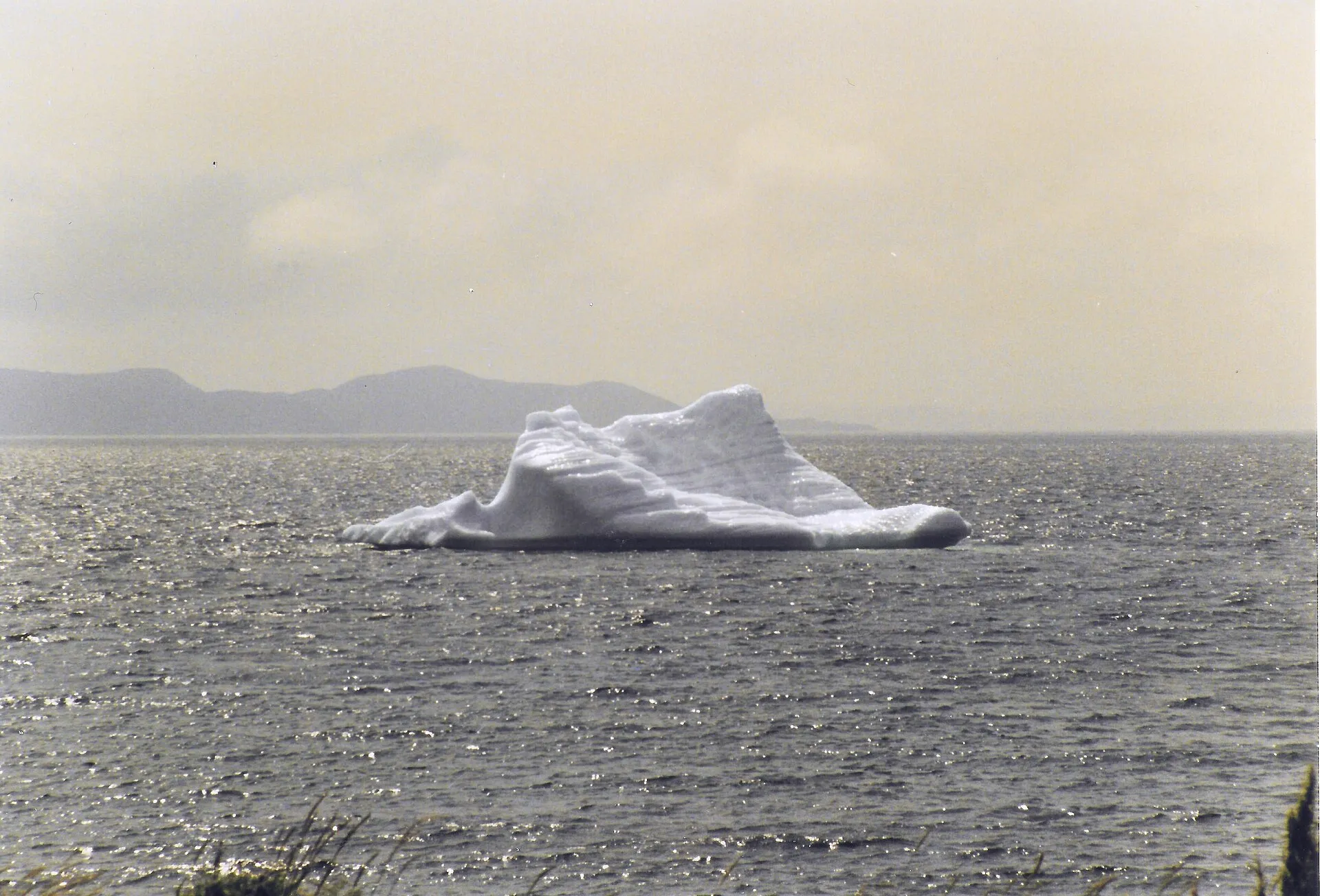
Or start from what you came to do
- Icebergs4 routes · 1h 21m–3h 1m · the viewing spots, measured →
- Whales6 routes · 34 min–3h 45m · the shore spot the province names →
- Ferries7 routes · 15 min–4h 4m · and what to do when the boat doesn't sail →
- Hiking11 routes · 58 measured trails · 34 min–2h 45m · routes with a named trail →
- Heritage40 routes · 34 min–5h 51m · towns where someone kept something →
- Camping12 routes · 1h 3m–5h 51m · campgrounds that actually exist on the page →
- Beaches5 routes · 1h 21m–4h 50m · see the routes →
- Downhill2 routes · 39 min–2h · see the routes →
- Cross-country3 routes · 47 min–1h 17m · see the routes →
- Skating4 routes · 47 min–1h 17m · the rink is the dot, schedules are the town's →
- Lighthouses6 routes · 34 min–4h 29m · see the routes →
- Birds9 routes · 46 min–4h 50m · see the routes →
- Stargazing1 route · 1h 3m · see the routes →
- Harbours3 routes · 1h 48m–2h 50m · see the routes →
- Small planes1 route · 3h 3m · see the routes →
Kayaking and snowmobiling are not on this list because we have measured nothing for them yet — we would rather leave them off than guess. Fishing and hunting are not drives at all: their licence rules are written down below.
Before you pick a destination
- Landing at Gander or Deer Lake
- Where to see icebergs near Gander
- Getting wheels at the doors
- Where to base yourself for icebergs and Fogo
- Change Islands
- The Baie Verte Peninsula
- Twillingate
- When the boat doesn't sail
- Fishing here: the licences, the rivers, the rules
- Hunting as a non-resident: the law, plainly
- Stargazing from the doors
- Harbours from the doors
- Snowmobiling: the railbed runs past both doors
- What to wear and carry on this coast
- Driving here on your home licence
- Flying yourself in: the island's small strips and seaplane bases
- Talk like you've been here before
- The UNESCO sites, measured from the doors
- The provincial parks, measured
Why trust the numbers
Every distance, coordinate and drive time carries the source it came from and the date it was checked. Anything that genuinely changes — iceberg sightings, ferry schedules, road conditions — is linked to the people who keep it current, never copied here to go stale.
66 routes measured from the terminal doors. See every destination from all three airports →
Run a place to stay, a tour, or a town page here? The measured maps are free to put on your own site — for partners →