Deer Lake Airport (YDF) to Cow Head and northern Gros Morne
- Distance
- 118.5 km
Use another map app
Apple Maps · Google Maps · Organic Maps · OsmAnd (both work offline, no tracking) · Waze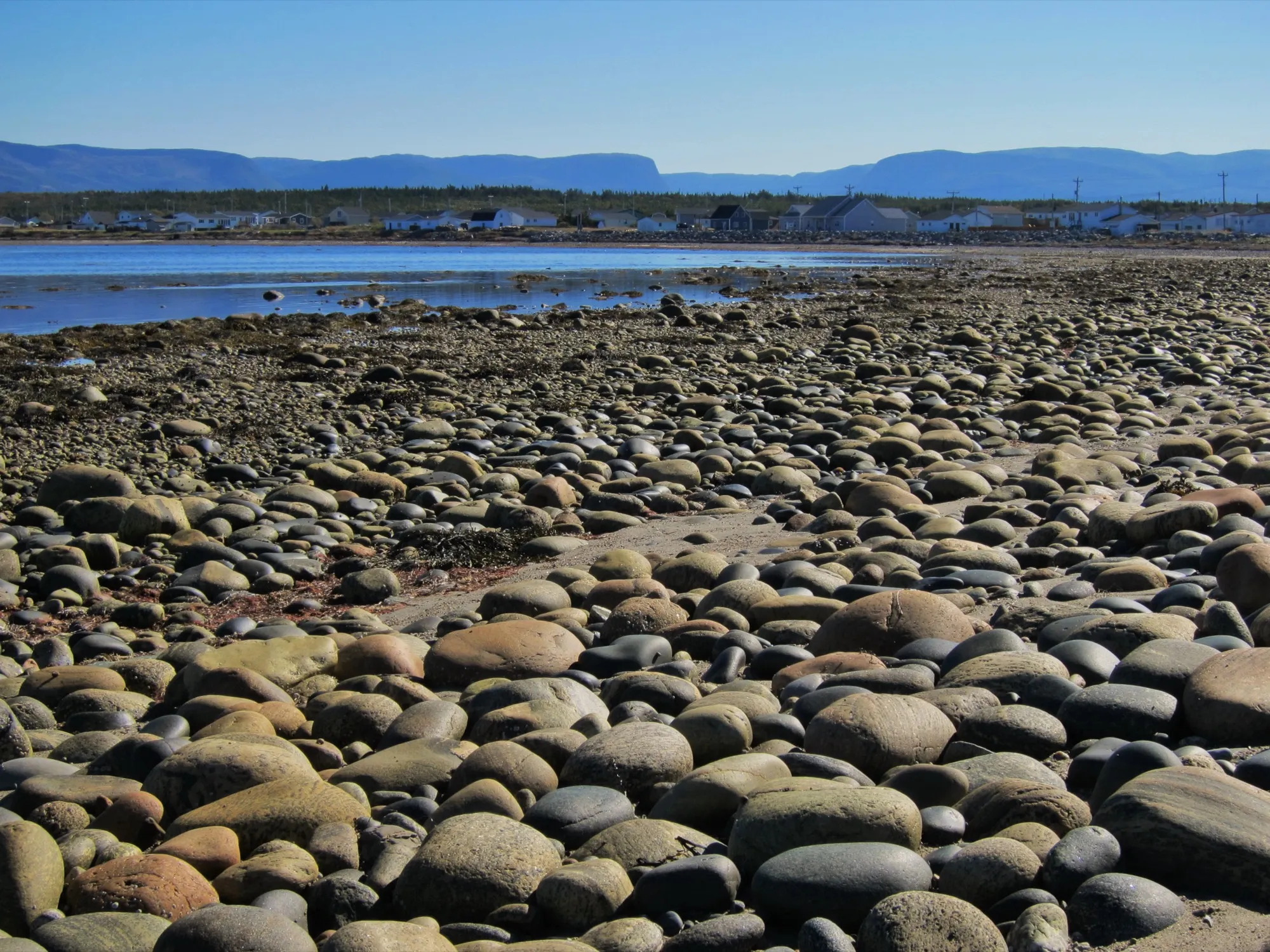

Places to stay in Cow Head
No place to stay in Cow Head is listed on Best Kind Stays yet. Every place it lists →
A place listed in Cow Head shows on 12 pages here: 6 drives to Cow Head, 1 arena or stage and 5 trails nearby.
Own a place in Cow Head? List it, free →
Guests book with you directly. Nothing paid changes the order.
Stop 1: Gros Morne Visitor Information Centre
The park's main entrance, early in the drive. Most of this drive is inside Gros Morne, and the centre explains the park.
Stopping here adds 0.8 km to the drive.
Directions →Show on map: Gros Morne Visitor Information Centre ↑Other map apps
Apple · Google · Organic Maps · OsmAnd (both work offline, no tracking) · WazeStop 2: Lobster Cove Head LighthouseDetour
A century-old lighthouse on the headland at Rocky Harbour, with Parks Canada's exhibit on the people of the coast inside and short trails out to the rocks and the open sea. Parks Canada calls it the place for sunsets; the exhibit keeps a summer season, on its page.
Stopping here adds 2.5 km to the drive.
Directions →Show on map: Lobster Cove Head Lighthouse ↑Other map apps
Apple · Google · Organic Maps · OsmAnd (both work offline, no tracking) · WazeStop 3: SS Ethie wreck site
The mapped historic wreck site of the coastal steamer that went ashore in 1919, steps from the highway.
Stopping here adds 0.3 km to the drive.
Directions →Show on map: SS Ethie wreck site ↑Other map apps
Apple · Google · Organic Maps · OsmAnd (both work offline, no tracking) · WazeStop 4: Western Brook Pond trailhead
The trailhead for the walk in to Gros Morne's most photographed water, the landlocked fjord on half the province's postcards. Parks Canada and the boat operator describe the walk and the tour. The parking is right off the highway.
Stopping here adds 0.2 km to the drive.
Directions →Show on map: Western Brook Pond trailhead ↑Other map apps
Apple · Google · Organic Maps · OsmAnd (both work offline, no tracking) · WazeStop 5: Steve's Trail, Broom Point
Parks Canada's 900 m return walk from the Broom Point parking lot: the woods open on a seaside meadow looking over the coast and the Long Range Mountains, and a stairway goes down to the sand where Western Brook meets the sea. Parks Canada lists it for sand dunes and a picnic. At the end of the road is Broom Point's restored fishing premises, the Mudge brothers' summer home from 1941 to 1975, open when Parks Canada staff are there.
Stopping here adds 1.6 km to the drive.
Directions →Show on map: Steve's Trail, Broom Point ↑Other map apps
Apple · Google · Organic Maps · OsmAnd (both work offline, no tracking) · WazeStop 6: Shallow Bay beachDetour
A long sweep of sand just past Cow Head, with the Parks Canada campground on this route behind it. Parks Canada publishes its season. The beach and the lighthouse peninsula make Cow Head worth the drive on its own.
Stopping here adds 5.2 km to the drive.
Directions →Show on map: Shallow Bay beach ↑Other map apps
Apple · Google · Organic Maps · OsmAnd (both work offline, no tracking) · Waze
Scan with your phone to open this page there. Then tap Keep for offline before you lose signal.
⛽ Fuel and gravel, road by road ▾
- Route 1 →Whole road: 54 fuel stations mapped, longest gap 119 km. Unpaved mapped: none; 68% has no surface tag, so unknown.
- Route 430 →Whole road: 17 fuel stations mapped, longest gap 97 km. Unpaved mapped: none; 44% has no surface tag, so unknown.
Drive measured Sep 3, 2026, terminal to town. Your maps app gives the time on the day. How we measure
Add to a trip →Staying here? Days out ↓Keep for offline ↓Download GPX (offline, Garmin)Airport info: Deer Lake Regional Airport →
118.5 km. Deer Lake airport to Cow Head: the Trans-Canada, then Route 430 past Gros Morne’s busy middle, where the traffic thins.
Why keep going. The park’s northern shore: Shallow Bay’s long sand, Cow Head’s lighthouse peninsula, and The Arches, 22.4 km further on. It makes a natural second Gros Morne day.
When you get to Cow Head
- Where to eat near Cow Head → 4 places, A to Z, with addresses and phone numbers.
- Out Door Theater → — the venue here, with food nearby and the drive from every airport and ferry.
Sunrise and sunset at Cow Head, by month
| The 15th | First light | Sunrise | Sunset | Last light |
|---|---|---|---|---|
| Jan | 7:36 am | 8:13 am | 4:46 pm | 5:23 pm |
| Feb | 6:59 am | 7:32 am | 5:38 pm | 6:11 pm |
| Mar | 7:04 am | 7:36 am | 7:25 pm | 7:57 pm |
| Apr | 5:55 am | 6:29 am | 8:13 pm | 8:47 pm |
| May | 4:56 am | 5:35 am | 8:58 pm | 9:37 pm |
| Jun | 4:27 am | 5:11 am | 9:31 pm | 10:15 pm |
| Jul | 4:46 am | 5:28 am | 9:25 pm | 10:07 pm |
| Aug | 5:34 am | 6:10 am | 8:41 pm | 9:17 pm |
| Sep | 6:23 am | 6:56 am | 7:36 pm | 8:09 pm |
| Oct | 7:09 am | 7:41 am | 6:31 pm | 7:04 pm |
| Nov | 6:58 am | 7:33 am | 4:38 pm | 5:14 pm |
| Dec | 7:34 am | 8:12 am | 4:20 pm | 4:58 pm |
Worked out for the 15th of each month at this spot, in local time. First and last light are when the sun is 6° below the horizon: light enough to see and shoot by. The weather line at the top has today's.
Places to eat on the way
Near the start, the places are on the town's own list: where to eat in Deer Lake →
10 places to eat within 2 km of this drive, in the order you pass them. The longest stretch with none is 59.6 km, after Funland Resort.
Every one of them, in the order you pass them
- Funland Resortrestaurantkm 11.1 · 948 m off the road
- Fisherman's Landingrestaurantkm 70.7 · 577 m off the road
- Earle‘srestaurantkm 70.7 · 1940 m off the road
- SunSet Cafécafékm 70.7 · 635 m off the road
- Jackie‘sfast foodkm 70.7 · 1648 m off the road
- Anchor Pubpubkm 70.7 · 566 m off the road
- Oceansrestaurantkm 70.7 · 554 m off the road
- Buoy & Arrowrestaurantkm 70.7 · 348 m off the road
- Treasure Box Crafts & Cafecafékm 70.7 · 713 m off the road
- Whale‘s Back Grub Hubrestaurantkm 89.9
Not ranked or complete, and nobody pays to be here. No opening hours: phone ahead. Open map data, read 2026-09-12 (how we measure). Missing one? Add it to the map or email us the details.
Using a wheelchair, or need step-free? Parks Canada describes easier access at Shallow Bay beach. Easier access in Gros Morne →
Here in winter? November to April ▾
Gros Morne National Park, in Parks Canada's words:
- Western Brook Pond boat tour Not in winter: “Mid May to mid October.”
- Visitor Centre, Rocky Harbour Open in winter: “Open year-round with reduced hours that are subject to change. October 13, 2026 to May 13, 2027: Monday – Friday, 10:00 am to 3:00 pm; closed Saturday, Sunday, including holidays.”
- Lobster Cove Head Lighthouse Grounds only: “May 15 to October 12, 2026. Grounds open year-round.”
- Camping Open in winter: “Green Point Campground is open year-round. … in winter, the campground operates on a self-registration basis.”
- Snowshoeing Open in winter: “Some of the park’s hiking trails make great snowshoe routes!”
- Cross-country skiing Open in winter: “The ski season in Gros Morne extends from January to April. … Visitor Centre Trails: 10.8 km of regularly groomed trails … The Owl Trail is lit nightly until 10 p.m.”
- Backcountry ski and snowshoe Open in winter: “Snow and ice conditions in these areas are most reliable from mid-January through late March but often extend into mid-April. … Trips are best suited to experienced skiers in groups.”
Winter in Gros Morne (Parks Canada) → Snow months and daylight →
Quoted from Parks Canada's pages, read October 8, 2026.
Short drives from Cow Head
Other map apps
Apple · Google · Organic Maps · OsmAnd (both work offline, no tracking) · WazeOr any of these: nearest first, measured by road from Cow Head. Each one's page has directions.
- Old Mail Roadtrail · 2.4 km out and back · easy4.5 km
- Steve's Trailtrail · 1 km out and back · easy16 km
- The Arches Provincial Parkstop29 km
Sea-carved limestone arches in the surf right beside Route 430.
- Coastal Trail (Gros Morne)trail · 5.8 km out and back · easy38 km
- Berry Head Pond Trailtrail · 2 km loop · easy41 km
- Lobster Cove Head Lighthouselighthouse45 km
Distances by road from Cow Head, measured on OpenStreetMap November 7, 2026. Your maps app gives the time on the day. How we measure
The trails
The line by each walk is its height, from start to finish.
- Western Brook Pond Rim Trail24.2 km walk · strenuous · about 825 m of climbing · profile, 3D flyover and the drive to the trailhead →
- Snug Harbour Trail14.4 km out and back · challenging · about 172 m of climbing · profile, 3D flyover and the drive to the trailhead →
- Steve's Trail1 km out and back · easy · about 17 m of climbing · profile, 3D flyover and the drive to the trailhead →
- Western Brook Pond Trail5.4 km out and back · easy · about 16 m of climbing · profile, 3D flyover and the drive to the trailhead →
- Old Mail Road2.4 km out and back · easy · about 0 m of climbing · profile, 3D flyover and the drive to the trailhead →
More about this drive
What has been recorded near here
Wildlife people have reported within 10 km of Cow Head, and the months they saw it. Tap a name for everywhere else on our drives it turns up.
- Northern gannetseabirdMorus bassanusReports cluster in August, July, June104 reports on record
Reports, not counts: busy harbours report more. No sighting is promised, and the list covers only the species we look up. Source: GBIF, the international record of wildlife sightings, checked 2026-10-07.
Doing it electric
- Fast chargers on this drive
- Deer Lake km 4, Rocky Harbour km 71, Cow Head km 117
- Longest stretch without one
- 67 km
- Deer Lake → Rocky Harbour, of 118 km driven
- Nearest fast charger to Cow Head
- at Cow Head
The chargers
Deer Lake km 4 of the drive
Irving Oil 62-102 Trans-Canada Highway
CCS and CHAdeMO plugs · 62.5 kW DC fast charger
Directions →Other map apps
Apple · Google · Organic Maps · OsmAnd (both work offline, no tracking) · WazeRocky Harbour km 71 of the drive, 0.7 km off it
Pharmasave 33 W Link
CCS and CHAdeMO plugs · 62.5 kW DC fast charger
Directions →Other map apps
Apple · Google · Organic Maps · OsmAnd (both work offline, no tracking) · WazeCow Head km 117 of the drive, 0.6 km off it
Shallow Bay Motel & Cabins 193 Main St, Cow Head, NL A0K 2A0
CCS and CHAdeMO plugs · 62.5 kW DC fast charger
Directions →Other map apps
Apple · Google · Organic Maps · OsmAnd (both work offline, no tracking) · Waze
Charging: about 100 km of range every 15 minutes, and most EVs to 80% in less than an hour. You start it with a free ChargePoint account, with the ChargePoint app or card. NL Hydro, read November 1, 2026.
Coming in 2026 (NL Hydro, October 22, 2026): Deer Lake, a second site in the same town (km 0; CCS and CHAdeMO plugs · ultra-fast, up to 175 kW to one car, 350 kW where a site has two or more chargers). Not counted until it opens.
NL Hydro fast chargers within 3 km of the drive. Check the app for one that's working. Exported October 22, 2026. How we measure
Paved or not, per the map
- Mapped as unpaved
- 0.1 km
- an unclassified road (0.06 km, 0.1 km from Cow Head)
- Mapped as paved
- 64%
- 73.1 km of 118.5 km driven
- No surface tag on the map
- 36%
- 40.8 km: surface not recorded
In a rental car: Hertz Canada’s terms say “use off paved roads or on roads which are not regularly maintained” voids the damage waiver. Check your own agreement. Hertz’s terms ↗. Source for these figures: OSRM driving profile, stored route query, with node annotations; OpenStreetMap surface tags via Overpass, checked 2026-09-06. Today's road conditions: 511.
Before you go
These change, so we link to the people who keep them up to date.
Park seasonGros Morne operates year-round; facilities are seasonal
Parks Canada publishes fees, trail status and campground dates.
parks.canada.ca →MooseYear round, worst between dusk and dawn
The province states that the likelihood of injury in a moose collision is twice as high between dusk and dawn as in daytime. Route 430 through the park is the most moose-storied road on this site.
gov.nl.ca →Road conditionsYear round, matters most November–April
Coastal 430 takes Gulf weather head-on. Check the cameras, especially before the drive back.
511nl.ca →
Renting a car? Book the car when you book the flight.
Summer rentals sell out, says NL Tourism, and in June 2026 BNN Bloomberg reported St. John's airport agencies booked for nearly all of summer.
Both checked October 7, 2026.
Rental counters at Deer Lake, with numbers →Arriving without a car
Not renting? Here's who Deer Lake Regional Airport lists at the terminal.
No rideshare here.
The airport's ground-transportation page lists no rideshare service, only three taxi firms, a shuttle and seven charter operators (checked 2026-09-15).
Taxi
Star Taxi, which the airport calls its primary ground transportation provider, serving the whole region with wheelchair-accessible vans and accommodating service dogs. The airport advises contacting them 24 to 48 hours before you arrive.
Taxi
Deer Lake Taxi, listed as operating around the clock across the province with no pre-booking required.
Shuttle
Star Taxi runs a shuttle between Corner Brook and the airport, serving named hotels, with a private-car option. It must be booked ahead. The airport publishes the fares.
Coach
DRL Coachlines' once-a-day coach each way between St. John's and Port aux Basques stops in Deer Lake town (the Circle K), not at the airport terminal. It reaches no island and no national park. Tickets are bought on the bus, cash only. Times and fares are DRL's: drl-lr.com.
Source: Deer Lake Regional Airport,2026-09-15. Check there for fares and times.
The drive back
Measured the other way, Cow Head back to Deer Lake is the same distance: 119 km.
Plan back from your check-in time. Give the planner your flight time and it tells you when to set off.
How early to arrive depends on the carrier and the season: check Deer Lake Regional Airport →
Return measured 2026-09-29, the same way as the drive out. How we measure
Questions
Should I fly into Deer Lake or Gander for Cow Head?+
Deer Lake: 119 km against 422 km from Gander. All of Gros Morne is closer to YDF.
How does this differ from the main Gros Morne drive?+
This is the same Route 430 continued past the park's famous middle: quieter shore, the Ethie's bones, Shallow Bay's sand, and Cow Head's lighthouse peninsula, with The Arches 22.4 km onward. It makes a second Gros Morne day.
What are The Arches?+
A provincial park around sea-carved rock arches on the shore, 22.4 km past Cow Head, an easy extension.
Is there really a beach worth stopping for this far north?+
Shallow Bay is mapped as an attraction in its own right and has a Parks Canada campground behind it, a 5.2 km detour. The live strip at the top of this page shows the water temperature.
No recorded track yet.Drove it? Send yours →
Put this map on your site
Run a place to stay, a tour or a town page on this drive? Add this map to your site. It shows your guests the drive and its distance. It is free, needs no account, and we keep the figures current.
<iframe src="https://fromtheairport.xyz/embed/ydf-cow-head"
  width="100%" height="420" style="border:0" loading="lazy"
title="Driving route: Deer Lake Regional Airport (YDF) to Cow Head"></iframe>?lat=&lon=&label= to the URL to pin your own property on the map.Every distance and coordinate on this page was checked against its source on September 3, 2026. Origin: OpenStreetMap way/180061286. Destination: OpenStreetMap node/1550469380 — Cow Head place node. Planning only: not live and not for navigation; roads and conditions change. Terms