Deer Lake Regional Airport (YDF) → Corner Brook
Deer Lake Airport (YDF) to Corner Brook
- Distance
- 56.9 km
- Drive time
- In your maps app ↗
Use another map app
Apple Maps · Google Maps · Organic Maps · OsmAnd (both work offline, no tracking) · Waze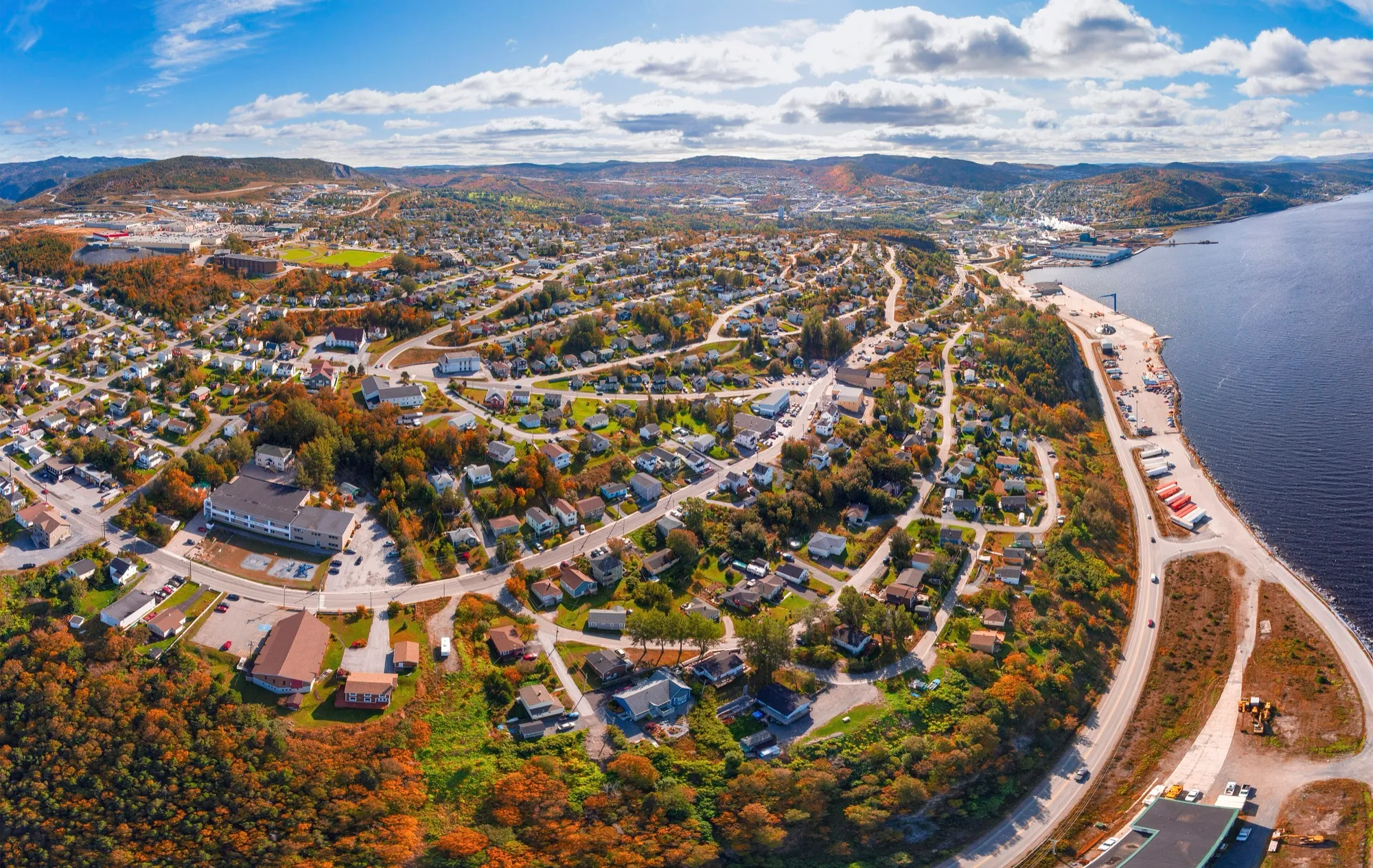
.jpg)
Filmed here: Frontier. The Frontier drive · every spot from every airport
Faded lines are other drives from Deer Lake Regional into this area: Marble Mountain Base Lodge (47 km). Each splits off where its line leaves this one.
Photograph: ParsonsPhotographyNL · CC BY-SA 4.0 Stop 1: Pepsi CentreDetour
The west coast's big indoor ice, just off this drive in the middle of the city. OpenStreetMap tags it for ice skating, hockey and gymnastics. Check the Centre's schedule for public-skate hours and rentals.
Stopping here adds 2.5 km to the drive.
Directions →Show on map: Pepsi Centre ↑Other map apps
Apple · Google · Organic Maps · OsmAnd (both work offline, no tracking) · WazeStop 2: Blow Me Down Cross Country Ski ParkDetour
The west coast's cross-country answer to Marble Mountain's downhill, just south of the city: 37 km of mapped ski trails, 27 of them named, from Jack Rabbit to Heart Break Ridge, plus a biathlon range and a Main Lodge (measured from the map 2026-09-04). The club sets grooming, season and fees; the weather strip above says whether there is snow.
Stopping here adds 6.8 km to the drive.
Directions →Show on map: Blow Me Down Cross Country Ski Park ↑Other map apps
Apple · Google · Organic Maps · OsmAnd (both work offline, no tracking) · WazeStop 3: Captain James Cook MemorialDetour
The mapped historic monument and lookout above the city, with the Captain James Cook Lookout Path threading the headland around it. Cook charted this bay before he charted the Pacific. A short climb through the streets gets you the view down the Humber Arm.
Stopping here adds 4.5 km to the drive.
Directions →Show on map: Captain James Cook Memorial ↑Other map apps
Apple · Google · Organic Maps · OsmAnd (both work offline, no tracking) · Waze
Scan with your phone to open this page there. Then tap Keep for offline before you lose signal.
⛽ Fuel and gravel, road by road ▾
Drive measured Sep 3, 2026, terminal to the city. Your maps app gives the time on the day. How we measure
Add to a trip →Staying here? Days out ↓Keep for offline ↓Download GPX (offline, Garmin)Airport info: Deer Lake Regional Airport →
56.9 km. Deer Lake airport to Corner Brook, the west coast’s city: the Trans-Canada down the Humber Valley, then Route 450A.
Worth the detour. The Captain James Cook Memorial on its headland above the Arm: 4.5 km of climbing streets, for a view of the whole Bay of Islands at once.
When you get to Corner Brook
- Staying in Corner Brook? → — the start page: short drives from town, food, and a planner that starts here.
- Where to eat near Corner Brook → — 72 places the open map records, alphabetically, with addresses and phone numbers.
- Kinsmen Baseball Field → · Kinsmen Soccer Field → · Pepsi Centre → — the venues here, with what you can reach and be back from between games.
Places to eat on the way
41 places to eat within 2 km of this drive, in the order you pass them.
The longest stretch with nothing mapped on it is 21.5 km — after Langers, until Oasis Grill House.
All 41, in the order you pass them — open the list
- Big Stop Restaurantrestaurantkm 4.1
- Tim Hortonfast foodkm 4.1 · 222 m off the road
- Mary Brown'sfast foodkm 4.6 · 192 m off the road
- Wingn' itrestaurantkm 5.1
- Pizza Delightrestaurantkm 5.7 · 235 m off the road
- Tim Hortonscafékm 5.8 · 225 m off the road
- A&Wfast foodkm 5.8 · 178 m off the road
- Subwayfast foodkm 5.9 · 177 m off the road
- KFCfast foodkm 6
- Burger Kingfast foodkm 6.1
- Peter's Pizzafast foodkm 6.1
- Langerspubkm 6.2 · 550 m off the road
- Oasis Grill Houserestaurantkm 27.7 · 244 m off the road
- Cafe 59restaurantkm 27.7 · 863 m off the road
- Tim Hortonscafékm 46
- Jungle Jim'srestaurantkm 53.5 · 1351 m off the road
- McDonald'sfast foodkm 53.5 · 1086 m off the road
- Wendy'sfast foodkm 53.5 · 1596 m off the road
- Pizza Delightrestaurantkm 54.1 · 207 m off the road
- Tim Hortonscafékm 54.2 · 190 m off the road
- Mary Brown'sfast foodkm 54.2 · 200 m off the road
- Samuel's Sammiches and Sweetsrestaurantkm 54.9 · 225 m off the road
- King Henry's Pubpubkm 55.4 · 393 m off the road
- KFCfast foodkm 55.4 · 272 m off the road
- Tim Hortonscafékm 55.4 · 247 m off the road
- Crown and Moosepubkm 55.5 · 269 m off the road
- Brewed Awakeningcafékm 55.5 · 253 m off the road
- Harbour Grounds (Café)cafékm 55.8
- Rinda's Kitchenrestaurantkm 56.1
- Mary Brown'sfast foodkm 56.4 · 151 m off the road
- Newfound Sushirestaurantkm 56.4 · 521 m off the road
- Taste of Jamaicarestaurantkm 56.4 · 454 m off the road
- Robin'sfast foodkm 56.4 · 240 m off the road
- Gina's Pubpubkm 56.5 · 1752 m off the road
- Union Street Bar & Billiardspubkm 56.5 · 1157 m off the road
- A&Wfast foodkm 56.5 · 1027 m off the road
- Tai-An Restaurantrestaurantkm 56.5 · 1006 m off the road
- Tim Hortonscafékm 56.5 · 1017 m off the road
- Tim Hortonscafékm 56.5 · 218 m off the road
- Soccer Field Canteenrestaurantkm 56.5 · 624 m off the road
- Sorrentorestaurantkm 56.6 · 193 m off the road
Not ranked or complete, and nobody pays to be here. No opening hours: phone ahead. Open map data, swept 2026-09-12. How we measure · Add a missing place
New place to eat, or one that's missing? This list comes from OpenStreetMap, so nobody can pay to be on it. Add it to the map yourself (about twenty minutes on a phone), or email us the details and we'll put it on the map.
What has been recorded near here
Wildlife people have reported within 10 km of Corner Brook, and the months they saw it. Tap a name for everywhere else on our drives it turns up.
- Northern gannetseabirdMorus bassanusReports cluster in August, September, July28 reports on record
Reports, not counts: busy harbours report more. No sighting is promised, and the list covers only the species we look up. Source: GBIF, the international record of wildlife sightings, checked 2026-10-07.
Short drives from Corner Brook
Other map apps
Apple · Google · Organic Maps · OsmAnd (both work offline, no tracking) · WazeOr any of these: nearest first, measured by road from Corner Brook.
- Gorge Viewpointstop6.2 km
A mapped viewpoint on the way through the Humber country.
Directions →Other map apps
Apple · Google · Organic Maps · OsmAnd (both work offline, no tracking) · Waze - Cardio Climbtrail · 7.6 km walk · moderate7.6 kmDirections →
Other map apps
Apple · Google · Organic Maps · OsmAnd (both work offline, no tracking) · Waze - Marble Mountain Base Lodgetown11 kmDirections →
Other map apps
Apple · Google · Organic Maps · OsmAnd (both work offline, no tracking) · Waze - Barachois Pond Provincial Parkstop69 km
The ParksNL camping park on this road: the province's 2026 camping list carries it, open May 15 to September 14 that year, dates subject to the weather.
Directions →Other map apps
Apple · Google · Organic Maps · OsmAnd (both work offline, no tracking) · Waze - Stephenvillestop85 km
The peninsula's service town, built around a runway.
Directions →Other map apps
Apple · Google · Organic Maps · OsmAnd (both work offline, no tracking) · Waze - Stuckless Pond Trailtrail · 9.5 km lollipop · moderate97 kmDirections →
Other map apps
Apple · Google · Organic Maps · OsmAnd (both work offline, no tracking) · Waze
Distances by road, measured on OpenStreetMap October 16, 2026, from where this route ends. Your maps app gives the time on the day. How we measure
Doing it electric
- Fast chargers on this drive
- Deer Lake km 4, Corner Brook km 54
- Longest stretch without one
- 50 km
- Deer Lake → Corner Brook, of 57 km driven
- Nearest fast charger to Corner Brook
- at Corner Brook
Coming in 2026 (NL Hydro, 2026-10-10): Deer Lake (km 0). Not counted until it opens.
NL Hydro fast chargers within 3 km of the drive. Check the app for one that's working. Exported 2026-10-10. How we measure
Paved or not, per the map
- Mapped as unpaved
- none
- Mapped as paved
- 32%
- 12.9 km of 56.9 km driven
- No surface tag on the map
- 68%
- 27.2 km: surface not recorded
Why it matters: Hertz Canada’s terms say “use off paved roads or on roads which are not regularly maintained” voids the damage waiver. Check your own agreement. The terms themselves. Source for these figures: OSRM driving profile, stored route query, with node annotations; OpenStreetMap surface tags via Overpass, checked 2026-09-06. Today's road conditions: 511.
Before you go
These change, so we link to the people who keep them up to date.
MooseYear round, worst between dusk and dawn
The province states that the likelihood of injury in a moose collision is twice as high between dusk and dawn as in daytime. This drive is short, but the valley stretch is still highway.
Check it now →Road conditionsYear round, matters most November–April
The Humber Valley funnels weather. This drive shares the Marble Mountain stretch and its winter conditions.
Check it now →
Renting a car? Book the car when you book the flight.
Summer rentals sell out, says NL Tourism, and in June 2026 CTV reported St. John's airport agencies booked for nearly all of summer.
Both read 2026-10-07.
Arriving without a car
Not renting? Here's who Deer Lake Regional Airport lists at the door. Fares change, so we link to them instead.
No rideshare here.
The airport's ground-transportation page lists no rideshare service, only three taxi firms, a shuttle and seven charter operators (checked 2026-09-15).
Taxi
Star Taxi, which the airport calls its primary ground transportation provider, serving the whole region with wheelchair-accessible vans and accommodating service dogs. The airport advises contacting them 24 to 48 hours before you arrive.
Taxi
Deer Lake Taxi, listed as operating around the clock across the province with no pre-booking required.
Shuttle
Star Taxi runs a shuttle between Corner Brook and the airport, serving named hotels, with a private-car option. It must be booked ahead. The airport publishes the fares.
Coach
DRL Coachlines' once-a-day coach each way between St. John's and Port aux Basques stops in Deer Lake town (the Circle K), not at the airport terminal. It reaches no island and no national park. Tickets are bought on the bus, cash only. Times and fares are DRL's: drl-lr.com.
Source: Deer Lake Regional Airport,2026-09-15. Check there for fares and times.
The drive back
Corner Brook back to Deer Lake measures 58 km — 0.6 km longer than the drive out.
Plan back from your check-in time. Give the planner your flight time and it tells you when to set off.
How early to arrive depends on the carrier and the season: check Deer Lake Regional Airport →
Return measured 2026-09-29, the same way as the drive out. How we measure
Questions people actually ask
Should I fly into Deer Lake or Gander for Corner Brook?+
Deer Lake, by a long way: 57 km against 360 km from Gander.
Why drive to a city?+
It is the west coast's service hub, and it has the Cook lookout, the university campus and big views of the Humber Arm. Most travellers pass through; the lookout is the reason to stop.
What is the drive actually like?+
The same Humber Valley run that carries every western route: Trans-Canada southwest past Steady Brook and Marble Mountain, then off at the 450A into the city's bowl above the Arm. Short, fast and pretty.
How does this pair with Marble Mountain?+
Same road, under 10 km apart. Hill, city and airport sit along one valley corridor, measured separately because you might drive them separately.
No recorded track yet.Drove it? Send yours →
Put this map on your site
Run a place to stay, a tour or a town page on this drive? Add this map to your site. It answers how far from the airport? Free, no account, and we keep the figures current.
<iframe src="https://fromtheairport.xyz/embed/ydf-corner-brook"
  width="100%" height="420" style="border:0" loading="lazy"
title="Driving route: Deer Lake Regional Airport (YDF) to Corner Brook"></iframe>?lat=&lon=&label= to the URL to pin your own property on the map.Every distance and coordinate on this page was checked against its source on September 3, 2026. Origin: OpenStreetMap way/180061286. Destination: OpenStreetMap node/2437986499 — Corner Brook place node.