Staying on Fogo Island
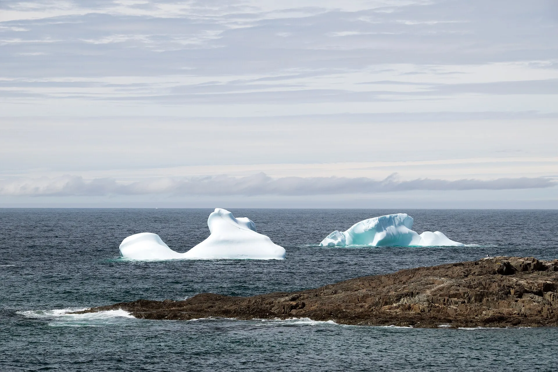
Icebergs pass Fogo Island: the best weeks are late May and early June. When they come, and where to watch →
Icebergs near Fogo Island: email me when it's worth the drive
Best weeks are late May and early June. One or two emails a year, in spring: when icebergs are showing up near Fogo Island, and which drive gets you there.
One step left: click the link in the confirmation email and you're on the list.
That didn't go through. Try again in a moment.
Iceberg-season email only, never shared. Unsubscribe any time, from any email. Privacy.
Places to stay in Fogo Island
From Best Kind Stays. Both sites are run by the same people. Listing is free and nothing paid changes the order.
- Escape By The Sea ↗Four furnished cottages in the woods by the ocean on Fogo Island.Books on its own site
Games and shows in Fogo Island
What's on soon in Fogo Island
An expected date follows the event's yearly pattern. Check the organiser's page before you book.
Getting here
To Fogo Island from every airport and ferry, measured by road.
Visitor information
By road. Every centre, by region →
Art in and near Fogo Island
- Herring Cove Art Gallery and Studio and Linda's Quilts · Gallery4.3 km
- Liam Gillick’s A Variability Quantifier · Installation6.8 km
- Fogo Clay Studio · Pottery7.8 km
- Fogo Island Workshops · Craft studio8.9 km
- Fogo Island Saltfire Pottery · Pottery9 km
- J.K. Contemporary · Gallery9.4 km
- Young Studios · Gallery11 km
- Anchor & Devil's Claw · Public art12 km
By road, from the open map. Shops and galleries keep their own hours. All the art, by region →
When you get to Fogo Island
- Where to eat near Fogo Island → 7 places, A to Z, with addresses and phone numbers.
Short drives from Farewell ferry terminal
Other map apps
Apple · Google · Organic Maps · OsmAnd (both work offline, no tracking) · WazeOr any of these: nearest first, measured by road from Farewell ferry terminal. Each one's page has directions.
- Indian Lookout Trailtrail · 2 km walk · easy13 km
- Shoreline Trailtrail · 11.6 km walk · moderate16 km
- Summerford Lookoutstop41 km
A marked viewpoint on New World Island, on the road.
- Dildo Run Provincial Parkstop45 km
A ParksNL provincial park on the causeway stretch through Dildo Run, and the nearest mapped campground to the archipelago.
- Black Head Trail (Dildo Run)trail · 4.4 km out and back · easy46 km
- Moreton's Harbour Museumstop54 km
A collection of artifacts, archival documents and local people's belongings, with a Fishermen's Room of inshore fishery tools, per the province's tourism site.
- Bridgeportstop54 km
West off Route 340 onto Route 345, out along the shore.
- Prime Berth Fishing Museumstop60 km
A fishing heritage site on the water just out of Twillingate, on the road.
More, up to 71 km (10)
- Purcell's Harbour to Little Harbour Trailtrail · 4.6 km walk · moderate62 km
- Carmanville Wetlands Main Linetrail · 3 km walk · easy63 km
- Black Rock Trail (Twillingate)trail · 1.1 km loop · easy63 km
- Lower Little Harbour Trailtrail · 2.4 km loop · easy64 km
Carmanville's wetlands interpretation site, beside Route 330 as it rounds Hamilton Sound.
- Minty's Farm Trailtrail · 4.6 km walk · easy66 km
- Comfort Cove-Newsteadtown67 km
- Twillingatetown68 km
- Back Bay Trailtrail · 3.6 km out and back · easy71 km
- Lewisporte Train Parkstop71 km
The town's park on Main Street, with four preserved railway cars on a short length of the old narrow-gauge line.
Distances by road from Farewell ferry terminal, measured on OpenStreetMap November 7, 2026. Your maps app gives the time on the day. How we measure
Out on the water from Fogo Island
Boat tours that leave from here. The sea and the season decide what you see: ask them what is about. Times and prices are on each one's page.
Fogo Island boat tours to Little Fogo Islands (MV Island Explorer) ↗
Fogo Island Tours & Charters Inc. · Government Wharf, Joe Batt's Arm, Fogo Island
Offering boat tours and charters from Joe Batt's Arm on Fogo Island.
Out and about near Fogo Island, by season
What the open map holds by road from Fogo Island, the town's festivals and races, what passes in season, and what the town says it has. Check each place before you go.
Spring
Nothing mapped near Fogo Island for spring yet.
Summer
In Fogo Island
- Festival: Brimstone Head Folk Festival →August
- Boat launches: the nearest of 2 →2.6 km
Fall
Nothing mapped near Fogo Island for fall yet.
Winter
Nothing mapped near Fogo Island for winter yet.
A ski trail, bike trail or boat launch near Fogo Island that isn't here? Send the GPX or tell us where, and we put it on the open map.
More about Fogo Island
Guides with places near Fogo Island
- Change Islands Newfoundland Pony Stables of Change Islands, Change Islands Historical Museum, Squid Jiggers Lookout
- Icebergs near Gander Fogo Island, Change Islands, Twillingate
- Twillingate Top of Twillingate Trailhead, George Hawkins Memorial Arena
- Bases for icebergs and Fogo Boyd's Cove, Twillingate
Before you come
- Renting a car Who rents cars at the airports, and what to do when they are sold out
- Your home licence here What a visiting driver needs, and when a long stay changes the rules
- What to wear & carry Layers, cold water and fog, from the safety authorities
Know Fogo Island? Help fill these in
- Walked GPX for trails in Fogo Island the open map lacks →
The Town lists the Deep Bay Trail; the open map does not have them whole yet. One walked GPX of any of them makes its page, measured like the rest.
Send the GPX
The email is already written: fill in what you know and send it. We check it and add it. Your name goes on what you send, or none if you prefer.
Plan days from here
Every night in Fogo Island, with days out from here. You pick where you arrive.
Plan days from Fogo Island →The town is Fogo Island as OpenStreetMap places it (node/1479107290). Other towns: every town start page →
Fogo Island's community page → The town's score and what it is asking for, on towns.fromtheairport.xyz.