St. John's International Airport (YYT) → Port Rexton
St. John's Airport (YYT) to Port Rexton
- Distance
- 259.8 km
- Drive time
- In your maps app ↗
Use another map app
Apple Maps · Google Maps · Organic Maps · OsmAnd (both work offline, no tracking) · Waze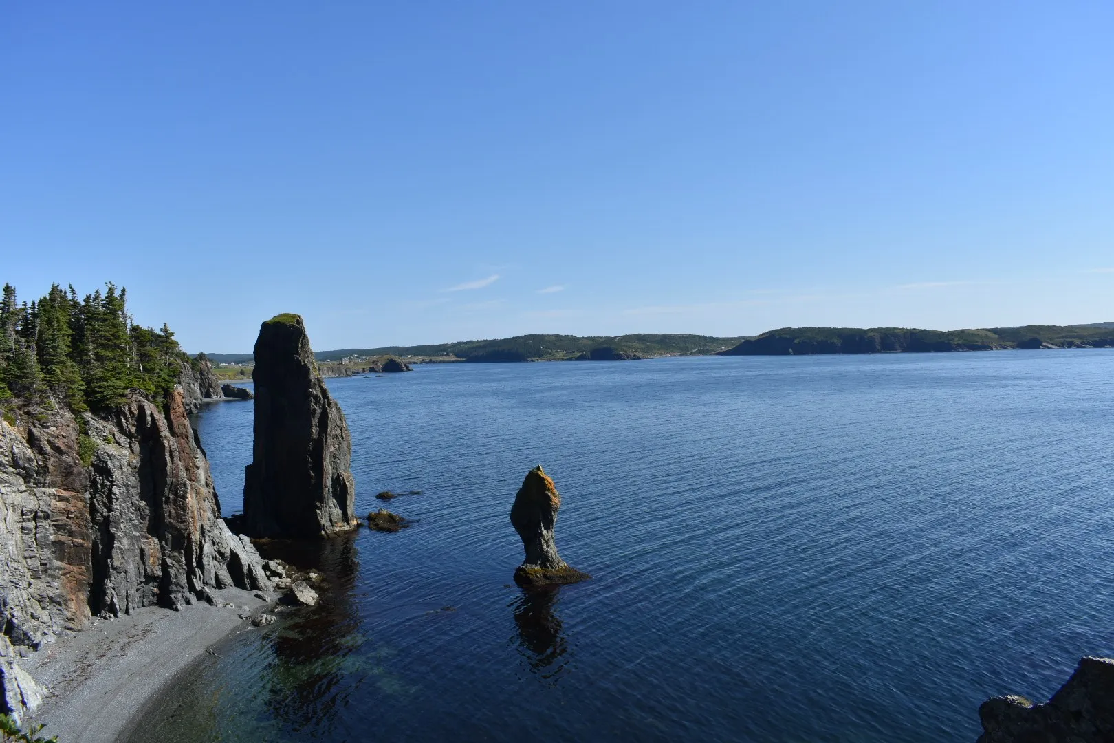

Faded lines are other drives from St. John's International into this area: Trinity (261 km), Cape Bonavista Lighthouse (309 km), Salvage (296 km), Burnside ferry terminal (293 km), Terra Nova National Park Visitor Centre (262 km). Each splits off where its line leaves this one.
Stop 1: Butter Pot Provincial ParkDetour
The drive runs along this park's boundary, but the park reaches well inland. ParksNL calls Butter Pot one of the most popular provincial parks in Newfoundland and Labrador. Its page lists ponds to swim, fish and paddle, sandy beaches, a campground, trails, and a view over the water from the top of Butter Pot Hill. A place to spend time, not a quick stop.
Stopping here adds 13.5 km to the drive.
Directions →Show on map: Butter Pot Provincial Park ↑Other map apps
Apple · Google · Organic Maps · OsmAnd (both work offline, no tracking) · WazeStop 2: Skerwink Trail lookoutDetour
A lookout on the Skerwink Trail at Port Rexton, which Travel + Leisure listed among the 25 best hikes in North America and Europe, per the province's tourism site. The trail passes a sea stack called the Music Box; the province names kittiwakes, gannets and whales among what you can see from it.
Stopping here adds 4.5 km to the drive.
Directions →Show on map: Skerwink Trail lookout ↑Other map apps
Apple · Google · Organic Maps · OsmAnd (both work offline, no tracking) · Waze
Scan with your phone to open this page there. Then tap Keep for offline before you lose signal.
⛽ Fuel and gravel, road by road ▾
- Route 40 →Whole road: 6 fuel stations mapped, longest gap 5.7 km. Unpaved mapped: none; 28% has no surface tag, so unknown.
- Route 1 →Whole road: 54 fuel stations mapped, longest gap 119 km. Unpaved mapped: none; 68% has no surface tag, so unknown.
- Route 230 →Whole road: 8 fuel stations mapped, longest gap 45 km. Unpaved mapped: none; 4% has no surface tag, so unknown.
Drive measured Oct 22, 2026, St. John's International Airport (YYT) to Port Rexton. Your maps app gives the time on the day. How we measure
Add to a trip →Staying here? Days out ↓Keep for offline ↓Airport info: St. John's International Airport →
Port Rexton is the town of the Skerwink Trail, which Travel + Leisure listed among the 25 best hikes in North America and Europe, as the province’s tourism site notes. The drive is 260 km from St. John’s airport.
The trail is a 5.1 km loop past sea stacks: the Skerwink Trail page has the climb and the map. Trinity is a short drive on.
When you get to Port Rexton
- Staying in Port Rexton? → — the start page: short drives from town, food, and a planner that starts here.
- Where to eat near Port Rexton → — 11 places the open map records, alphabetically, with addresses and phone numbers.
New place to eat, or one that's missing? This list comes from OpenStreetMap, so nobody can pay to be on it. Add it to the map yourself (about twenty minutes on a phone), or email us the details and we'll put it on the map.
Short drives from Port Rexton
Other map apps
Apple · Google · Organic Maps · OsmAnd (both work offline, no tracking) · WazeOr any of these: nearest first, measured by road from Port Rexton.
- Skerwink Trailtrail · 5.1 km loop · moderate1.6 kmDirections →
Other map apps
Apple · Google · Organic Maps · OsmAnd (both work offline, no tracking) · Waze - Lockston Path Provincial Parkstop6.9 km
The peninsula's ParksNL campground, just off Route 236 near Port Rexton, and the campground on this route.
Directions →Other map apps
Apple · Google · Organic Maps · OsmAnd (both work offline, no tracking) · Waze - Trinitytown9.1 kmDirections →
Other map apps
Apple · Google · Organic Maps · OsmAnd (both work offline, no tracking) · Waze - Fort Point viewpointstop14 km
The mapped bench at Fort Point, across the harbour mouth, on the old gun battery's ground.
Directions →Other map apps
Apple · Google · Organic Maps · OsmAnd (both work offline, no tracking) · Waze - Random Passagestop21 km
The set of the TV miniseries Random Passage at New Bonaventure, a replica of an early 1800s fishing village, per the province's tourism site.
Directions →Other map apps
Apple · Google · Organic Maps · OsmAnd (both work offline, no tracking) · Waze - Port Unionstop25 km
A town built by a union and founded by the fishermen's leader Sir William Coaker, as the province's tourism site tells it.
Directions →Other map apps
Apple · Google · Organic Maps · OsmAnd (both work offline, no tracking) · Waze - Green Island (Catalina) Lighthouselighthouse29 kmDirections →
Other map apps
Apple · Google · Organic Maps · OsmAnd (both work offline, no tracking) · Waze Opened at Elliston in June 2014, a hundred years after the disaster it exists for.
Directions →Other map apps
Apple · Google · Organic Maps · OsmAnd (both work offline, no tracking) · Waze
More, up to 68 km (7)
- Ryan Premises National Historic Sitestop43 km
The Parks Canada site on Bonavista's waterfront tells five centuries of the salt-fish trade in the merchant premises where it ran.
Directions →Other map apps
Apple · Google · Organic Maps · OsmAnd (both work offline, no tracking) · Waze - Mathew (ship) Replicamuseum44 kmDirections →
Other map apps
Apple · Google · Organic Maps · OsmAnd (both work offline, no tracking) · Waze - Mockbeggar Plantationstop45 km
A provincial historic site and the legacy of F.
Directions →Other map apps
Apple · Google · Organic Maps · OsmAnd (both work offline, no tracking) · Waze - Elliston Puffin Viewing Pointstop45 km
The viewpoint facing the Elliston puffin colony, close enough to watch from land in season.
Directions →Other map apps
Apple · Google · Organic Maps · OsmAnd (both work offline, no tracking) · Waze - Dungeon Provincial Parkstop46 km
A ParksNL day-use park around a collapsed sea cave, with two ocean windows in a sheep pasture, just before the cape.
Directions →Other map apps
Apple · Google · Organic Maps · OsmAnd (both work offline, no tracking) · Waze - Cape Bonavista Lighthousetown50 kmDirections →
Other map apps
Apple · Google · Organic Maps · OsmAnd (both work offline, no tracking) · Waze - Clarenvilletown68 kmDirections →
Other map apps
Apple · Google · Organic Maps · OsmAnd (both work offline, no tracking) · Waze
Distances by road, measured on OpenStreetMap October 16, 2026, from where this route ends. Your maps app gives the time on the day. How we measure
Doing it electric
- Fast chargers on this drive
- Paradise km 16, St. John’s km 17, Goobies km 162, Port Rexton km 259
- Longest stretch without one
- 145 km
- St. John’s → Goobies, of 259 km driven
- Nearest fast charger to Port Rexton
- at Port Rexton
Coming in 2026 (NL Hydro, 2026-10-22): St. John’s (km 17) and Whitbourne (km 89) and Clarenville (km 188). Not counted until it opens.
NL Hydro fast chargers within 3 km of the drive. Check the app for one that's working. Exported 2026-10-22. How we measure
Paved or not, per the map
- Mapped as unpaved
- 0.5 km
- Church Road (0.49 km, 0.3 km from Port Rexton)
- Mapped as paved
- 41%
- 94.8 km of 259.8 km driven
- No surface tag on the map
- 59%
- 136 km: surface not recorded
In a rental car: Hertz Canada’s terms say “use off paved roads or on roads which are not regularly maintained” voids the damage waiver. Check your own agreement. Hertz’s terms ↗. Source for these figures: OSRM driving profile, stored route query, with node annotations; OpenStreetMap surface tags via Overpass, checked 2026-10-22. Today's road conditions: 511.
Before you go
These change, so we link to the people who keep them up to date.
MooseYear round, worst between dusk and dawn
The province says the likelihood of injury in a moose collision is twice as high between dusk and dawn as in daytime. This is 259.8 km, much of it unlit two-lane highway; plan the drive for daylight where you can.
gov.nl.ca →Road conditionsYear round, matters most November–April
Conditions change fast on this coast. Check before you set off.
511nl.ca →
Renting a car? Book the car when you book the flight.
Summer rentals sell out, says NL Tourism, and in June 2026 BNN Bloomberg reported St. John's airport agencies booked for nearly all of summer.
Both checked October 7, 2026.
Rental counters at St. John's, with numbers →Arriving without a car
Not renting? Here's who St. John's International Airport Authority lists at the terminal.
Rideshare: it depends who you ask.
The Airport Authority's own ground-transportation pages name City Wide Taxi as “the exclusive provider of ground transportation services for the public” and do not mention rideshare anywhere. Uber publishes pickup instructions for YYT, and the Airport's own account welcomed Uber in 2024. Both are true. The Authority's pages govern the kerb, so check them on the day.
Taxi
City Wide Taxi, which the Airport Authority names as the exclusive provider for the public. Cabs queue outside the Arrivals area and a dispatcher is there to help. The Authority publishes preset fares to named hotels and a meter-plus-surcharge rate everywhere else.
Public transit
Metrobus route 14 runs between the airport and the St. John's metro region, including Memorial University. There are two stops at the airport: one near the arrivals area, and one on World Parkway by the Holiday Inn Express. The Authority says Metrobus has committed to a wheelchair-accessible service on this route and can take large, non-folding mobility aids. Schedule and fares are Metrobus's.
Source: St. John's International Airport Authority,2026-09-15. Check there for fares and times.
Questions
How far is Port Rexton from St. John's airport?+
259.8 km by road from the terminal to Port Rexton.
What route do I take?+
Routes 40, 1 and 230. Your maps app has the turns.
Where does the Skerwink Trail start?+
On Main Road in Port Rexton. The trail is a 5.1 km loop by our map: 4.7 km of path and 0.4 km back by road.
No recorded track yet.Drove it? Send yours →
Put this map on your site
Run a place to stay, a tour or a town page on this drive? Add this map to your site. It shows your guests the drive and its distance. It is free, needs no account, and we keep the figures current.
<iframe src="https://fromtheairport.xyz/embed/yyt-port-rexton"
  width="100%" height="420" style="border:0" loading="lazy"
title="Driving route: St. John's International Airport (YYT) to Port Rexton"></iframe>?lat=&lon=&label= to the URL to pin your own property on the map.Every distance and coordinate on this page was checked against its source on October 22, 2026. Origin: OpenStreetMap way/279110348 — St. John's International Airport. Destination: OpenStreetMap node/1446542917 — Port Rexton.