Port aux Basques ferry terminal → Corner Brook
Port aux Basques ferry terminal to Corner Brook
- Distance
- 221.8 km
- Drive time
- In your maps app ↗
Use another map app
Apple Maps · Google Maps · Organic Maps · OsmAnd (both work offline, no tracking) · Waze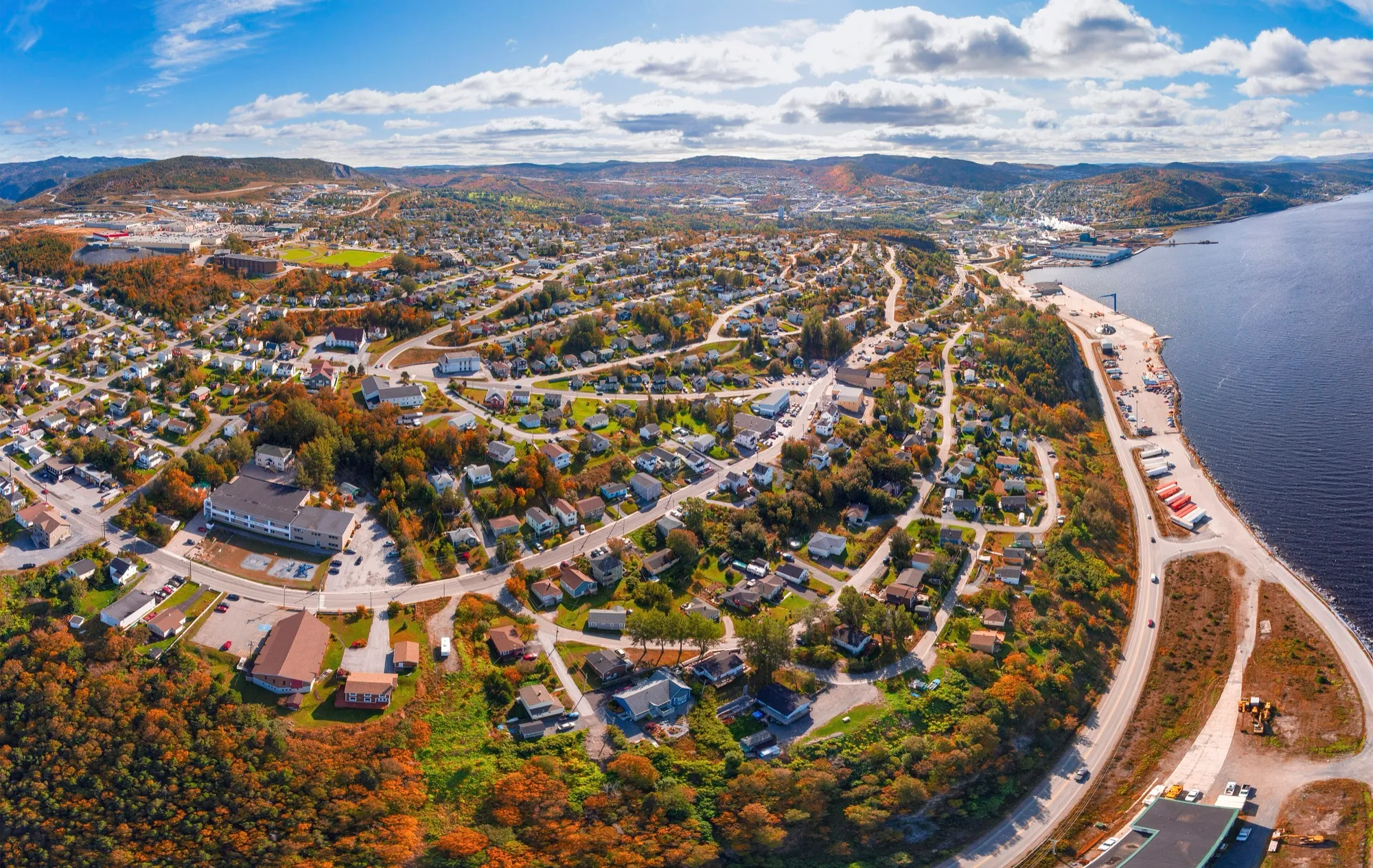
.jpg)
Filmed here: Frontier. The Frontier drive · every spot from every airport
You arrive by ferry — North Sydney, Nova Scotia to Port aux Basques
Port aux Basques is the island's year-round sea door, and everyone who comes through it has their own car already ashore.
Operated by Marine Atlantic. The drive below starts where the boat lands.
Crossings & current schedule →Stop 1: J.T. Cheeseman Provincial Park
A ParksNL campground close to the ferry terminal: sand beach, dune boardwalk, and the first sheltered pitch off the boat. Piping plovers nest here, so parts of the beach close; the park's postings say where. Check ParksNL for season and sites.
Stopping here adds 4.4 km to the drive.
Directions →Show on map: J.T. Cheeseman Provincial Park ↑Other map apps
Apple · Google · Organic Maps · OsmAnd (both work offline, no tracking) · WazeStop 2: Cape Ray LighthouseDetour
The light on the island's southwest corner, where the Cabot Strait begins. It is mapped at the end of Cape Ray Road with a Maritime Link information board alongside, and J.T. Cheeseman's beach between it and town. The Table Mountains stand behind; the ferry you came on passes in front.
Stopping here adds 9.1 km to the drive.
Directions →Show on map: Cape Ray Lighthouse ↑Other map apps
Apple · Google · Organic Maps · OsmAnd (both work offline, no tracking) · WazeStop 3: Wreckhouse
The most famous stretch of wind in Newfoundland. The Long Range funnels southeasterlies here so hard that a man was once employed to decide whether trains could pass: Lauchie MacDougall, the human wind gauge. The Trans-Canada runs straight through, and high-sided vehicles still get held when it blows. Check the forecast before you go.
Stopping here adds 0.2 km to the drive.
Directions →Show on map: Wreckhouse ↑Other map apps
Apple · Google · Organic Maps · OsmAnd (both work offline, no tracking) · WazeStop 4: Codroy Valley Provincial ParkDetour
The mapped reserve on the Grand Codroy estuary, the sheltered river mouth that makes this valley the west coast's great bird water. Waterfowl gather in the wetlands with the Long Range mountains behind. ParksNL publishes what operates and when.
Stopping here adds 17.2 km to the drive.
Directions →Show on map: Codroy Valley Provincial Park ↑Other map apps
Apple · Google · Organic Maps · OsmAnd (both work offline, no tracking) · WazeStop 5: Barachois Pond Provincial ParkDetour
The ParksNL camping park on this road: the province's 2026 camping list carries it, open May 15 to September 14 that year, dates subject to the weather.
Stopping here adds 3.6 km to the drive.
Directions →Show on map: Barachois Pond Provincial Park ↑Other map apps
Apple · Google · Organic Maps · OsmAnd (both work offline, no tracking) · WazeStop 6: Captain James Cook MemorialDetour
The mapped historic monument and lookout above the city, with the Captain James Cook Lookout Path threading the headland around it. Cook charted this bay before he charted the Pacific, and the view down the Humber Arm shows why the survey mattered. A short climb up the hill shows the whole lay of the land.
Stopping here adds 4.5 km to the drive.
Directions →Show on map: Captain James Cook Memorial ↑Other map apps
Apple · Google · Organic Maps · OsmAnd (both work offline, no tracking) · Waze
Scan with your phone to open this page there. Then tap Keep for offline before you lose signal.
⛽ Fuel and gravel, road by road ▾
Drive measured Oct 8, 2026, Port aux Basques ferry terminal to Corner Brook. Your maps app gives the time on the day. How we measure
Add to a trip →Staying here? Days out ↓Keep for offline ↓Download GPX (offline, Garmin)Ferry info: Marine Atlantic →
The first city off the boat and the west coast’s service hub. The drive up is the west coast entire: Wreckhouse, the Codroy Valley under the Long Range, the Bay St. George lowlands, then the Humber Arm.
Port aux Basques to Gros Morne continues past the city’s turn-off for anyone headed north.
When you get to Corner Brook
- Staying in Corner Brook? → — the start page: short drives from town, food, and a planner that starts here.
- Where to eat near Corner Brook → — 72 places the open map records, alphabetically, with addresses and phone numbers.
- Kinsmen Baseball Field → · Kinsmen Soccer Field → · Pepsi Centre → — the venues here, with what you can reach and be back from between games.
New place to eat, or one that's missing? This list comes from OpenStreetMap, so nobody can pay to be on it. Add it to the map yourself (about twenty minutes on a phone), or email us the details and we'll put it on the map.
Short drives from Corner Brook
Other map apps
Apple · Google · Organic Maps · OsmAnd (both work offline, no tracking) · WazeOr any of these: nearest first, measured by road from Corner Brook.
- Pepsi Centrestop2.5 km
The west coast's big indoor ice.
Directions →Other map apps
Apple · Google · Organic Maps · OsmAnd (both work offline, no tracking) · Waze - Gorge Viewpointstop6.2 km
A mapped viewpoint on the way through the Humber country.
Directions →Other map apps
Apple · Google · Organic Maps · OsmAnd (both work offline, no tracking) · Waze - Blow Me Down Cross Country Ski Parkstop6.8 km
The west coast's cross-country answer to Marble Mountain's downhill, just south of the city: 37 km of mapped ski trails, 27 of them named, from Jack Rabbit to Heart Break Ridge, plus a biathlon range and a Main Lodge (measured from the map 2026-09-04).
Directions →Other map apps
Apple · Google · Organic Maps · OsmAnd (both work offline, no tracking) · Waze - Cardio Climbtrail · 7.6 km walk · moderate7.6 kmDirections →
Other map apps
Apple · Google · Organic Maps · OsmAnd (both work offline, no tracking) · Waze - Marble Mountain Base Lodgetown11 kmDirections →
Other map apps
Apple · Google · Organic Maps · OsmAnd (both work offline, no tracking) · Waze - Pasadena's beach on Deer Lakestop31 km
An unnamed lakefront beach on Deer Lake at Pasadena, halfway along the drive.
Directions →Other map apps
Apple · Google · Organic Maps · OsmAnd (both work offline, no tracking) · Waze - Joe Butts Lookoutstop53 km
A mapped viewpoint just off the highway at the Deer Lake end, with a quick look at the country ahead.
Directions →Other map apps
Apple · Google · Organic Maps · OsmAnd (both work offline, no tracking) · Waze - Deer Lake visitor centrestop53 km
Where the airport road meets the Trans-Canada.
Directions →Other map apps
Apple · Google · Organic Maps · OsmAnd (both work offline, no tracking) · Waze
More, up to 97 km (2)
- Newfoundland Insectariumstop55 km
An insect museum close to the terminal.
Directions →Other map apps
Apple · Google · Organic Maps · OsmAnd (both work offline, no tracking) · Waze - Stuckless Pond Trailtrail · 9.5 km lollipop · moderate97 kmDirections →
Other map apps
Apple · Google · Organic Maps · OsmAnd (both work offline, no tracking) · Waze
Distances by road, measured on OpenStreetMap October 16, 2026, from where this route ends. Your maps app gives the time on the day. How we measure
Doing it electric
- Fast chargers on this drive
- Port aux Basques km 3, Robinsons km 107, Corner Brook km 216
- Longest stretch without one
- 109 km
- Robinsons → Corner Brook, of 222 km driven
- Nearest fast charger to Corner Brook
- at Corner Brook
NL Hydro fast chargers within 3 km of the drive. Check the app for one that's working. Exported 2026-10-10. How we measure
Paved or not, per the map
- Mapped as unpaved
- none
- Mapped as paved
- 23%
- 44.2 km of 221.8 km driven
- No surface tag on the map
- 77%
- 147.9 km: surface not recorded
Why it matters: Hertz Canada’s terms say “use off paved roads or on roads which are not regularly maintained” voids the damage waiver. Check your own agreement. The terms themselves. Source for these figures: OSRM driving profile, stored route query, with node annotations; OpenStreetMap surface tags via Overpass, checked 2026-10-08. Today's road conditions: 511.
Before you go
These change, so we link to the people who keep them up to date.
Wreckhouse winds and road conditionsYear round, and wind matters here in any season
The drive crosses Wreckhouse early on, and the province holds high-sided vehicles there when it blows. The terminal page carries the forecast and the conditions service; check them before you leave the dock.
Check it now →MooseYear round, worst between dusk and dawn
The province states the likelihood of injury in a moose collision is twice as high between dusk and dawn as in daytime. After a night crossing, most of this drive is on unlit highway.
Check it now →
Questions people actually ask
How far is Corner Brook from the Port aux Basques ferry?+
About 222 km, up the Trans-Canada and in on Route 450A.
Is there anywhere to camp on the way?+
J.T. Cheeseman, close to the terminal, and Barachois Pond further up the Trans-Canada are both ParksNL camping parks. Their detours are in the stops above; the provincial parks guide has their season.
Corner Brook or Gros Morne first?+
Corner Brook is on the way: the Gros Morne drive from this dock passes the city's turn-off. See the Port aux Basques to Gros Morne page.
No recorded track yet.Drove it? Send yours →
Put this map on your site
Run a place to stay, a tour or a town page on this drive? Add this map to your site. It answers how far from the airport? Free, no account, and we keep the figures current.
<iframe src="https://fromtheairport.xyz/embed/pab-corner-brook"
  width="100%" height="420" style="border:0" loading="lazy"
title="Driving route: Port aux Basques ferry terminal to Corner Brook"></iframe>?lat=&lon=&label= to the URL to pin your own property on the map.Every distance and coordinate on this page was checked against its source on October 8, 2026. Origin: OpenStreetMap way/215300568 — Port aux Basques Ferry Terminal. Destination: OpenStreetMap node/2437986499 — Corner Brook.