St. John's International Airport (YYT) → Downtown St. John's
St. John's Airport (YYT) to downtown St. John's
- Distance
- 7.7 km
- Drive time
- In your maps app ↗
- Roads
- 40
Use another map app
Apple Maps · Google Maps · Organic Maps · OsmAnd (both work offline, no tracking) · Waze

Filmed here: Frontier. The Frontier drive · every spot from every airport
Faded lines are other drives from St. John's International into this area: Signal Hill (Cabot Tower) (9 km), Cape Spear (24 km), Portugal Cove ferry terminal (11 km), Witless Bay (46 km), Brigus (75 km), Harbour Grace (108 km), Clarke's Beach (88 km). Each splits off where its line leaves this one.
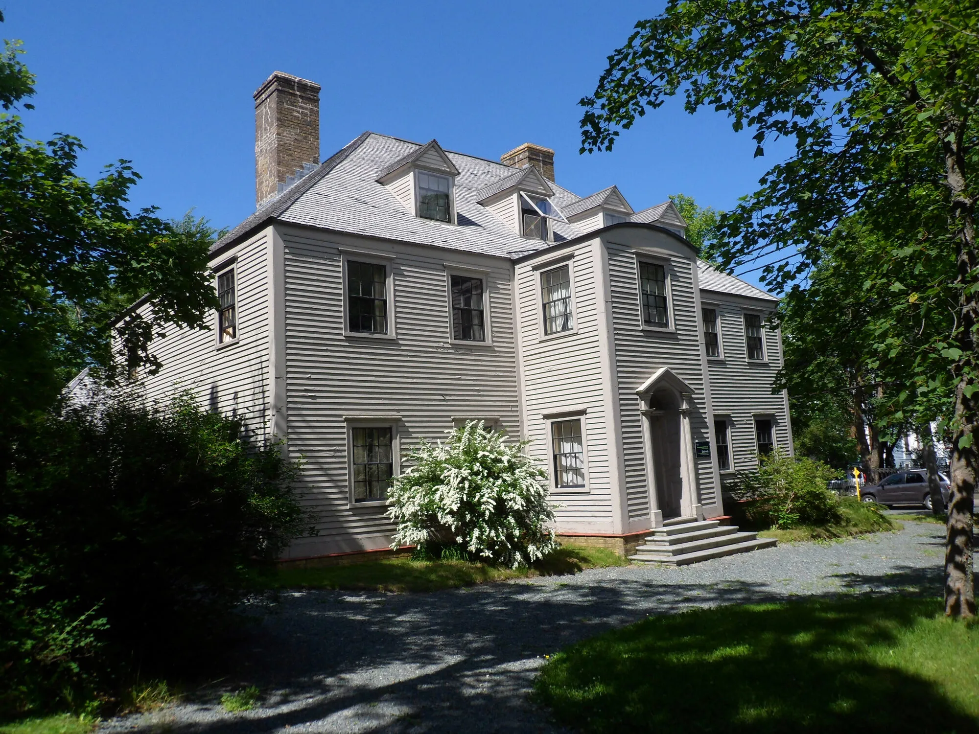
Photograph: Mo Laidlaw · CC BY-SA 3.0 Stop 1: Colonial Building
On Military Road as the drive comes down into town. The province's historic sites agency says it housed the Newfoundland and Labrador Legislative Assembly from 1850 until 1959, and calls it a gem of neoclassical architecture. It has a visitor season; the province's dates are linked below.
Stopping here adds 0.4 km to the drive.
Directions →Show on map: Colonial Building ↑Other map apps
Apple · Google · Organic Maps · OsmAnd (both work offline, no tracking) · WazePhotograph: Mo Laidlaw · CC BY-SA 3.0 Stop 2: Cathedral Basilica of Saint John the Baptist
A few hundred metres along Military Road: Parks Canada's register describes a massive stone cathedral built in the mid 19th century in the Lombard Romanesque Revival style, a national historic site since 1983.
Stopping here adds 0.6 km to the drive.
Directions →Show on map: Cathedral Basilica of Saint John the Baptist ↑Other map apps
Apple · Google · Organic Maps · OsmAnd (both work offline, no tracking) · WazeStop 3: The Rooms
The province's museum, art gallery and archives under one roof, on the hill above the harbour. The Canadian Register of Historic Places says it was built on the site of Fort Townshend, headquarters of the Newfoundland garrison from 1779 to 1871, of which no remains are visible. Hours and admission are linked below.
Stopping here adds 1.1 km to the drive.
Directions →Show on map: The Rooms ↑Other map apps
Apple · Google · Organic Maps · OsmAnd (both work offline, no tracking) · Waze

Scan with your phone to open this page there. Then tap Keep for offline before you lose signal.
Drive measured Oct 9, 2026, St. John's International Airport (YYT) to Downtown St. John's. Your maps app gives the time on the day. How we measure
Add to a trip →Staying here? Days out ↓Keep for offline ↓Download GPX (offline, Garmin)Airport info: St. John's International Airport →
7.7 km. From the terminal on Route 40, then city streets down the hill into the old town above the harbour.
Why people come. The old town is the destination: the province’s museum, art gallery and archives at The Rooms, the stone Basilica on Military Road, and the Colonial Building where the legislature sat until 1959, all within a few hundred metres of each other.
Arriving without a car? See St. John’s without a car. Every other drive from this airport is on the St. John’s page, and food in town is on eating in St. John’s.
New place to eat, or one that's missing? This list comes from OpenStreetMap, so nobody can pay to be on it. Add it to the map yourself (about twenty minutes on a phone), or email us the details and we'll put it on the map.
Short drives from Downtown St. John's
Other map apps
Apple · Google · Organic Maps · OsmAnd (both work offline, no tracking) · WazeOr any of these: nearest first, measured by road from Downtown St. John's.
- Railway Coastal Museumstop1.5 km
The drive passes it at 495 Water Street: St. John's old railway station, now the Railway Coastal Museum, about the Newfoundland Railway and the coastal boats.
Directions →Other map apps
Apple · Google · Organic Maps · OsmAnd (both work offline, no tracking) · Waze - The Batterystop1.7 km
On the harbour side of Signal Hill Road.
Directions →Other map apps
Apple · Google · Organic Maps · OsmAnd (both work offline, no tracking) · Waze - Signal Hill Visitor Centrestop2.1 km
Halfway up Signal Hill Road.
Directions →Other map apps
Apple · Google · Organic Maps · OsmAnd (both work offline, no tracking) · Waze - Quidi Vidistop2.5 km
A small village on its own harbour, north of Signal Hill.
Directions →Other map apps
Apple · Google · Organic Maps · OsmAnd (both work offline, no tracking) · Waze - North Head Trailtrail · 1.6 km point to point, one way · easy2.7 kmDirections →
Other map apps
Apple · Google · Organic Maps · OsmAnd (both work offline, no tracking) · Waze - Fort Amherst Lighthouselighthouse5.9 kmDirections →
Other map apps
Apple · Google · Organic Maps · OsmAnd (both work offline, no tracking) · Waze On screen: the marine research lab where Calvin tries to sell the iceberg fragment he caught, in the first episode.
Directions →Other map apps
Apple · Google · Organic Maps · OsmAnd (both work offline, no tracking) · WazeIn Blackhead, on the road out to the cape, a small community museum by this name.
Directions →Other map apps
Apple · Google · Organic Maps · OsmAnd (both work offline, no tracking) · Waze
More, up to 33 km (10)
- Deadmans Bay Pathtrail · 10.5 km point to point, one way · moderate to difficult13 kmDirections →
Other map apps
Apple · Google · Organic Maps · OsmAnd (both work offline, no tracking) · Waze - Father Troy's Pathtrail · 8.9 km point to point, one way · easy14 kmDirections →
Other map apps
Apple · Google · Organic Maps · OsmAnd (both work offline, no tracking) · Waze - Motion Pathtrail · 13.8 km point to point, one way · moderate to difficult15 kmDirections →
Other map apps
Apple · Google · Organic Maps · OsmAnd (both work offline, no tracking) · Waze - Cape Speartown16 kmDirections →
Other map apps
Apple · Google · Organic Maps · OsmAnd (both work offline, no tracking) · Waze - Portugal Cove ferry terminaltown17 kmDirections →
Other map apps
Apple · Google · Organic Maps · OsmAnd (both work offline, no tracking) · Waze - Piccos Ridge Pathtrail · 14.5 km point to point, one way · strenuous17 kmDirections →
Other map apps
Apple · Google · Organic Maps · OsmAnd (both work offline, no tracking) · Waze - Stiles Cove Pathtrail · 15.1 km point to point, one way · moderate22 kmDirections →
Other map apps
Apple · Google · Organic Maps · OsmAnd (both work offline, no tracking) · Waze - White Horse Pathtrail · 18.2 km point to point, one way · strenuous23 kmDirections →
Other map apps
Apple · Google · Organic Maps · OsmAnd (both work offline, no tracking) · Waze - Manuel's River Interpretation Centerstop24 km
The interpretation centre stands beside the river valley in Conception Bay South.
Directions →Other map apps
Apple · Google · Organic Maps · OsmAnd (both work offline, no tracking) · Waze - Bay Bulls harbourstop33 km
On screen: where Wade and Jerry head out at night from the marine base to harvest an iceberg.
Directions →Other map apps
Apple · Google · Organic Maps · OsmAnd (both work offline, no tracking) · Waze
Distances by road, measured on OpenStreetMap October 16, 2026, from where this route ends. Your maps app gives the time on the day. How we measure
Doing it electric
- Fast chargers on this drive
- none
- Longest stretch without one
- 8 km
- the YYT door → Downtown St. John's, of 8 km driven
- Nearest fast charger to Downtown St. John's
- 14.4 km
- by road, at St. John’s
No fast charger at Downtown St. John's. From the YYT door it is 8 km there and the same back: plan on about 16 km on one charge, more in cold weather or with the heat on. Or charge at St. John’s, 14.4 km from Downtown St. John's by road, off this drive's own road.
NL Hydro fast chargers within 3 km of the drive. Check the app for one that's working. Exported 2026-10-10. How we measure
Paved or not, per the map
- Mapped as unpaved
- none
- Mapped as paved
- 66%
- 3.6 km of 7.7 km driven
- No surface tag on the map
- 34%
- 1.8 km: surface not recorded
Why it matters: Hertz Canada’s terms say “use off paved roads or on roads which are not regularly maintained” voids the damage waiver. Check your own agreement. The terms themselves. Source for these figures: OSRM driving profile, stored route query, with node annotations; OpenStreetMap surface tags via Overpass, checked 2026-10-09. Today's road conditions: 511.
Before you go
These change, so we link to the people who keep them up to date.
Colonial BuildingA visitor season, set by the province
Provincial Historic Sites publishes the Colonial Building's open dates and hours each year. Check them there rather than here.
Check it now →The RoomsSet by The Rooms
The museum, gallery and archives publish their own hours and prices. Check them before you go.
Check it now →MooseYear round, worst between dusk and dawn
The province states the likelihood of injury in a moose collision is about twice as high between dusk and dawn as in daytime. This drive is city street, but every drive onward leaves the city.
Check it now →Road conditionsYear round, matters most November to April
Short and almost all city street, but winter can still make it slow. Check the province's road conditions.
Check it now →
Renting a car? Book the car when you book the flight.
Summer rentals sell out, says NL Tourism, and in June 2026 CTV reported St. John's airport agencies booked for nearly all of summer.
Both read 2026-10-07.
Arriving without a car
Not renting? Here's who St. John's International Airport Authority lists at the door. Fares change, so we link to them instead.
Rideshare: it depends who you ask.
The Airport Authority's own ground-transportation pages name City Wide Taxi as “the exclusive provider of ground transportation services for the public” and do not mention rideshare anywhere. Uber publishes pickup instructions for YYT, and the Airport's own account welcomed Uber in 2024. Both are true. The Authority's pages govern the kerb, so check them on the day.
Taxi
City Wide Taxi, which the Airport Authority names as the exclusive provider for the public. Cabs queue outside the Arrivals area and a dispatcher is there to help. The Authority publishes preset fares to named hotels and a meter-plus-surcharge rate everywhere else.
Public transit
Metrobus route 14 runs between the airport and the St. John's metro region, including Memorial University. There are two stops at the airport: one near the arrivals area, and one on World Parkway by the Holiday Inn Express. The Authority says Metrobus has committed to a wheelchair-accessible service on this route and can take large, non-folding mobility aids. Schedule and fares are Metrobus's.
Source: St. John's International Airport Authority,2026-09-15. Check there for fares and times.
Questions people actually ask
How far is downtown St. John's from the airport?+
7.7 km, measured by road from the terminal door to the city centre as OpenStreetMap places it (node/236053950), on Route 40 for the numbered part. That is the routing engine's time with no traffic or parking, so allow more.
Can I get downtown without a car?+
[The no-car page for this airport](/no-car/st-johns) shows the taxis and buses the airport lists, and what you can walk to. Everything else on this site assumes a car.
Where should I stay?+
This site does not name places to sleep. Every drive from this airport is on the St. John's page, nearest first.
No recorded track yet.Drove it? Send yours →
Put this map on your site
Run a place to stay, a tour or a town page on this drive? Add this map to your site. It answers how far from the airport? Free, no account, and we keep the figures current.
<iframe src="https://fromtheairport.xyz/embed/yyt-downtown-st-johns"
  width="100%" height="420" style="border:0" loading="lazy"
title="Driving route: St. John's International Airport (YYT) to Downtown St. John's"></iframe>?lat=&lon=&label= to the URL to pin your own property on the map.Every distance and coordinate on this page was checked against its source on October 9, 2026. Origin: OpenStreetMap way/279110348 — St. John's International Airport. Destination: OpenStreetMap node/236053950 — St. John's.