A loop from Gander International Airport (YQX)
Gander airport to Lewisporte and Twillingate, a day loop
- Distance
- 269.3 km
- Drive time
- In your maps app ↗
Use another map app
Apple Maps · Google Maps · Organic Maps · OsmAnd (both work offline, no tracking) · Waze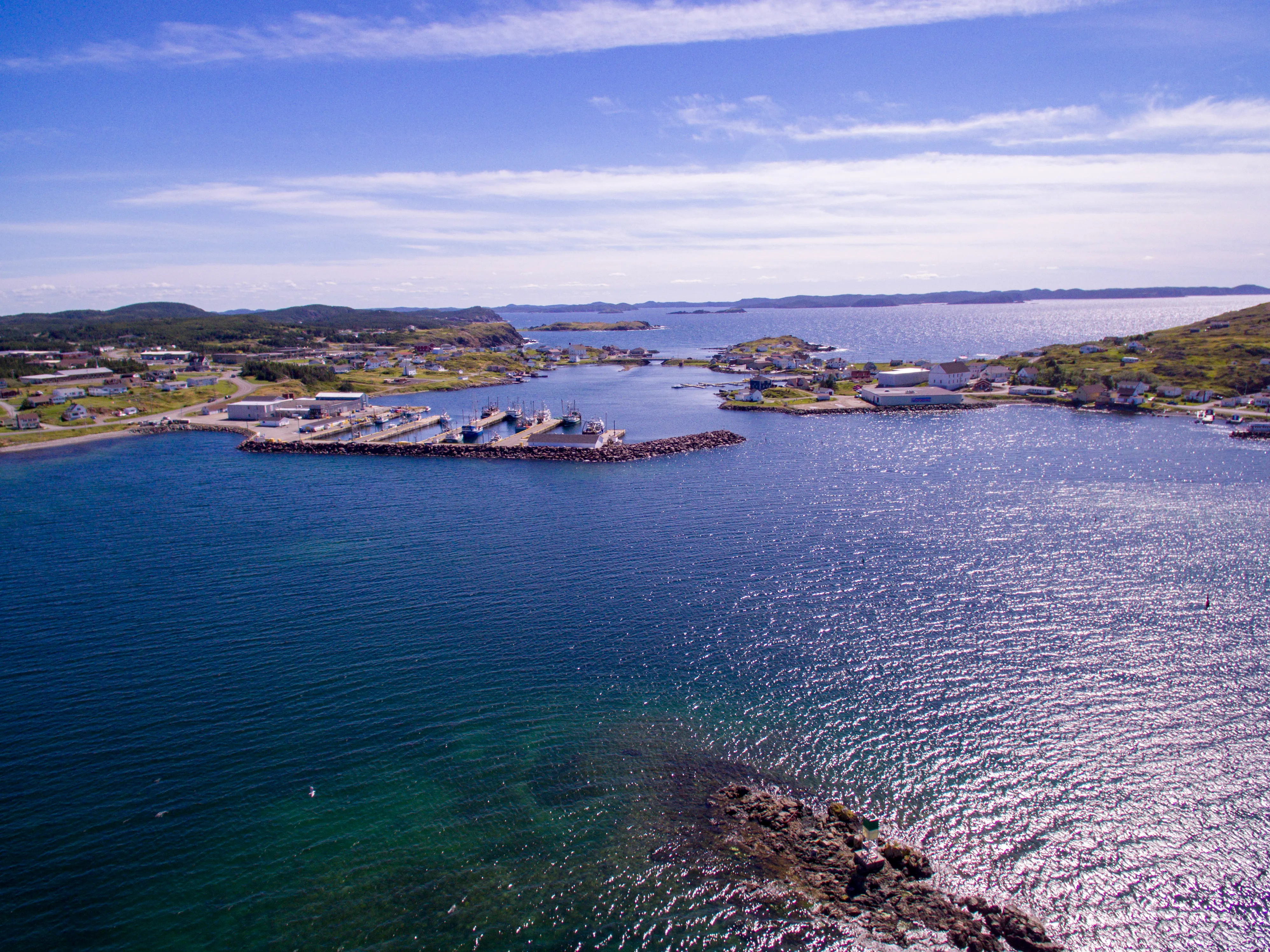

Filmed here: Below. The Below drive · every spot from every airport
Stop 1: North Atlantic Aviation Museum
An aviation museum in Gander, at the start of the drive. Gander exists because of transatlantic flight, and this museum tells that story. Check current hours with the museum.
Stopping here adds 1.5 km to the drive.
Directions →Show on map: North Atlantic Aviation Museum ↑Other map apps
Apple · Google · Organic Maps · OsmAnd (both work offline, no tracking) · WazeStop 2: Lewisporte
A full-service town on Burnt Bay, at the end of Route 341, where sailors, kayakers and people bound for Notre Dame Bay's islands get on the water.
Directions →Show on map: Lewisporte ↑Other map apps
Apple · Google · Organic Maps · OsmAnd (both work offline, no tracking) · WazeStop 3: Boyd's Cove Beothuk Interpretation CentreDetour
A provincial interpretation centre on the site of a Beothuk winter settlement, on a turn off the highway near the Route 331 junction. Opening is seasonal; confirm hours with the site.
Stopping here adds 4.2 km to the drive.
Directions →Show on map: Boyd's Cove Beothuk Interpretation Centre ↑Other map apps
Apple · Google · Organic Maps · OsmAnd (both work offline, no tracking) · WazeStop 4: Summerford Lookout
A marked viewpoint on New World Island, right on the road. On a clear day it looks over the water either side of the causeways.
Directions →Show on map: Summerford Lookout ↑Other map apps
Apple · Google · Organic Maps · OsmAnd (both work offline, no tracking) · WazeStop 5: Prime Berth Fishing Museum
A fishing heritage site on the water just short of Twillingate, right on the road. Opening is seasonal; confirm before you go.
Directions →Show on map: Prime Berth Fishing Museum ↑Other map apps
Apple · Google · Organic Maps · OsmAnd (both work offline, no tracking) · WazePhotograph: Shhewitt · CC BY-SA 4.0 Stop 6: Twillingate
The turning point: one of the iceberg viewing spots Newfoundland and Labrador Tourism names, on the islands at the top of Route 340. From here the loop goes home by Gander Bay.
Directions →Show on map: Twillingate ↑Other map apps
Apple · Google · Organic Maps · OsmAnd (both work offline, no tracking) · WazeStop 7: Long Point LighthouseDetour
The headland most berg-watchers stand on: the lighthouse at Long Point, past Crow Head at the island's tip, with a historical exhibit beside it. A there-and-back from Twillingate. The best lookout on a given day depends on where the ice is.
Stopping here adds 13.6 km to the drive.
Directions →Show on map: Long Point Lighthouse ↑Other map apps
Apple · Google · Organic Maps · OsmAnd (both work offline, no tracking) · Waze
Scan with your phone to open this page there. Then tap Keep for offline before you lose signal.
Drive measured Oct 13, 2026, Gander International Airport (YQX) round by Lewisporte and Twillingate and back by Gander Bay. Your maps app gives the time on the day. How we measure
Add to a trip →Staying here? Days out ↓Keep for offline ↓Airport info: Gander International Airport →
269.3 km, all the way round. Gander airport out to Lewisporte, north on Route 340 across the causeways to Twillingate, and home a different way, across Route 331 to Gander Bay and down Route 330 to Gander. It is the Twillingate–Lewisporte drive with the airport at both ends.
What you drive twice: only the island roads past Boyd’s Cove, because Twillingate is at the end of the road.
Close to the province’s own loop. The Road to the Isles is the same circle started from Notre Dame Junction, with Moreton’s Harbour in it and Lewisporte left as a side trip.
Short drives from Gander International Airport (YQX)
Other map apps
Apple · Google · Organic Maps · OsmAnd (both work offline, no tracking) · WazeOr any of these: nearest first, measured by road from Gander International Airport (YQX).
- Gandertown3.7 kmDirections →
Other map apps
Apple · Google · Organic Maps · OsmAnd (both work offline, no tracking) · Waze - Cobb's Pond Looptrail · 4.5 km loop · easy6.1 kmDirections →
Other map apps
Apple · Google · Organic Maps · OsmAnd (both work offline, no tracking) · Waze - Gander Golf Clubstop6.3 km
The closest golf course to the Gander terminal, right off this road.
Directions →Other map apps
Apple · Google · Organic Maps · OsmAnd (both work offline, no tracking) · Waze - Airport Nordic Ski Clubstop7.5 km
A cross-country ski club named after the airport you just left.
Directions →Other map apps
Apple · Google · Organic Maps · OsmAnd (both work offline, no tracking) · Waze - Silent Witnesses Memorialstop8 km
A memorial on Route 1 outside Gander.
Directions →Other map apps
Apple · Google · Organic Maps · OsmAnd (both work offline, no tracking) · Waze - Edgar Baird Lakeside Trailtrail · 4.2 km walk · easy8.4 kmDirections →
Other map apps
Apple · Google · Organic Maps · OsmAnd (both work offline, no tracking) · Waze - Thomas Howe Demonstration Foreststop8.5 km
A demonstration forest with walking trails on the Gander side, early in the drive.
Directions →Other map apps
Apple · Google · Organic Maps · OsmAnd (both work offline, no tracking) · Waze - Jonathan's Pond Provincial Parkstop18 km
A Provincial Park Reserve on Route 330 north of Gander, a short way off the road.
Directions →Other map apps
Apple · Google · Organic Maps · OsmAnd (both work offline, no tracking) · Waze
More, up to 72 km (9)
- Glenwood Provincial Parkstop20 km
A campground just off the Trans-Canada.
Directions →Other map apps
Apple · Google · Organic Maps · OsmAnd (both work offline, no tracking) · Waze - Square Pondstop33 km
A campground a little under halfway along, right on the Trans-Canada.
Directions →Other map apps
Apple · Google · Organic Maps · OsmAnd (both work offline, no tracking) · Waze - Joey's Lookoutstop41 km
The viewpoint above Gambo.
Directions →Other map apps
Apple · Google · Organic Maps · OsmAnd (both work offline, no tracking) · Waze - Notre Dame Provincial Parkstop48 km
The one ParksNL park on this drive.
Directions →Other map apps
Apple · Google · Organic Maps · OsmAnd (both work offline, no tracking) · Waze - Eelbrook Hiking Trailtrail · 2.5 km loop · easy56 kmDirections →
Other map apps
Apple · Google · Organic Maps · OsmAnd (both work offline, no tracking) · Waze - Lewisportetown63 kmDirections →
Other map apps
Apple · Google · Organic Maps · OsmAnd (both work offline, no tracking) · Waze - Woolfrey's Pond Lookoutstop64 km
The town's pondside park at the edge of Lewisporte, with a lookout and boardwalk loops above the water.
Directions →Other map apps
Apple · Google · Organic Maps · OsmAnd (both work offline, no tracking) · Waze - Louil Hill Trailtrail · 3.7 km loop · easy70 kmDirections →
Other map apps
Apple · Google · Organic Maps · OsmAnd (both work offline, no tracking) · Waze - Mill Cove Lookout Trailtrail · 1.6 km out and back · easy72 kmDirections →
Other map apps
Apple · Google · Organic Maps · OsmAnd (both work offline, no tracking) · Waze
Distances by road, measured on OpenStreetMap October 16, 2026, from where this route ends. Your maps app gives the time on the day. How we measure
Doing it electric
- Fast chargers on this drive
- Gander km 3, Lewisporte km 60
- Longest stretch without one
- 209 km
- Lewisporte → Gander International Airport (YQX), of 269 km driven
- Nearest fast charger to Gander International Airport (YQX)
- at Gander
Coming in 2026 (NL Hydro, 2026-10-10): Gander (km 3). Not counted until it opens.
NL Hydro fast chargers within 3 km of the drive. Check the app for one that's working. Exported 2026-10-10. How we measure
Paved or not, per the map
- Mapped as unpaved
- none
- Mapped as paved
- 24%
- 43.6 km of 269.3 km driven
- No surface tag on the map
- 76%
- 136.4 km: surface not recorded
Why it matters: Hertz Canada’s terms say “use off paved roads or on roads which are not regularly maintained” voids the damage waiver. Check your own agreement. The terms themselves. Source for these figures: OSRM driving profile, stored route query, with node annotations; OpenStreetMap surface tags via Overpass, checked 2026-10-13. Today's road conditions: 511.
Before you go
These change, so we link to the people who keep them up to date.
IcebergsTypically late spring into early summer
Iceberg presence varies year to year and week to week. Check current sightings before you set out.
Check it now →Boyd's Cove Beothuk Interpretation CentreSeasonal — the operator publishes the dates
The provincial historic sites service publishes the current season and hours.
Check it now →MooseYear round, worst between dusk and dawn
The province states the likelihood of injury in a moose collision is twice as high between dusk and dawn as in daytime. This is 269 km of driving, and the leg home by Gander Bay on Routes 331 and 330 is long, unlit two-lane road, usually driven in the evening.
Check it now →Road conditionsYear round, matters most November–April
The causeways onto New World Island are exposed, and Routes 331 and 330 have long unserviced stretches. 511 is the province's road-conditions service; check it before leaving the airport.
Check it now →
Renting a car? Book the car when you book the flight.
Summer rentals sell out, says NL Tourism, and in June 2026 CTV reported St. John's airport agencies booked for nearly all of summer.
Both read 2026-10-07.
Arriving without a car
Not renting? Here's who Gander International Airport Authority lists at the door. Fares change, so we link to them instead.
No rideshare here.
The Airport Authority's transport page lists no rideshare service (checked 2026-09-15).
Taxi
Busy Bee Cabs, which the Airport Authority says runs a 24-hour service available curbside in the Domestic Arrivals area.
Coach
DRL Coachlines runs the island's one scheduled coach, once a day each way, between St. John's and the Marine Atlantic terminal at Port aux Basques. It stops at Gander Airport itself (the restaurant), and at Lewisporte, Grand Falls-Windsor, Deer Lake and Corner Brook among others. It reaches no island and no national park. Tickets are bought on the bus, cash only. The Airport Authority says a wheelchair-accessible bus needs 48 hours' notice. Times and fares are DRL's: drl-lr.com.
Limousine
Nobel Limousines, listed by the Airport Authority.
Avis, Budget, National and Enterprise are listed at the airport. The Authority says accessible vehicles with wheelchair accommodation or hand controls are limited and need 48 hours' notice.
Source: Gander International Airport Authority,2026-09-15. Check there for fares and times.
Questions people actually ask
How far is the loop from Gander airport by Lewisporte and Twillingate?+
From the Gander International Airport (YQX) terminal and back: 269.3 km of driving on the OSRM driving profile, before stops. Out on the Trans-Canada to Lewisporte, north on Route 340 over the causeways to Twillingate, and home across Route 331 to Gander Bay and down Route 330 to Gander.
Which way round should I go?+
It hardly matters. Lewisporte first is 0.4 km shorter than Twillingate first. This page draws Lewisporte first. The other way puts Twillingate in the morning and Lewisporte at the end of the day.
How much longer is this than going to Twillingate and back?+
Twillingate and back from the airport by the same road measures 227.8 km. The loop is about 42 km more. For that you get Lewisporte, and you only drive the island stretch past Boyd's Cove twice.
Can I do it in a day?+
The driving is 269 km, plus your stops. A late start puts the leg home by Gander Bay after dark, when the moose risk is highest. Start early, or stay over and split it.
No recorded track yet.Drove it? Send yours →
Put this map on your site
Run a place to stay, a tour or a town page on this drive? Add this map to your site. It answers how far from the airport? Free, no account, and we keep the figures current.
<iframe src="https://fromtheairport.xyz/embed/yqx-twillingate-lewisporte-loop"
  width="100%" height="420" style="border:0" loading="lazy"
title="Driving route: Gander International Airport (YQX) to Gander International Airport (YQX)"></iframe>?lat=&lon=&label= to the URL to pin your own property on the map.Every distance and coordinate on this page was checked against its source on October 13, 2026. Origin: OpenStreetMap way/154350645 — Terminal. Destination: OpenStreetMap way/154350645 — Terminal.