A loop from St. John's International Airport (YYT)
Below filming locations: every drive, from St. John's and Gander
- Electric: plan 368 km on a charge. Chargers ↓
- Distance
- 249.2 km
- Drive time
- In your maps app ↗
Use another map app
Apple Maps · Google Maps · Organic Maps · OsmAnd (both work offline, no tracking) · Waze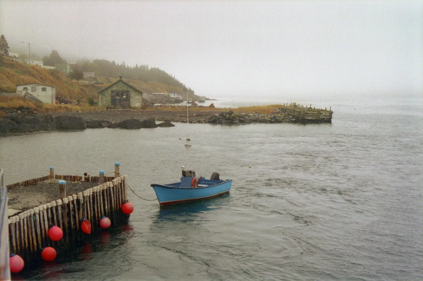

Every Below location, from every airport
Tap a distance for directions. Green is the closest airport to that spot. → is our route page, ↗ opens your maps app.
| Location | St. John'sYYT | GanderYQX | Deer LakeYDF |
|---|---|---|---|
| Logy Bay, St. John'sOcean Sciences Centre | 10 km↗ | 341 km↗ | 644 km↗ |
| Pouch CoveMarine Park | 23 km↗ | 355 km↗ | 658 km↗ |
| Pouch CovePouch Cove Heritage Society | 25 km↗ | 357 km↗ | 660 km↗ |
| Bay BullsBay Bulls harbour | 40 km→ | 316 km↗ | 619 km↗ |
| Harbour MainRising Tide Convenience | 55 km↗ | 287 km↗ | 591 km↗ |
| Brigus SouthBrigus South harbour | 72 km↗ | 342 km↗ | 645 km↗ |
| Twillingate | 447 km→ | 114 km→ | 361 km→ |
Stop 1: Rising Tide Convenience, Harbour Main
On screen: the inside of this shop became Linda's Bar, where the Penney family meet in episodes one and three. It is a convenience store on the Conception Bay Highway, and the bar was a set: there is no bar to visit. What you can see is the outside.
Directions →Show on map: Rising Tide Convenience, Harbour Main ↑Other map apps
Apple · Google · Organic Maps · OsmAnd (both work offline, no tracking) · Waze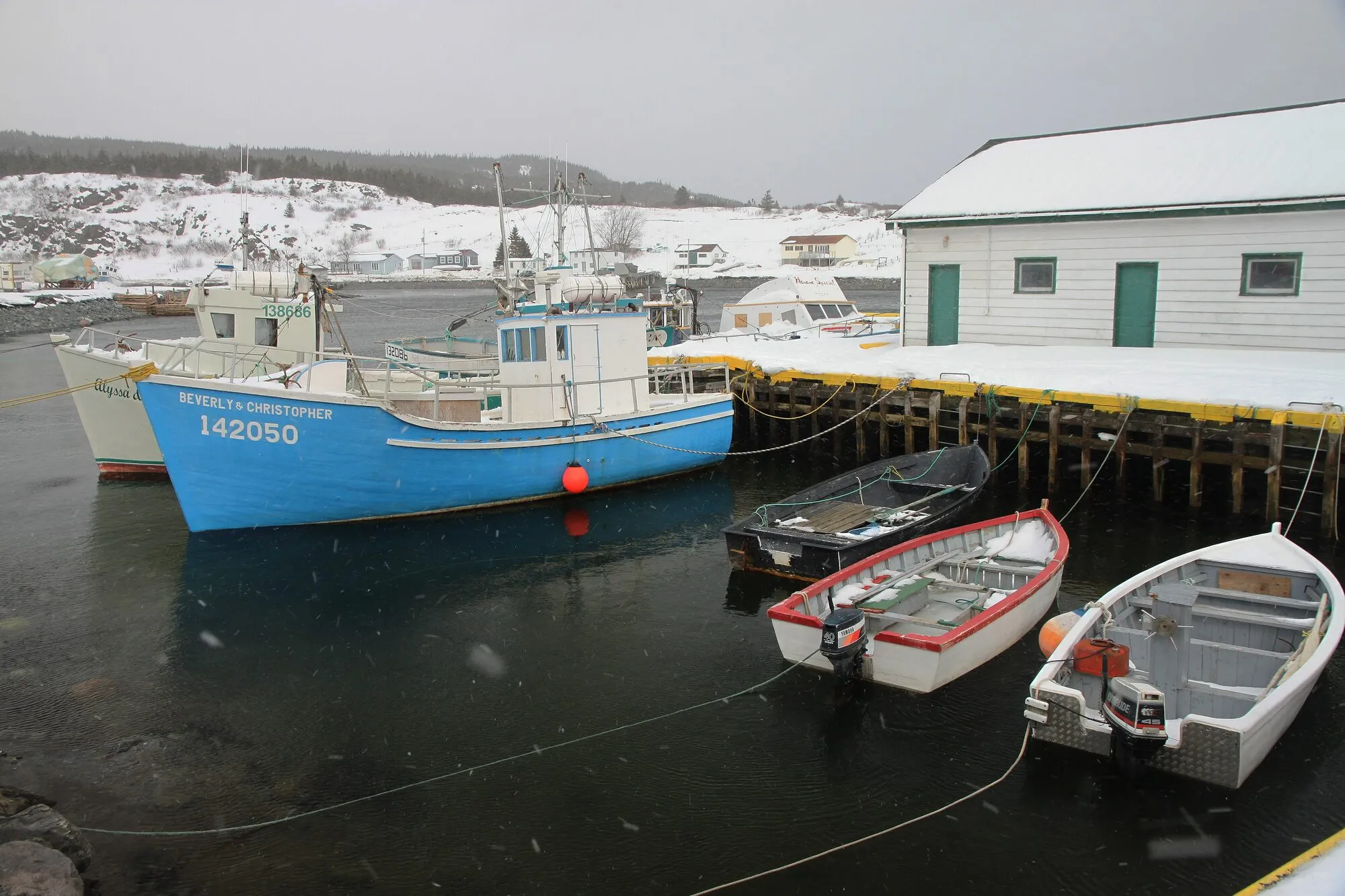
Photograph: Alan Schmierer · CC0 Stop 2: Brigus South harbour
On screen: the Harbour Authority building here plays the Harbour Master's Shack, where Ruth works. The Brigus Head Path of the East Coast Trail starts from the harbour.
Directions →Show on map: Brigus South harbour ↑Other map apps
Apple · Google · Organic Maps · OsmAnd (both work offline, no tracking) · WazePhotograph: Ken Eckert · CC BY-SA 4.0 Stop 3: Bay Bulls harbour
On screen: where Wade and Jerry head out at night from the marine base to harvest an iceberg. The base is a working marine facility, so the harbour is what you see.
Directions →Show on map: Bay Bulls harbour ↑Other map apps
Apple · Google · Organic Maps · OsmAnd (both work offline, no tracking) · WazeStop 4: Ocean Sciences Centre (Memorial University)
On screen: the marine research lab where Calvin tries to sell the iceberg fragment he caught, in the first episode. It is a working Memorial University research station at Logy Bay. There is a summer public program, with a touch tank and interpreters; check the university's own page for when that runs.
Directions →Show on map: Ocean Sciences Centre (Memorial University) ↑Other map apps
Apple · Google · Organic Maps · OsmAnd (both work offline, no tracking) · Waze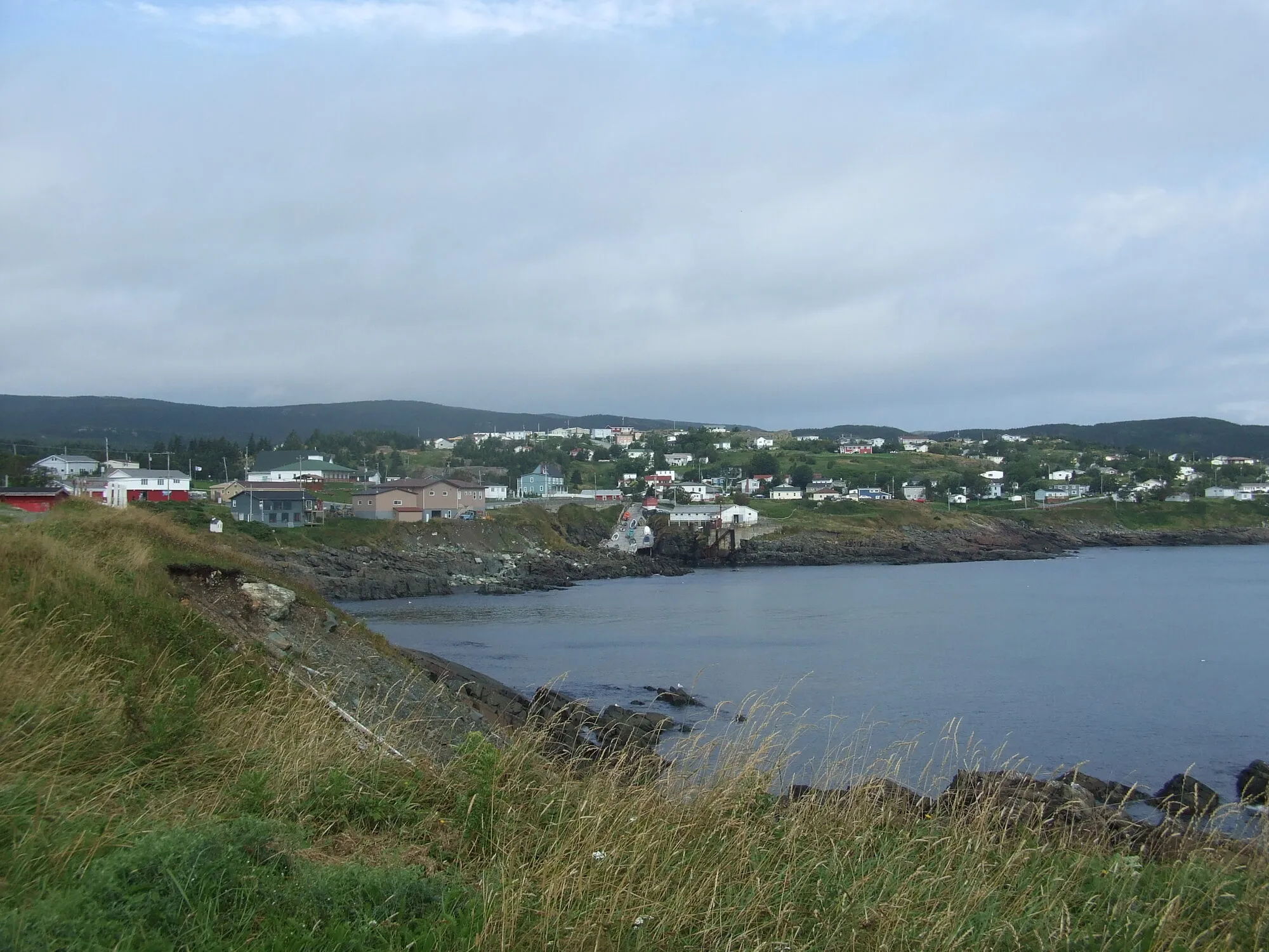
Photograph: Haydn Blackey · CC BY-SA 2.0 Stop 5: Pouch Cove Heritage Society
On screen: this building plays Fisherman's Hall, where the town meets about the creature.
Directions →Show on map: Pouch Cove Heritage Society ↑Other map apps
Apple · Google · Organic Maps · OsmAnd (both work offline, no tracking) · Waze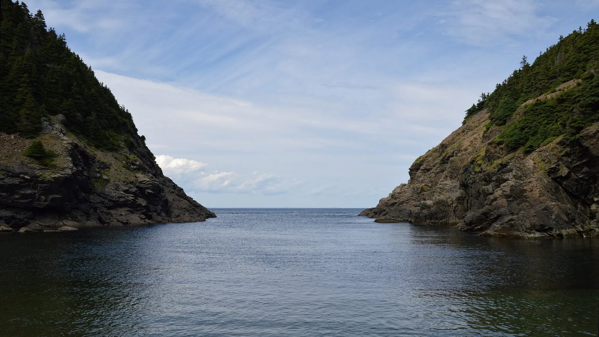
Photograph: Ryan Hodnett · CC BY-SA 4.0 Stop 6: Marine Park
On screen: the fish farm where a fisherman first sees something wrong in the water. It is really a campground, with trails, a beach and lakes.
Directions →Show on map: Marine Park ↑Other map apps
Apple · Google · Organic Maps · OsmAnd (both work offline, no tracking) · Waze
_(5454449111).jpg)

.jpg)
Scan with your phone to open this page there. Then tap Keep for offline before you lose signal.
Drive measured Oct 13, 2026, St. John's International Airport (YYT) round by Harbour Main, Brigus South, Bay Bulls, Logy Bay and Pouch Cove and back. Your maps app gives the time on the day. How we measure
Add to a trip →Staying here? Days out ↓Keep for offline ↓Airport info: St. John's International Airport →
249.2 km. St. John’s airport round the six places on the Avalon where Netflix filmed Below, and back: Harbour Main on Conception Bay, Brigus South and Bay Bulls on the Southern Shore, the Ocean Sciences Centre at Logy Bay, then Pouch Cove and Marine Park at the north end.
Where this comes from. Every location and scene on this page is as Netflix lists them on Netflix in Your Neighbourhood. Most are working places: a shop, two harbours, a research station. None of it is a set you can walk into. All the Netflix filming spots in Newfoundland are on one page.
Short drives from St. John's International Airport (YYT)
Other map apps
Apple · Google · Organic Maps · OsmAnd (both work offline, no tracking) · WazeOr any of these: nearest first, measured by road from St. John's International Airport (YYT).
- Colonial Buildingstop7 km
On Military Road as the drive comes down into town.
Directions →Other map apps
Apple · Google · Organic Maps · OsmAnd (both work offline, no tracking) · Waze A few hundred metres along Military Road: Parks Canada's register describes a massive stone cathedral built in the mid 19th century in the Lombard Romanesque Revival style, a national historic site since 1983.
Directions →Other map apps
Apple · Google · Organic Maps · OsmAnd (both work offline, no tracking) · Waze- St. John'stown7.7 kmDirections →
Other map apps
Apple · Google · Organic Maps · OsmAnd (both work offline, no tracking) · Waze - The Batterystop7.8 km
On the harbour side of Signal Hill Road.
Directions →Other map apps
Apple · Google · Organic Maps · OsmAnd (both work offline, no tracking) · Waze - Trans-Canada Highway Zero Kmstop8 km
OpenStreetMap records a highway milestone here reading distance zero, named for the Trans-Canada Highway.
Directions →Other map apps
Apple · Google · Organic Maps · OsmAnd (both work offline, no tracking) · Waze - Quidi Vidistop8.1 km
A small village on its own harbour, north of Signal Hill.
Directions →Other map apps
Apple · Google · Organic Maps · OsmAnd (both work offline, no tracking) · Waze - Signal Hill Visitor Centrestop8.2 km
Halfway up Signal Hill Road.
Directions →Other map apps
Apple · Google · Organic Maps · OsmAnd (both work offline, no tracking) · Waze - North Head Trailtrail · 1.6 km point to point, one way · easy8.8 kmDirections →
Other map apps
Apple · Google · Organic Maps · OsmAnd (both work offline, no tracking) · Waze
More, up to 25 km (10)
- Railway Coastal Museumstop9.2 km
The drive passes it at 495 Water Street: St. John's old railway station, now the Railway Coastal Museum, about the Newfoundland Railway and the coastal boats.
Directions →Other map apps
Apple · Google · Organic Maps · OsmAnd (both work offline, no tracking) · Waze - Portugal Cove ferry terminaltown11 kmDirections →
Other map apps
Apple · Google · Organic Maps · OsmAnd (both work offline, no tracking) · Waze - Piccos Ridge Pathtrail · 14.5 km point to point, one way · strenuous11 kmDirections →
Other map apps
Apple · Google · Organic Maps · OsmAnd (both work offline, no tracking) · Waze - Father Troy's Pathtrail · 8.9 km point to point, one way · easy12 kmDirections →
Other map apps
Apple · Google · Organic Maps · OsmAnd (both work offline, no tracking) · Waze - Fort Amherst Lighthouselighthouse14 kmDirections →
Other map apps
Apple · Google · Organic Maps · OsmAnd (both work offline, no tracking) · Waze In Blackhead, on the road out to the cape, a small community museum by this name.
Directions →Other map apps
Apple · Google · Organic Maps · OsmAnd (both work offline, no tracking) · Waze- Deadmans Bay Pathtrail · 10.5 km point to point, one way · moderate to difficult20 kmDirections →
Other map apps
Apple · Google · Organic Maps · OsmAnd (both work offline, no tracking) · Waze - White Horse Pathtrail · 18.2 km point to point, one way · strenuous21 kmDirections →
Other map apps
Apple · Google · Organic Maps · OsmAnd (both work offline, no tracking) · Waze - Motion Pathtrail · 13.8 km point to point, one way · moderate to difficult23 kmDirections →
Other map apps
Apple · Google · Organic Maps · OsmAnd (both work offline, no tracking) · Waze - Manuel's River Interpretation Centerstop25 km
The interpretation centre stands beside the river valley in Conception Bay South.
Directions →Other map apps
Apple · Google · Organic Maps · OsmAnd (both work offline, no tracking) · Waze
Distances by road, measured on OpenStreetMap October 16, 2026, from where this route ends. Your maps app gives the time on the day. How we measure
Doing it electric
- Fast chargers on this drive
- St. John’s km 17, Paradise km 18, Holyrood km 65
- Longest stretch without one
- 184 km
- Holyrood → St. John's International Airport (YYT), of 249 km driven
- Nearest fast charger to St. John's International Airport (YYT)
- 17.2 km
- by road, at Paradise
No fast charger at St. John's International Airport (YYT). From Holyrood it is 184 km there and the same back: plan on about 368 km on one charge, more in cold weather or with the heat on. Or charge at Paradise, 17.2 km from St. John's International Airport (YYT) by road, off this drive's own road.
Coming in 2026 (NL Hydro, 2026-10-10): St. John’s (km 17). Not counted until it opens.
NL Hydro fast chargers within 3 km of the drive. Check the app for one that's working. Exported 2026-10-10. How we measure
Paved or not, per the map
- Mapped as unpaved
- 0.1 km
- Dalton's Road (0.06 km, 37.5 km from St. John's International Airport (YYT))
- Mapped as paved
- 34%
- 59.1 km of 249.2 km driven
- No surface tag on the map
- 66%
- 116.8 km: surface not recorded
Why it matters: Hertz Canada’s terms say “use off paved roads or on roads which are not regularly maintained” voids the damage waiver. Check your own agreement. The terms themselves. Source for these figures: OSRM driving profile, stored route query, with node annotations; OpenStreetMap surface tags via Overpass, checked 2026-10-13. Today's road conditions: 511.
Before you go
These change, so we link to the people who keep them up to date.
MooseYear round, worst between dusk and dawn
The province states the likelihood of injury in a moose collision is twice as high between dusk and dawn as in daytime. This is a 249 km loop before you stop anywhere, and much of it is outside the city; a loop begun late in the day finishes after dark.
Check it now →Road conditionsYear round, matters most November–April
Fog is the Avalon's own weather, in any season. 511 is the province's road-conditions service; check it before you leave the airport.
Check it now →
Renting a car? Book the car when you book the flight.
Summer rentals sell out, says NL Tourism, and in June 2026 CTV reported St. John's airport agencies booked for nearly all of summer.
Both read 2026-10-07.
Arriving without a car
Not renting? Here's who St. John's International Airport Authority lists at the door. Fares change, so we link to them instead.
Rideshare: it depends who you ask.
The Airport Authority's own ground-transportation pages name City Wide Taxi as “the exclusive provider of ground transportation services for the public” and do not mention rideshare anywhere. Uber publishes pickup instructions for YYT, and the Airport's own account welcomed Uber in 2024. Both are true. The Authority's pages govern the kerb, so check them on the day.
Taxi
City Wide Taxi, which the Airport Authority names as the exclusive provider for the public. Cabs queue outside the Arrivals area and a dispatcher is there to help. The Authority publishes preset fares to named hotels and a meter-plus-surcharge rate everywhere else.
Public transit
Metrobus route 14 runs between the airport and the St. John's metro region, including Memorial University. There are two stops at the airport: one near the arrivals area, and one on World Parkway by the Holiday Inn Express. The Authority says Metrobus has committed to a wheelchair-accessible service on this route and can take large, non-folding mobility aids. Schedule and fares are Metrobus's.
Source: St. John's International Airport Authority,2026-09-15. Check there for fares and times.
Questions people actually ask
How far is the drive round all the Below filming locations?+
From St. John's International Airport (YYT) through all six Avalon locations Netflix names and back: 249.2 km of driving on the OSRM driving profile, before you stop anywhere.
Which order does this page take them in?+
Harbour Main first, then south to Brigus South, back north to Bay Bulls, through St. John's to the Ocean Sciences Centre at Logy Bay, up to Pouch Cove and Marine Park, and back to the airport. It was the shortest of the orders measured. A loop has no fixed start, so you can join it anywhere.
Why is Twillingate not on this loop?+
The icebergs Calvin goes out after were filmed off Twillingate, on the Gander side of the island. It is a separate drive from Gander airport: see the Gander to Twillingate route.
Can I go inside the filming locations?+
Mostly not as sets. The bar at Harbour Main was a set inside a convenience store, the Bay Bulls base is a working marine facility, and the Ocean Sciences Centre is a working research station with a summer public program. What you can see at each is the place itself.
No recorded track yet.Drove it? Send yours →
Put this map on your site
Run a place to stay, a tour or a town page on this drive? Add this map to your site. It answers how far from the airport? Free, no account, and we keep the figures current.
<iframe src="https://fromtheairport.xyz/embed/yyt-below-filming-loop"
  width="100%" height="420" style="border:0" loading="lazy"
title="Driving route: St. John's International Airport (YYT) to St. John's International Airport (YYT)"></iframe>?lat=&lon=&label= to the URL to pin your own property on the map.Every distance and coordinate on this page was checked against its source on October 13, 2026. Origin: OpenStreetMap way/279110348 — St. John's International Airport. Destination: OpenStreetMap way/279110348 — St. John's International Airport.