Fortune ferry terminal → Signal Hill (Cabot Tower)
Fortune ferry to Signal Hill
- ⛽ Route 210 has 105 km with no fuel. Where to fill up →
- Distance
- 367 km
Use another map app
Apple Maps · Google Maps · Organic Maps · OsmAnd (both work offline, no tracking) · Waze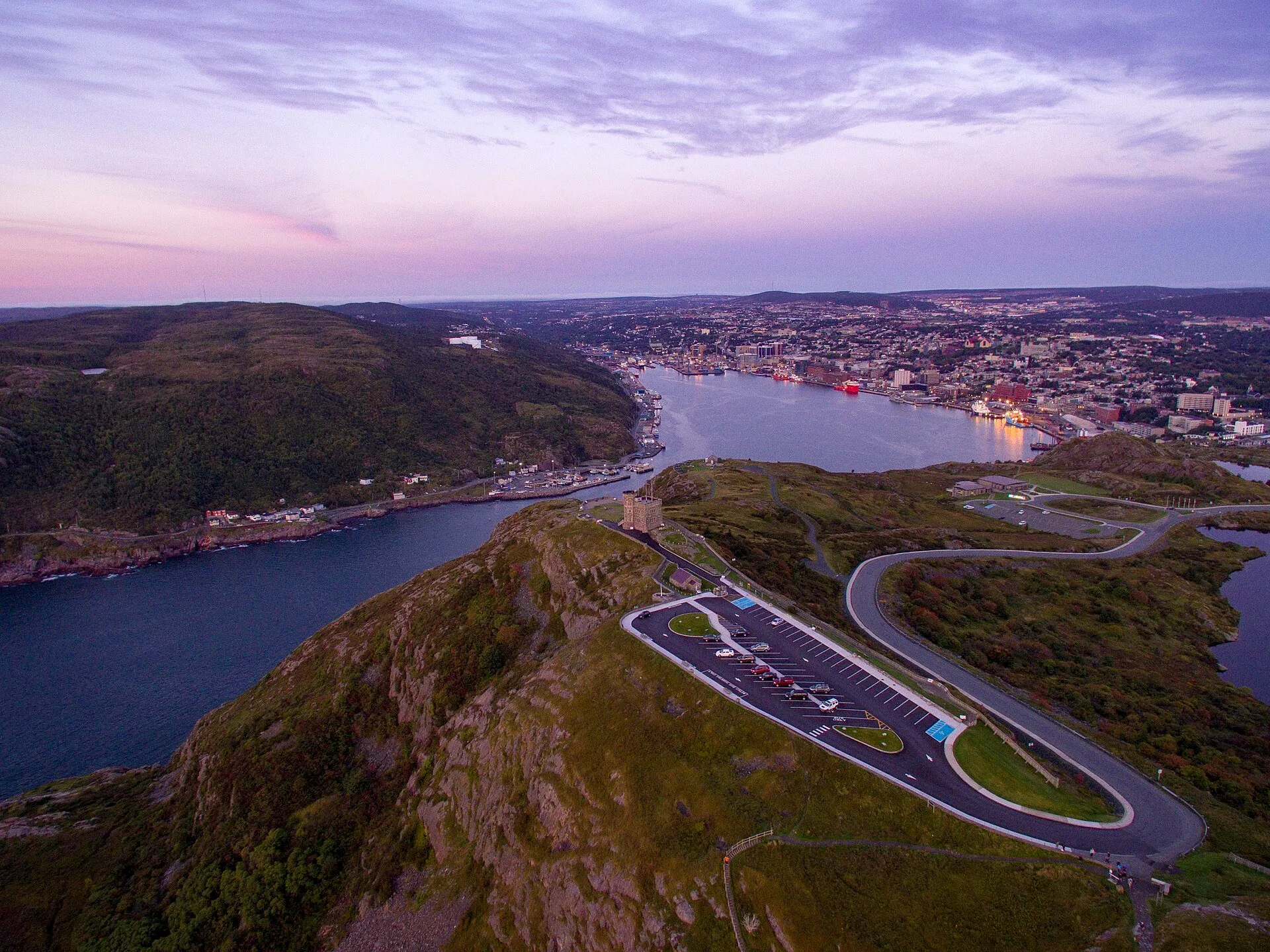

Filmed here: Frontier. The Frontier drive · every spot from every airport
You arrive by ferry — Saint-Pierre, Saint-Pierre-et-Miquelon to Fortune
The boat from Saint-Pierre-et-Miquelon lands at Fortune, on the Burin Peninsula. It is an international crossing: passports, and the rules for bringing a car, are the operator's and the border's to state. SPM Ferries publishes sailings and fares.
SPM Ferries: crossings & current schedule →Stop 1: Swift Current
The first community down Route 210, long a favourite for sport fishing, per the province's tourism site. It also names Vernon's Antique Car Museum here.
Directions →Show on map: Swift Current ↑Other map apps
Apple · Google · Organic Maps · OsmAnd (both work offline, no tracking) · WazeStop 2: Butter Pot Provincial ParkDetour
ParksNL calls Butter Pot one of the most popular provincial parks in Newfoundland and Labrador. Its page lists ponds to swim, fish and paddle, sandy beaches, a campground, trails, and a view over the water from the top of Butter Pot Hill. A place to spend time, not a quick stop.
Stopping here adds 6.6 km to the drive.
Directions →Show on map: Butter Pot Provincial Park ↑Other map apps
Apple · Google · Organic Maps · OsmAnd (both work offline, no tracking) · WazeStop 3: Railway Coastal MuseumDetour
At 495 Water Street, St. John's old railway station, now the Railway Coastal Museum, about the Newfoundland Railway and the coastal boats.
Stopping here adds 0.9 km to the drive.
Directions →Show on map: Railway Coastal Museum ↑Other map apps
Apple · Google · Organic Maps · OsmAnd (both work offline, no tracking) · WazeStop 4: Trans-Canada Highway Zero KmDetour
Mile Zero of the Trans-Canada, beside St. John's City Hall on New Gower Street, the old Trans-Canada.
Stopping here adds 0.8 km to the drive.
Directions →Show on map: Trans-Canada Highway Zero Km ↑Other map apps
Apple · Google · Organic Maps · OsmAnd (both work offline, no tracking) · Waze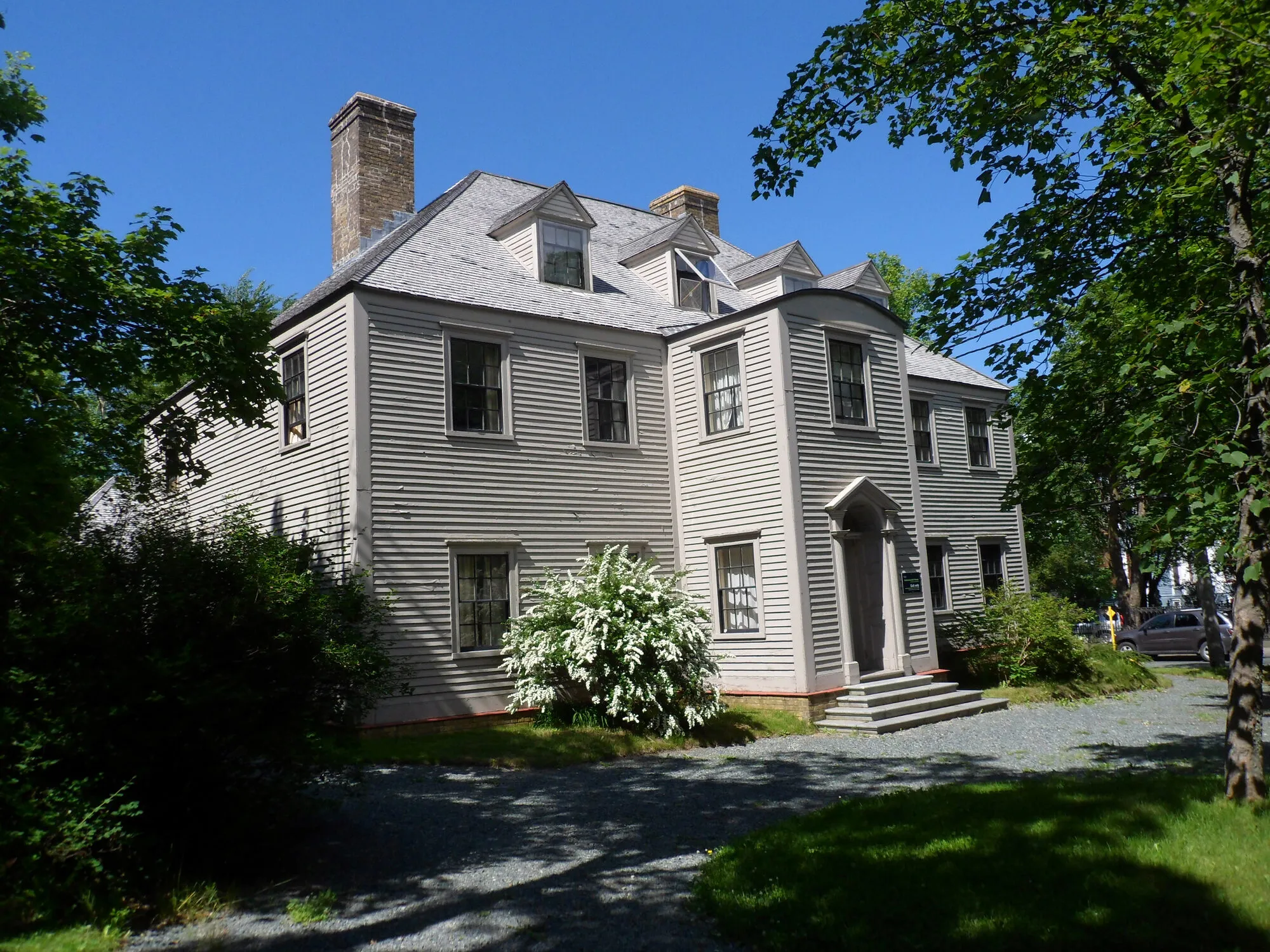
Photograph: Mo Laidlaw · CC BY-SA 3.0 Stop 5: Cathedral Basilica of Saint John the BaptistDetour
A few hundred metres along Military Road: Parks Canada's register describes a massive stone cathedral built in the mid 19th century in the Lombard Romanesque Revival style, a national historic site since 1983.
Stopping here adds 1.2 km to the drive.
Directions →Show on map: Cathedral Basilica of Saint John the Baptist ↑Other map apps
Apple · Google · Organic Maps · OsmAnd (both work offline, no tracking) · WazePhotograph: Mo Laidlaw · CC BY-SA 3.0 Stop 6: Terry Fox Mile 0
Terry Fox's statue at Mile 0 of his Marathon of Hope, which began in St. John's on April 12, 1980, when he dipped his right leg in the Atlantic Ocean.
Directions →Show on map: Terry Fox Mile 0 ↑Other map apps
Apple · Google · Organic Maps · OsmAnd (both work offline, no tracking) · WazeStop 7: Quidi VidiDetour
A small village on its own harbour, north of Signal Hill. The Canadian Register of Historic Places lists Mallard Cottage here, a national historic site typical of the houses Irish immigrants built in the early 1800s, and the Quidi Vidi Battery, a provincial historic site rebuilt on the site of a British coastal battery.
Stopping here adds 3.2 km to the drive.
Directions →Show on map: Quidi Vidi ↑Other map apps
Apple · Google · Organic Maps · OsmAnd (both work offline, no tracking) · Waze

Scan with your phone to open this page there. Then tap Keep for offline before you lose signal.
⛽ Fuel and gravel, road by road ▾
- Route 220 →Whole road: 7 fuel stations mapped, longest gap 35 km. Unpaved mapped: none; 0% has no surface tag, so unknown.
- Route 210 →Whole road: 5 fuel stations mapped, longest gap 105 km. Unpaved mapped: none; 0% has no surface tag, so unknown.
- Route 1 →Whole road: 54 fuel stations mapped, longest gap 119 km. Unpaved mapped: none; 68% has no surface tag, so unknown.
- Route 2 →Whole road: 10 fuel stations mapped, longest gap 28 km. Unpaved mapped: none; 70% has no surface tag, so unknown.
Drive measured Nov 1, 2026, Fortune ferry terminal to Signal Hill (Cabot Tower). Your maps app gives the time on the day. How we measure
367 km. Off the ferry at Fortune to Signal Hill (Cabot Tower), on Routes 220, 210, 1 and 2.
Sunrise and sunset at Signal Hill (Cabot Tower), by month
| The 15th | First light | Sunrise | Sunset | Last light |
|---|---|---|---|---|
| Jan | 7:09 am | 7:44 am | 4:35 pm | 5:09 pm |
| Feb | 6:35 am | 7:07 am | 5:22 pm | 5:54 pm |
| Mar | 6:44 am | 7:15 am | 7:05 pm | 7:36 pm |
| Apr | 5:40 am | 6:12 am | 7:48 pm | 8:21 pm |
| May | 4:47 am | 5:23 am | 8:29 pm | 9:06 pm |
| Jun | 4:21 am | 5:02 am | 8:59 pm | 9:40 pm |
| Jul | 4:39 am | 5:18 am | 8:55 pm | 9:33 pm |
| Aug | 5:22 am | 5:56 am | 8:14 pm | 8:48 pm |
| Sep | 6:06 am | 6:37 am | 7:14 pm | 7:45 pm |
| Oct | 6:47 am | 7:18 am | 6:14 pm | 6:45 pm |
| Nov | 6:32 am | 7:05 am | 4:25 pm | 4:59 pm |
| Dec | 7:06 am | 7:42 am | 4:09 pm | 4:45 pm |
Worked out for the 15th of each month at this spot, in local time. First and last light are when the sun is 6° below the horizon: light enough to see and shoot by. The weather line at the top has today's.
Places to eat on the way
192 places to eat within 2 km of this drive, in the order you pass them.
The longest stretch with nothing mapped on it is 105.5 km, after The Tea Rose, until Breen's.
Show all 192
- Sage Head Cafecafékm 0.3
- Sarah Rays Placerestaurantkm 6.2 · 710 m off the road
- Sharon's Nook Coffee Shoprestaurantkm 6.3 · 878 m off the road
- Tim Hortonscafékm 60.1
- McDonald'sfast foodkm 60.3
- The Tea Roserestaurantkm 98.3
- Breen'srestaurantkm 203.8
- Robin's Donutscafékm 204.1
- Meghan's Restaurantrestaurantkm 228.4
- A&Wfast foodkm 275.6
- Tim Hortonscafékm 275.7
- Subwayfast foodkm 275.7
- Mary Brown'srestaurantkm 276.3
- Robin's Donutsfast foodkm 347.7 · 1760 m off the road
- Donovan's Irvingrestaurantkm 348.7 · 1243 m off the road
- Subwayfast foodkm 348.7 · 1881 m off the road
- Costco Food Courtfast foodkm 348.7 · 478 m off the road
- Starbuckscafékm 348.8 · 378 m off the road
- Five Guysrestaurantkm 348.9 · 439 m off the road
- A&Wfast foodkm 349.1
- A&Wfast foodkm 349.1
- Pizza Hutrestaurantkm 349.2 · 383 m off the road
- McDonald'sfast foodkm 349.4 · 1614 m off the road
- Tim Hortonscafékm 349.4 · 1834 m off the road
- Wendy'sfast foodkm 349.4 · 296 m off the road
- Tim Hortonscafékm 349.4 · 306 m off the road
- Mary Brown'sfast foodkm 349.4 · 1735 m off the road
- Fat Bastard Burritorestaurantkm 349.4 · 405 m off the road
- KFCfast foodkm 349.4 · 1658 m off the road
- McDonald'sfast foodkm 349.4 · 1610 m off the road
- Old Town Pizzeriarestaurantkm 349.4 · 1708 m off the road
- A&Wfast foodkm 349.4 · 325 m off the road
- Taco Bellfast foodkm 349.5 · 1684 m off the road
- Acropolis Pizzarestaurantkm 349.5 · 382 m off the road
- Full House Restaurantrestaurantkm 349.5 · 323 m off the road
- Tim Hortonscafékm 349.5 · 347 m off the road
- Asian Caferestaurantkm 349.7 · 1619 m off the road
- McDonald'sfast foodkm 350.6 · 156 m off the road
- Extreme Pitafast foodkm 350.7 · 331 m off the road
- Smitty'srestaurantkm 350.9 · 353 m off the road
- Harvey'sfast foodkm 350.9 · 464 m off the road
- Thaï Expressfast foodkm 350.9 · 328 m off the road
- Harvey'sfast foodkm 350.9 · 466 m off the road
- Subwayfast foodkm 351 · 391 m off the road
- Pizza Delightrestaurantkm 351 · 330 m off the road
- Tim Hortonscafékm 351 · 325 m off the road
- Booster Juicefast foodkm 351 · 173 m off the road
- Tim Hortonscafékm 351 · 327 m off the road
- Little Caesarsfast foodkm 351.1 · 282 m off the road
- Dairy Queenfast foodkm 351.1 · 276 m off the road
- Landwash Brewerypubkm 352.8 · 964 m off the road
- Johny & Mae'sfast foodkm 352.8 · 960 m off the road
- The Sweet Newfie Kitchenfast foodkm 354.1 · 1941 m off the road
- Oscars Eatery & Caférestaurantkm 354.1 · 1852 m off the road
- Jasmine's Restaurantrestaurantkm 355.2 · 1610 m off the road
- Dairy Queenfast foodkm 355.3 · 1498 m off the road
- Redrock Bar & Grillrestaurantkm 355.3 · 1524 m off the road
- New Moon Restaurantrestaurantkm 355.4 · 1517 m off the road
- Ches's Fish and Chipsfast foodkm 355.4 · 1359 m off the road
- Tim Hortonscafékm 355.4 · 1475 m off the road
- Topsail Road Pizzeria and Loungefast foodkm 355.4 · 1483 m off the road
- Big Cheese Pizzafast foodkm 355.4 · 1377 m off the road
- Jungle Jim'srestaurantkm 355.4 · 1374 m off the road
- Sushi Makirestaurantkm 355.4 · 1374 m off the road
- Starbuckscafékm 355.4 · 1488 m off the road
- Mary Brown'sfast foodkm 356.4 · 1398 m off the road
- Mary Brown'sfast foodkm 356.4 · 1404 m off the road
- Burger Kingfast foodkm 356.9 · 983 m off the road
- McDonald'sfast foodkm 356.9 · 975 m off the road
- Tim Hortonscafékm 356.9 · 953 m off the road
- Tim Hortonscafékm 356.9
- Peter's Pizzarestaurantkm 357 · 1190 m off the road
- Rack and Roll Lounge and Games Roompubkm 357 · 1294 m off the road
- Red Pepperrestaurantkm 357 · 1202 m off the road
- Subwayfast foodkm 357 · 1095 m off the road
- Wendy'sfast foodkm 358.1 · 977 m off the road
- Domino'sfast foodkm 358.9 · 1479 m off the road
- Mary Brown'sfast foodkm 359 · 1331 m off the road
- The Big R Restaurantrestaurantkm 359.5 · 1194 m off the road
- Mr. Subfast foodkm 360.3 · 1646 m off the road
- Subwayfast foodkm 360.5 · 1559 m off the road
- The Cove Climbing Cafécafékm 360.5 · 851 m off the road
- Tim Hortonscafékm 360.5 · 1624 m off the road
- Burger Kingfast foodkm 360.5 · 1658 m off the road
- KFCfast foodkm 360.5 · 1704 m off the road
- Tim Hortonscafékm 360.5 · 369 m off the road
- RJ Pinoy Yumrestaurantkm 361.5 · 1643 m off the road
- No Name Pizzafast foodkm 361.5 · 1617 m off the road
- Ziggy Peelgoodsfast foodkm 361.5 · 1581 m off the road
- The Station Loungepubkm 361.5
- Humphreys Restaurant and Pubrestaurantkm 361.9
- Fabulous Foodsrestaurantkm 361.9 · 1055 m off the road
- Magic Wok Eateryrestaurantkm 361.9
- Chinched Bistrorestaurantkm 362
- Fiddlers Pubpubkm 362
- Fat Bastard Burritofast foodkm 362.2
- Downtown Pizza fast foodkm 362.2
- Kelly's Pubpubkm 362.2
- Shamrock City Pubpubkm 362.2
- Christian'spubkm 362.2
- Adelaide Oyster Houserestaurantkm 362.2
- Gahan Housepubkm 362.2
- Subwayfast foodkm 362.2
- Yellowbelly Brewerypubkm 362.3
- The Kegrestaurantkm 362.3
- Afghan Restaurantrestaurantkm 362.3
- Piatto Restaurantrestaurantkm 362.3 · 152 m off the road
- The Republicpubkm 362.3 · 155 m off the road
- The Sprout Restaurantrestaurantkm 362.3 · 157 m off the road
- Jack Astor'srestaurantkm 362.3
- O'Reilly'spubkm 362.3
- Trapper John's Museum & Pubpubkm 362.3
- Rob Roy Pubpubkm 362.3
- Green Sleeves Pub & Restaurantpubkm 362.3
- Formosa Tea Houserestaurantkm 362.3 · 527 m off the road
- Celtic Hearthrestaurantkm 362.3
- Bridie Molloy’spubkm 362.3
- Merchant Tavernrestaurantkm 362.3
- Chinchedrestaurantkm 362.3 · 176 m off the road
- Carribean Cornerrestaurantkm 362.3
- LIVrestaurantkm 362.3
- Frugal Steinsrestaurantkm 362.3
- Saltwaterrestaurantkm 362.3
- Black Cat Pizzeriarestaurantkm 362.3 · 526 m off the road
- Casa Amigos Restaurant NLrestaurantkm 362.3 · 211 m off the road
- Tim Hortonscafékm 362.3 · 529 m off the road
- Leo's Fish and Chipsfast foodkm 362.3 · 621 m off the road
- Ches' Fish & Chipsfast foodkm 362.3 · 578 m off the road
- Sushi Islandrestaurantkm 362.5
- Ziggy Peelgoods French Friesfast foodkm 362.5
- Jumping Bean Coffeecafékm 362.5 · 464 m off the road
- 3 Sisters Vietnamese Subsfast foodkm 362.7
- Duke of Duckworthpubkm 362.7
- Cojones Tacos & Tequilarestaurantkm 362.7
- Oliver'srestaurantkm 362.8
- Water St.Varietycafékm 362.8
- Smoke's Poutinefast foodkm 362.8
- Biancarestaurantkm 362.8
- The Fifth Ticketrestaurantkm 362.8
- Peaceful Loftrestaurantkm 363
- Bamboo Gardenrestaurantkm 363
- Bagel Caferestaurantkm 363
- Ziggy Peelgoodfast foodkm 363 · 1631 m off the road
- Big Bite Pitafast foodkm 363 · 1631 m off the road
- Tim Hortonscafékm 363 · 1530 m off the road
- MajesTeacafékm 363 · 1645 m off the road
- Donati'sfast foodkm 363 · 1523 m off the road
- Fat Nanny'scafékm 363
- Shalimarrestaurantkm 363
- Pop's Dinerrestaurantkm 363 · 1530 m off the road
- NJ's Kitchenrestaurantkm 363 · 1482 m off the road
- Ship Pubpubkm 363
- Hungry Heartcafékm 363 · 335 m off the road
- Georgestown Cafe and Bookshelfcafékm 363 · 714 m off the road
- Smitty'srestaurantkm 363 · 1530 m off the road
- Noodle Namirestaurantkm 363 · 1517 m off the road
- Portagerestaurantkm 363
- No.4 Restaurant & Barrestaurantkm 363 · 167 m off the road
- India Gaterestaurantkm 363
- Saltwaterrestaurantkm 363
- Subwayfast foodkm 363 · 1667 m off the road
- Quintana'srestaurantkm 363 · 1661 m off the road
- Big Ben's Pubpubkm 363 · 1648 m off the road
- The Georgetown Pubpubkm 363 · 794 m off the road
- Sun Sushi & Bubbled Tearestaurantkm 363.2
- Get Stuffedrestaurantkm 363.2
- Fixed Coffee and Bakingcafékm 363.2
- J Korean Restaurantrestaurantkm 363.2
- Pirestaurantkm 363.2
- The Parlourrestaurantkm 363.3 · 338 m off the road
- Smitty'srestaurantkm 363.4
- Beavertailsfast foodkm 363.4 · 455 m off the road
- Portobello's Restaurantrestaurantkm 363.5
- Chatters Coffeecafékm 363.5
- Classic Cafe Eastcafékm 363.6
- Coffee Matterscafékm 363.6
- Zachary's Restaurantrestaurantkm 363.6
- Bannerman Brewing Co.pubkm 363.6
- Piattorestaurantkm 363.7 · 1754 m off the road
- Jumping Beancafékm 363.8 · 1598 m off the road
- Desi Mealrestaurantkm 363.8 · 1649 m off the road
- Pizza Supremerestaurantkm 363.8 · 1655 m off the road
- Wedgwood Cafe & Cateringrestaurantkm 363.8 · 1686 m off the road
- Sequerra's Restaurantrestaurantkm 363.8 · 1646 m off the road
- Breen's Delicafékm 363.8 · 1847 m off the road
- Mary Brown'sfast foodkm 363.8 · 1765 m off the road
- International Flavoursrestaurantkm 363.9
- Battery Cafecafékm 363.9
- Gracie Joe'srestaurantkm 364.1 · 329 m off the road
- Robin's Donutsfast foodkm 364.3 · 1525 m off the road
- Newfoundland Chocolate Cafecafékm 364.8
- Inn of Oldepubkm 365.4 · 1114 m off the road
Not ranked or complete, and nobody pays to be here. No opening hours: phone ahead. Open map data, read 2026-10-18 (how we measure). Missing one? Add it to the map or email us the details.
Run a place to stay near Signal Hill (Cabot Tower)?
Places to stay on this site come from Best Kind Stays, run by the same people: places that book with their owner, never a booking platform. Listing is free and nothing paid changes the order.
How to be listed on Best Kind Stays ↗Want directions on your own booking page? That's a separate, private service and never appears here. Email us to ask
Access, as its own page says: Partly step-free: The visitor centre's accessible washrooms and accessible parking in both lots; an all-terrain mobility aid booked ahead. From the main lot to Cabot Tower is a sloped gravel path, and Burma Road is mostly flat gravel. Gibbet Hill, Ladies' Lookout and the North Head Trail are uneven and steep, with stairs. The visitor centre's film has closed captions and ASL. Accessible travel, with the sources →
More about this drive
Doing it electric
- Fast chargers on this drive
- Marystown km 60, Goobies km 204, Paradise km 348, St. John’s km 350
- Longest stretch without one
- 144 km
- Marystown → Goobies, of 366 km driven
- Nearest fast charger to Signal Hill (Cabot Tower)
- 17 km
- by road, at St. John’s
The chargers
Marystown km 60 of the drive
Marystown Hotel and Convention Centre 180-190 Ville Marie Dr, Marystown, NL A0E 2M0
CCS and CHAdeMO plugs · 62.5 kW DC fast charger
Directions →Other map apps
Apple · Google · Organic Maps · OsmAnd (both work offline, no tracking) · WazeGoobies km 204 of the drive
Irving Oil 162 Trans Canada
CCS and CHAdeMO plugs · 62.5 kW DC fast charger
Directions →Other map apps
Apple · Google · Organic Maps · OsmAnd (both work offline, no tracking) · WazeParadise km 348 of the drive, 2.4 km off it
Paradise Town Hall 28 McNamara Dr, Paradise, NL A1L 1Y5
CCS and CHAdeMO plugs · 62.5 kW DC fast charger
Directions →Other map apps
Apple · Google · Organic Maps · OsmAnd (both work offline, no tracking) · WazeSt. John’s km 350 of the drive
The Shoppes at Galway 42 Danny Drive, St. John’s
CCS and CHAdeMO plugs · 62.5 kW DC fast charger
Directions →Other map apps
Apple · Google · Organic Maps · OsmAnd (both work offline, no tracking) · Waze
Charging: about 100 km of range every 15 minutes, and most EVs to 80% in less than an hour. You start it with a free ChargePoint account, with the ChargePoint app or card. NL Hydro, read November 1, 2026.
Coming in 2026 (NL Hydro, October 22, 2026): Whitbourne (km 277; CCS and CHAdeMO plugs · ultra-fast, up to 175 kW to one car, 350 kW where a site has two or more chargers) and St. John’s, a second site in the same town (km 350; CCS and CHAdeMO plugs · ultra-fast, up to 175 kW to one car, 350 kW where a site has two or more chargers). Not counted until it opens.
NL Hydro fast chargers within 3 km of the drive. Check the app for one that's working. Exported October 22, 2026. How we measure
Paved or not, per the map
- Mapped as unpaved
- 0.1 km
- Lake to Lookout Walk (0.07 km, 0 km from Signal Hill (Cabot Tower))
- Mapped as paved
- 71%
- 231.6 km of 367 km driven
- No surface tag on the map
- 29%
- 92.6 km: surface not recorded
In a rental car: Hertz Canada’s terms say “use off paved roads or on roads which are not regularly maintained” voids the damage waiver. Check your own agreement. Hertz’s terms ↗. Source for these figures: OSRM driving profile, stored route query, with node annotations; OpenStreetMap surface tags from a local Geofabrik extract (Overpass unreachable), checked 2026-11-01. Today's road conditions: 511.
Before you go
These change, so we link to the people who keep them up to date.
The crossing you arrive onCheck the operator; the season matters
SPM Ferries sails between Saint-Pierre and Fortune. Confirm the sailing, and what you can bring across, before you plan the drive.
spm-ferries.fr →MooseYear round, worst between dusk and dawn
The province says the likelihood of injury in a moose collision is twice as high between dusk and dawn as in daytime. This is 367 km, much of it unlit two-lane highway; plan the drive for daylight where you can.
gov.nl.ca →Road conditionsYear round, matters most November–April
Conditions change fast on this coast. Check before you set off.
511nl.ca →
Questions
How far is Signal Hill (Cabot Tower) from the Fortune ferry?+
367 km from the ferry terminal to Signal Hill (Cabot Tower).
What route do I take?+
Routes 220, 210, 1 and 2. Your maps app has the turns.
Can I bring a car on the boat?+
That is SPM Ferries' and the border's to state: read the operator's page before you set off.
No recorded track yet.Drove it? Send yours →
Put this map on your site
Run a place to stay, a tour or a town page on this drive? Add this map to your site. It shows your guests the drive and its distance. It is free, needs no account, and we keep the figures current.
<iframe src="https://fromtheairport.xyz/embed/for-signal-hill"
  width="100%" height="420" style="border:0" loading="lazy"
title="Driving route: Fortune ferry terminal to Signal Hill (Cabot Tower)"></iframe>?lat=&lon=&label= to the URL to pin your own property on the map.Every distance and coordinate on this page was checked against its source on November 1, 2026. Origin: OpenStreetMap node/7740476043 — Fortune. Destination: OpenStreetMap relation/7531386 — Cabot Tower. Planning only: not live and not for navigation; roads and conditions change. Terms