Paradise → Ocean Sciences Centre, Logy Bay
Killick Coast
Getting to the start from every airport and ferry ↓
- Distance
- 81.4 km
- Drive time
- In your maps app ↗
Use another map app
Apple Maps · Google Maps · Organic Maps · OsmAnd (both work offline, no tracking) · WazeNo photograph of Killick Coast yet.
Taken one? Send it and we credit you by name.
Filmed here: Below. The Below drive · every spot from every airport
Stop 1: Portugal Cove ferry terminal
The ferry to Bell Island leaves here, carrying passengers and a limited number of vehicles. On the island are the former submarine iron mines, a clifftop lighthouse and outdoor murals, per the province's tourism site.
Directions →Show on map: Portugal Cove ferry terminal ↑Other map apps
Apple · Google · Organic Maps · OsmAnd (both work offline, no tracking) · WazeStop 2: Bauline
Route 21 runs from Portugal Cove through Bauline on its way to Pouch Cove, as the province's tourism site lays out the drive.
Directions →Show on map: Bauline ↑Other map apps
Apple · Google · Organic Maps · OsmAnd (both work offline, no tracking) · Waze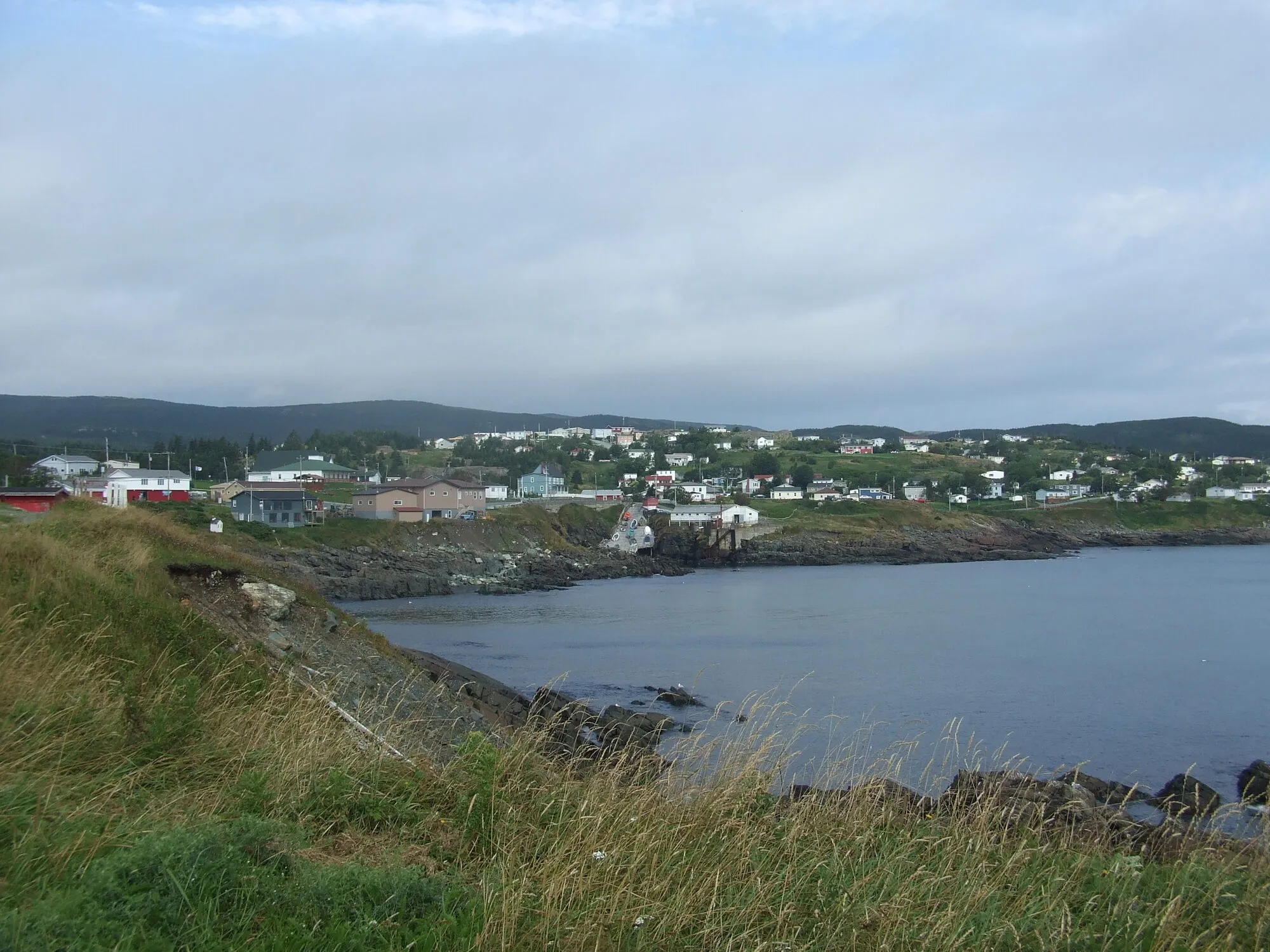
Photograph: Haydn Blackey · CC BY-SA 2.0 Stop 3: Pouch Cove
Said "pooch". Many of the hikes on this coast are East Coast Trail paths, including the Biscan Cove Path near here, per the province's tourism site.
Directions →Show on map: Pouch Cove ↑Other map apps
Apple · Google · Organic Maps · OsmAnd (both work offline, no tracking) · WazeStop 4: Cape St. Francis LighthouseDetour
At the end of a gravel road that the province's tourism site calls good berry picking country.
Stopping here adds 12.1 km to the drive.
Directions →Show on map: Cape St. Francis Lighthouse ↑Other map apps
Apple · Google · Organic Maps · OsmAnd (both work offline, no tracking) · WazeStop 5: Flatrock
One of the settled coves along this rugged shore, with another view of the coast round each bend, per the province's tourism site.
Directions →Show on map: Flatrock ↑Other map apps
Apple · Google · Organic Maps · OsmAnd (both work offline, no tracking) · WazeStop 6: Torbay Beach
Start of the Father Troy Trail along the shore, past fields of farm animals and wildflowers, per the province's tourism site.
Directions →Show on map: Torbay Beach ↑Other map apps
Apple · Google · Organic Maps · OsmAnd (both work offline, no tracking) · Waze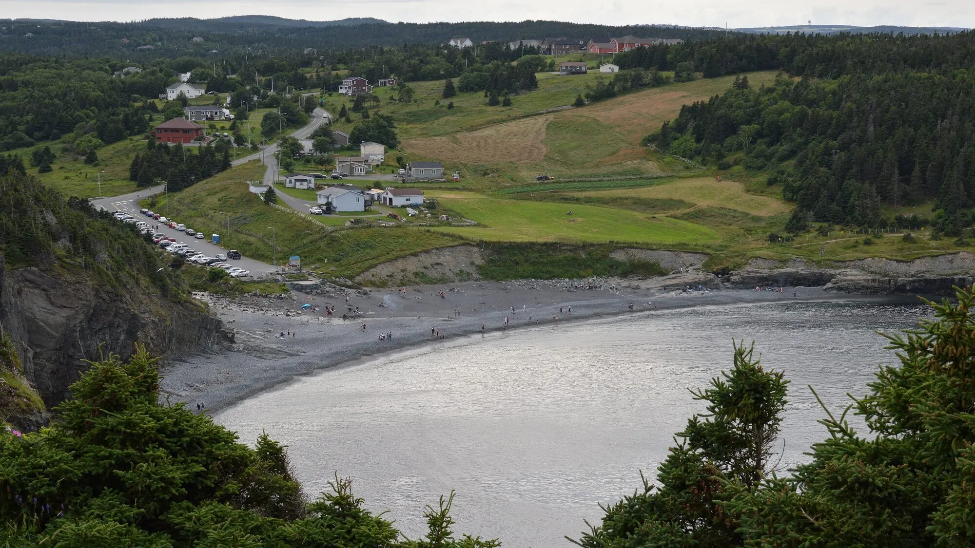
Photograph: Ryan Hodnett · CC BY-SA 4.0 Stop 7: Middle Cove Beach
A beach on the shore road between Torbay and Logy Bay, one of the settled coves the province's tourism site names on this drive.
Directions →Show on map: Middle Cove Beach ↑Other map apps
Apple · Google · Organic Maps · OsmAnd (both work offline, no tracking) · Waze


Scan with your phone to open this page there. Then tap Keep for offline before you lose signal.
⛽ Fuel and gravel, road by road ▾
- Route 1 →Whole road: 54 fuel stations mapped, longest gap 119 km. Unpaved mapped: none; 68% has no surface tag, so unknown.
- Route 40 →Whole road: 6 fuel stations mapped, longest gap 5.7 km. Unpaved mapped: none; 28% has no surface tag, so unknown.
- Route 21 →Whole road: 0 fuel stations mapped, longest gap 9 km. Unpaved mapped: none; 0% has no surface tag, so unknown.
Drive measured Oct 20, 2026, Paradise to Ocean Sciences Centre, Logy Bay. Your maps app gives the time on the day. How we measure
81.4 km. The province’s Killick Coast runs from Paradise to Portugal Cove, where the Bell Island ferry leaves, then by Route 21 through Bauline to Pouch Cove and down Route 20 past Flatrock, Torbay and Middle Cove to Logy Bay.
Many of the walks on this coast are East Coast Trail paths, per the province’s tourism site. The gravel road to Cape St. Francis is a side trip from Pouch Cove.
Sunrise and sunset at Ocean Sciences Centre, Logy Bay, by month
| Month (the 15th) | Sunrise | Sunset |
|---|---|---|
| January | 7:44 am | 4:34 pm |
| February | 7:07 am | 5:22 pm |
| March | 7:15 am | 7:05 pm |
| April | 6:12 am | 7:48 pm |
| May | 5:23 am | 8:29 pm |
| June | 5:01 am | 8:59 pm |
| July | 5:17 am | 8:55 pm |
| August | 5:55 am | 8:14 pm |
| September | 6:37 am | 7:14 pm |
| October | 7:18 am | 6:13 pm |
| November | 7:05 am | 4:25 pm |
| December | 7:42 am | 4:09 pm |
Worked out for the 15th of each month at this spot, in local time. The weather line at the top has today's.
Places to eat on the way
44 places to eat within 2 km of this drive, in the order you pass them.
The longest stretch with nothing mapped on it is 37.1 km — after The Grounds, until Lorina’s Restaurant.
All 44, in the order you pass them — open the list
- Canteenrestaurantkm 0 · 422 m off the road
- Little Caesarsfast foodkm 0.3 · 734 m off the road
- Pür & Simplerestaurantkm 0.3 · 164 m off the road
- Starbuckscafékm 0.3
- Burger Kingfast foodkm 0.3 · 191 m off the road
- Pizza Housefast foodkm 0.6
- Subwayfast foodkm 1.3
- Domino'sfast foodkm 1.4
- Cojonesrestaurantkm 1.5
- Robin's Donutsfast foodkm 1.6 · 822 m off the road
- Coffee Matters Paradisecafékm 1.8
- Ye's Wokrestaurantkm 1.9
- A&Wfast foodkm 1.9
- Tiny's Bar and Grillrestaurantkm 2.3
- Dairy Queenfast foodkm 2.4
- Kozy Kitchenrestaurantkm 2.6
- Donovan's Irvingrestaurantkm 2.7 · 1426 m off the road
- Mary Brown'sfast foodkm 2.7
- Mr. G's Loungepubkm 2.7 · 259 m off the road
- Ocean Sushirestaurantkm 2.7 · 252 m off the road
- Peter's Pizzafast foodkm 2.7 · 266 m off the road
- Subwayfast foodkm 2.7 · 819 m off the road
- Tim Hortonscafékm 2.7 · 203 m off the road
- McDonald'sfast foodkm 2.7 · 468 m off the road
- By the Beachrestaurantkm 15.2 · 1916 m off the road
- Beachy Cove Cafe B&Brestaurantkm 18.1
- Wild Horses Pub & Eateryrestaurantkm 18.2
- Landing's Seafood Houserestaurantkm 18.3
- Dick's Seaview Lounge and Restaurantrestaurantkm 24
- Dick's Seaview Lounge and Restaurantrestaurantkm 24.1
- Ferry Last Stop Cafecafékm 30.5
- The Groundscafékm 32 · 1201 m off the road
- Lorina’s Restaurantrestaurantkm 69.1
- Mary Brown'sfast foodkm 70
- Atlas Pizzarestaurantkm 70.4 · 622 m off the road
- Killick Coast Restaurant and Take-outrestaurantkm 70.5 · 347 m off the road
- Pizza Delightrestaurantkm 77.8 · 1595 m off the road
- Subwayfast foodkm 77.8 · 1653 m off the road
- Little Caesarsfast foodkm 77.8 · 1980 m off the road
- Freshiirestaurantkm 77.8 · 1975 m off the road
- Burger Kingfast foodkm 77.8 · 1711 m off the road
- Swiss Chaletrestaurantkm 77.8 · 1715 m off the road
- Boston Pizzarestaurantkm 77.8 · 1532 m off the road
- Tim Hortonscafékm 77.8 · 1613 m off the road
Not ranked or complete, and nobody pays to be here. No opening hours: phone ahead. Open map data, swept 2026-10-18. How we measure · Add a missing place
New place to eat, or one that's missing? This list comes from OpenStreetMap, so nobody can pay to be on it. Add it to the map yourself (about twenty minutes on a phone), or email us the details and we'll put it on the map.
Doing it electric
- Fast chargers on this drive
- Paradise km 0
- Longest stretch without one
- 81 km
- Paradise → Ocean Sciences Centre, Logy Bay, of 81 km driven
- Nearest fast charger to Ocean Sciences Centre, Logy Bay
- 21.1 km
- by road, at Paradise
No fast charger at Ocean Sciences Centre, Logy Bay. From Paradise it is 81 km there and the same back: plan on about 162 km on one charge, more in cold weather or with the heat on. Or charge at Paradise, 21.1 km from Ocean Sciences Centre, Logy Bay by road, off this drive's own road.
NL Hydro fast chargers within 3 km of the drive. Check the app for one that's working. Exported 2026-10-22. How we measure
Paved or not, per the map
- Mapped as unpaved
- 0.1 km
- Main street (0.05 km, 16.7 km from Ocean Sciences Centre, Logy Bay)
- Mapped as paved
- 87%
- 44.2 km of 81.4 km driven
- No surface tag on the map
- 13%
- 6.6 km: surface not recorded
In a rental car: Hertz Canada’s terms say “use off paved roads or on roads which are not regularly maintained” voids the damage waiver. Check your own agreement. Hertz’s terms ↗. Source for these figures: OSRM driving profile, stored route query, with node annotations; OpenStreetMap surface tags via Overpass, checked 2026-10-20. Today's road conditions: 511.
Before you go
These change, so we link to the people who keep them up to date.
MooseYear round, worst between dusk and dawn
The province states the likelihood of injury in a moose collision is twice as high between dusk and dawn as in daytime. The shore roads between Portugal Cove and Pouch Cove are unlit outside the towns.
gov.nl.ca →Road conditionsYear round, matters most November–April
Routes 21 and 20 are narrow, winding shore roads. Fog comes in from the sea in any season.
511nl.ca →
Questions
How far is the Killick Coast?+
81.4 km from Paradise through Portugal Cove, Bauline, Pouch Cove, Flatrock and Torbay to the Ocean Sciences Centre at Logy Bay, measured on the OSRM driving profile. Newfoundland and Labrador Tourism, which names the drive, gives about 80 km, so the two agree closely. The gravel road to Cape St. Francis is a side trip, measured with its stop. The province adds the ferry crossing to Bell Island on top.
Where do I start, and which way round?+
The province gives Paradise, Portugal Cove or Logy Bay as starts, and says its drives can be taken in either direction. This page runs from Paradise round the coast to Logy Bay, which is a short drive from St. John's.
Can I take the car to Bell Island?+
The ferry from Portugal Cove carries passengers and a limited number of vehicles, per the province's tourism site. Check the province's ferry schedules before you go: https://www.tw.gov.nl.ca/ferryservices/schedules
No recorded track yet.Drove it? Send yours →
Put this map on your site
Run a place to stay, a tour or a town page on this drive? Add this map to your site. It shows your guests the drive and its distance. It is free, needs no account, and we keep the figures current.
<iframe src="https://fromtheairport.xyz/embed/killick-coast"
  width="100%" height="420" style="border:0" loading="lazy"
title="Driving route: Paradise to Ocean Sciences Centre, Logy Bay"></iframe>?lat=&lon=&label= to the URL to pin your own property on the map.Every distance and coordinate on this page was checked against its source on October 20, 2026. Origin: OpenStreetMap node/1291572865 — Paradise. Destination: OpenStreetMap way/278791686 — Ocean Sciences Centre (Memorial University).