Staying in Bonavista
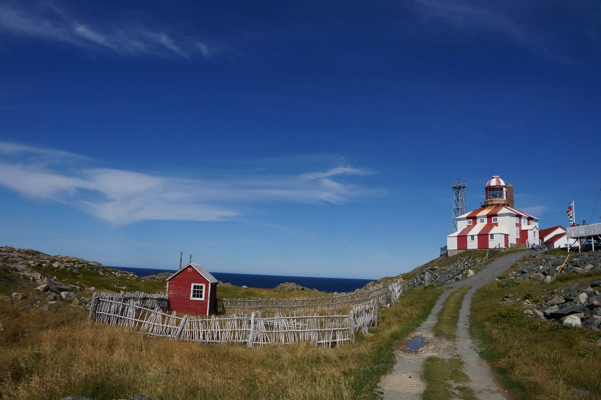
Icebergs pass Bonavista: the best weeks are late May and early June. When they come, and where to watch →
Icebergs near Bonavista: email me when it's worth the drive
Best weeks are late May and early June. One or two emails a year, in spring: when icebergs are showing up near Bonavista, and which drive gets you there.
One step left: click the link in the confirmation email and you're on the list.
That didn't go through. Try again in a moment.
Iceberg-season email only, never shared. Unsubscribe any time, from any email. Privacy.
Places to stay in Bonavista
No place to stay in Bonavista is listed on Best Kind Stays yet. Every place it lists →
A place listed in Bonavista shows on 12 pages here: the town page, 6 drives to Bonavista, 2 arenas and stages and 3 trails nearby.
Own a place in Bonavista? List it, free →
Guests book with you directly. Nothing paid changes the order.
Games and shows in Bonavista
What's on soon in Bonavista
An expected date follows the event's yearly pattern. Check the organiser's page before you book.
Getting here
To Bonavista from every airport and ferry, measured by road.
Visitor information
- Matthew Legacy Visitor Information Centre · 0.6 km · 709-468-1493
- Elliston Visitor Information Centre · 7 km · 709-468-7080
By road. Every centre, by region →
Art in and near Bonavista
- Artistry on Church · Craft studiohere
- Proprietor's House · Gallery0.9 km
- Wierd Wonderful and One of a Kind · Art shop6.5 km
- Elliston Adventure Craft Store · Craft studio7.4 km
By road, from the open map. Shops and galleries keep their own hours. All the art, by region →
When you get to Bonavista
- Where to eat near Bonavista → 22 places, A to Z, with addresses and phone numbers.
Short drives from Cape Bonavista Lighthouse
Other map apps
Apple · Google · Organic Maps · OsmAnd (both work offline, no tracking) · WazeOr any of these: nearest first, measured by road from Cape Bonavista Lighthouse. Each one's page has directions.
- Dungeon Provincial Parkstop5.1 km
A ParksNL day-use park around a collapsed sea cave, with two ocean windows in a sheep pasture, just before the cape.
- Mathew (ship) Replicamuseum6.8 kmDirections →
Other map apps
Apple · Google · Organic Maps · OsmAnd (both work offline, no tracking) · Waze - Mockbeggar Plantationstop6.8 km
A provincial historic site and the legacy of F.
- Ryan Premises National Historic Sitestop7.1 km
The Parks Canada site on Bonavista's waterfront tells five centuries of the salt-fish trade in the merchant premises where it ran.
- Klondike Trailtrail · 6.4 km walk · moderate8.4 km
Opened at Elliston in June 2014, a hundred years after the disaster it exists for.
- Elliston Puffin Viewing Pointstop14 km
The viewpoint facing the Elliston puffin colony, close enough to watch from land in season.
- Green Island (Catalina) Lighthouselighthouse23 kmDirections →
Other map apps
Apple · Google · Organic Maps · OsmAnd (both work offline, no tracking) · Waze
More, up to 63 km (8)
- Little Catalina to Maberly Trailtrail · 27.4 km walk · strenuous24 km
- Port Unionstop25 km
A town built by a union and founded by the fishermen's leader Sir William Coaker, as the province's tourism site tells it.
- Murphy's Cove to Lodge's Pond Trailtrail · 6.4 km loop · moderate26 km
- Port Rextontown50 km
- Skerwink Trailtrail · 5.1 km loop · moderate51 km
- Skerwink Trail lookoutstop52 km
A lookout on the Skerwink Trail at Port Rexton, which Travel + Leisure listed among the 25 best hikes in North America and Europe, per the province's tourism site.
- Trinitytown58 km
- Fort Point viewpointstop63 km
The mapped bench at Fort Point, across the harbour mouth, on the old gun battery's ground.
Distances by road from Cape Bonavista Lighthouse, measured on OpenStreetMap November 7, 2026. Your maps app gives the time on the day. How we measure
Out on the water from Bonavista
Boat tours that leave from here. The sea and the season decide what you see: ask them what is about. Times and prices are on each one's page.
Discovery Sea Adventure Tours (Fast Rescue Craft boat tour) ↗
Discovery Sea Adventure Tours · Dock adjacent to the Matthew Legacy Building on Roper Street
Tours depart from our dock in Bonavista, adjacent to the Matthew Legacy Building on Roper Street.
Junction Campbell Street and Station Road, Bonavista
Join us for a 2-hour tour of Bonavista's beautiful rugged coast, view whales, puffins, icebergs…
Out and about near Bonavista, by season
What the open map holds by road from Bonavista, the town's festivals and races, what passes in season, and what the town says it has. Check each place before you go.
A ski trail, bike trail or boat launch near Bonavista that isn't here? Send the GPX or tell us where, and we put it on the open map.
More about Bonavista
Guides with places near Bonavista
- Provincial parks Dungeon Provincial Park, Lockston Path Provincial Park
Before you come
- Renting a car Who rents cars at the airports, and what to do when they are sold out
- Your home licence here What a visiting driver needs, and when a long stay changes the rules
- What to wear & carry Layers, cold water and fog, from the safety authorities
Filmed here: Peter Pan & Wendy and Severance. What was shot in Bonavista →
Know Bonavista? Help fill these in
- Walked GPX for trails in Bonavista the open map lacks →
The Town lists the Old Days Pond and Beaver Pond boardwalks and the Cape Shore Trail (mapped with gaps); Hike Discovery lists the Lighthouse Trail at King's Cove; the open map does not have them whole yet. One walked GPX of any of them makes its page, measured like the rest.
Send the GPX
The email is already written: fill in what you know and send it. We check it and add it. Your name goes on what you send, or none if you prefer.
Plan days from here
Every night in Bonavista, with days out from here. You pick where you arrive.
Plan days from Bonavista →The town is Bonavista as OpenStreetMap places it (node/463178693). Other towns: every town start page →
Bonavista's community page → The town's score and what it is asking for, on towns.fromtheairport.xyz.