Argentia ferry terminal → Heart's Content
Argentia ferry terminal to Heart's Content
- Distance
- 106.5 km
- Drive time
- In your maps app ↗
Use another map app
Apple Maps · Google Maps · Organic Maps · OsmAnd (both work offline, no tracking) · Waze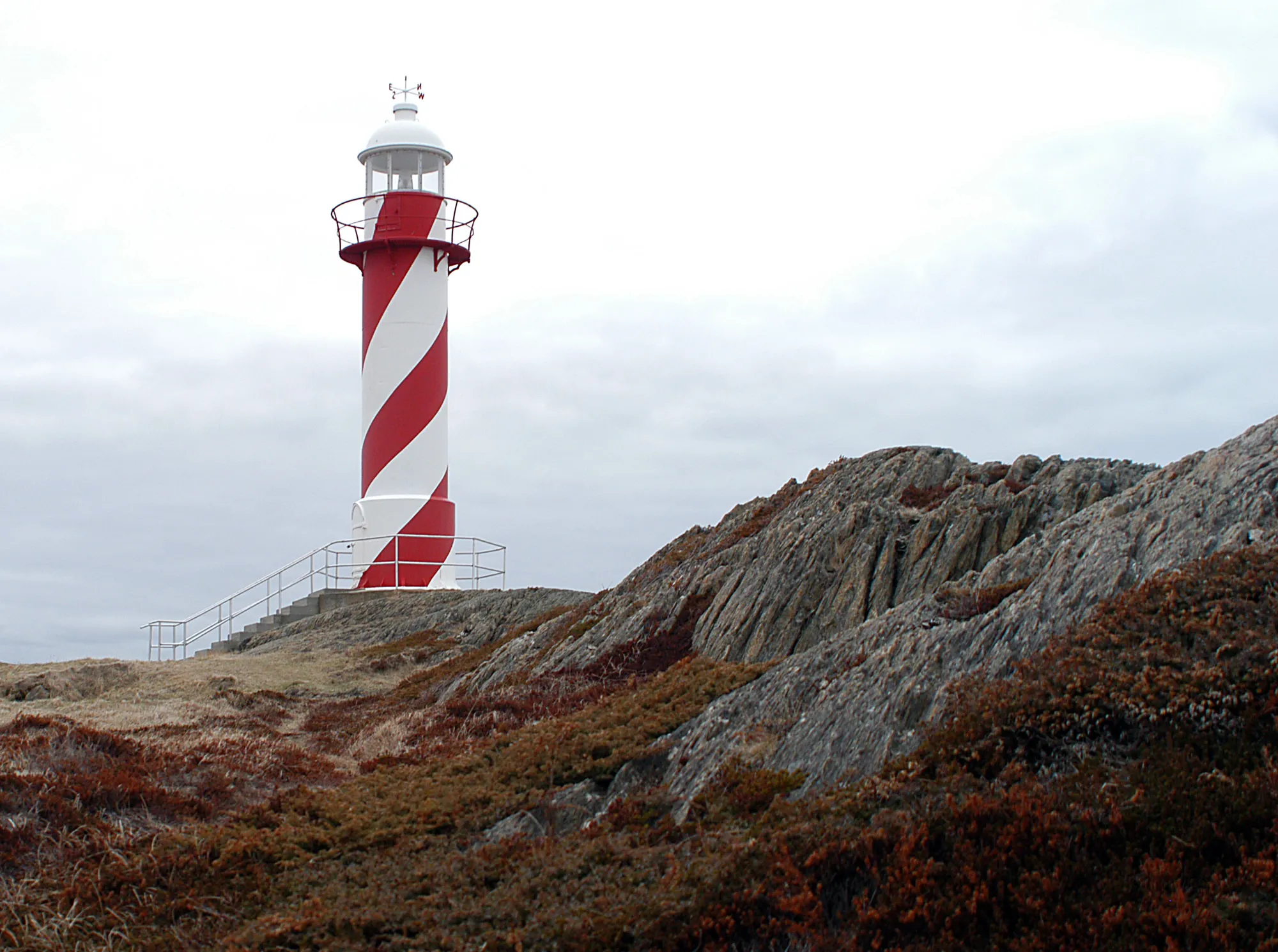
.jpg)
You arrive by ferry — North Sydney, Nova Scotia to Argentia
Marine Atlantic gives this crossing as about 16.5 hours over 518 km of water, mid-June to late September, up to three times a week — against seven hours year-round and daily into Port aux Basques. It is a long way round, chosen for where it lands you. Check Marine Atlantic for sailings and fares.
Operated by Marine Atlantic. The drive below starts where the boat lands.
Crossings & current schedule →Faded lines are other drives from Argentia ferry terminal into this area: Harbour Grace (96 km), Clarke's Beach (78 km), Brigus (78 km). Each splits off where its line leaves this one.
Stop 1: Fitzgerald's Pond Provincial Park
A Provincial Park Reserve, not a provincial park with a campground. ParksNL defines the category: pre-1997 parks whose campground area was deproclaimed and privatised, with the rest kept to protect natural features. ParksNL states that park reserves have no visitor services, so there is no washroom. It sits on the driven line and costs no extra driving.
Directions →Show on map: Fitzgerald's Pond Provincial Park ↑Other map apps
Apple · Google · Organic Maps · OsmAnd (both work offline, no tracking) · WazeStop 2: Shag Rock lookout
A viewpoint OpenStreetMap records beside Route 80, close enough to the driven line that stopping costs nothing. Nothing else is known about it, including what you can see from it. It is here because it is free to try.
Directions →Show on map: Shag Rock lookout ↑Other map apps
Apple · Google · Organic Maps · OsmAnd (both work offline, no tracking) · Waze
Scan with your phone to open this page there. Then tap Keep for offline before you lose signal.
Drive measured Oct 1, 2026, ferry terminal to the town. Your maps app gives the time on the day. How we measure
Add to a trip →Staying here? Days out ↓Keep for offline ↓Download GPX (offline, Garmin)Ferry info: Marine Atlantic →
106.5 km. Argentia ferry terminal to Heart’s Content: the Trans-Canada across the isthmus, then Routes 81 and 80 up the Trinity Bay shore, with water on your left for the last stretch.
Why people come. In 1866 the first permanent transatlantic telegraph cable was landed here, and a message across the ocean went from weeks to minutes. The cable station, an 1875 office with a 1918 extension, still stands off Route 80.
When you get to Heart's Content
- Where to eat near Heart's Content → — 2 places the open map records, alphabetically, with addresses and phone numbers.
New place to eat, or one that's missing? This list comes from OpenStreetMap, so nobody can pay to be on it. Add it to the map yourself (about twenty minutes on a phone), or email us the details and we'll put it on the map.
Short drives from Heart's Content
Other map apps
Apple · Google · Organic Maps · OsmAnd (both work offline, no tracking) · WazeOr any of these: nearest first, measured by road from Heart's Content.
- Heart's Content Lighthouselighthouse2.9 kmDirections →
Other map apps
Apple · Google · Organic Maps · OsmAnd (both work offline, no tracking) · Waze - Railway Station Museumstop21 km
Carbonear's station was built in 1917-18 by the Reid Newfoundland Company, replacing an earlier station destroyed by fire, and stayed the northern terminus of the Brigus Junction to Carbonear branch line until passenger trains ceased in 1984.
Directions →Other map apps
Apple · Google · Organic Maps · OsmAnd (both work offline, no tracking) · Waze The 1884 Harbour Grace railway station, kept as a museum.
Directions →Other map apps
Apple · Google · Organic Maps · OsmAnd (both work offline, no tracking) · Waze- Harbour Gracetown27 kmDirections →
Other map apps
Apple · Google · Organic Maps · OsmAnd (both work offline, no tracking) · Waze - Danny Cleary Lookoutstop28 km
A viewpoint OpenStreetMap records on the way into town.
Directions →Other map apps
Apple · Google · Organic Maps · OsmAnd (both work offline, no tracking) · Waze - Spirit of Harbour Gracestop31 km
A 1943 Douglas DC-3 that served in North Africa in the war and later flew freight between Stephenville and Goose Bay until 1988; Air Labrador's owner donated it to the town in 1993 as the Spirit of Harbour Grace, for the town's part in early transatlantic flight (explorenewfoundlandandlabrador.com).
Directions →Other map apps
Apple · Google · Organic Maps · OsmAnd (both work offline, no tracking) · Waze - Clarke's Beachtown50 kmDirections →
Other map apps
Apple · Google · Organic Maps · OsmAnd (both work offline, no tracking) · Waze - Cupids Legacy Centrestop55 km
A museum at Cupids.
Directions →Other map apps
Apple · Google · Organic Maps · OsmAnd (both work offline, no tracking) · Waze
More, up to 56 km (1)
- Brigustown56 kmDirections →
Other map apps
Apple · Google · Organic Maps · OsmAnd (both work offline, no tracking) · Waze
Distances by road, measured on OpenStreetMap October 16, 2026, from where this route ends. Your maps app gives the time on the day. How we measure
Doing it electric
- Fast chargers on this drive
- none
- Longest stretch without one
- 106 km
- the ARG door → Heart's Content, of 106 km driven
- Nearest fast charger to Heart's Content
- 23 km
- by road, at Carbonear
No fast charger at Heart's Content. From the ARG door it is 106 km there and the same back: plan on about 212 km on one charge, more in cold weather or with the heat on. Or charge at Carbonear, 23 km from Heart's Content by road, off this drive's own road.
Coming in 2026 (NL Hydro, 2026-10-10): Whitbourne (km 46). Not counted until it opens.
NL Hydro fast chargers within 3 km of the drive. Check the app for one that's working. Exported 2026-10-10. How we measure
Paved or not, per the map
- Mapped as unpaved
- none
- Mapped as paved
- 49%
- 44.7 km of 106.5 km driven
- No surface tag on the map
- 51%
- 46.4 km: surface not recorded
Why it matters: Hertz Canada’s terms say “use off paved roads or on roads which are not regularly maintained” voids the damage waiver. Check your own agreement. The terms themselves. Source for these figures: OSRM driving profile, stored route query, with node annotations; OpenStreetMap surface tags via Overpass, checked 2026-10-01. Today's road conditions: 511.
Before you go
These change, so we link to the people who keep them up to date.
The cable stationA published season, and it is shorter than the summer
The Provincial Historic Site opens for part of the year only, and the dates and hours change. Check the province's page before you build the drive around it. The building itself is visible from Route 80 year round.
Check it now →The crossing you arrive onSeasonal — Argentia is not the year-round door
Port aux Basques runs through the winter; Argentia does not. Confirm the sailing first. The other landing is on the far side of the island and turns a 106 km drive into most of a day.
Check it now →MooseYear round, worst between dusk and dawn
The province puts the likelihood of injury in a moose collision at twice as high between dusk and dawn as in daylight. Routes 81 and 80 run unlit through the Trinity Bay side of the peninsula for most of their length.
Check it now →Road conditionsYear round, most of all November to April
The isthmus catches weather from both bays, and the Trans-Canada across it is the only way off the Avalon. Check before you drive, and again before the drive back.
Check it now →
Questions people actually ask
Why drive here from Argentia rather than St. John's?+
It is closer: 106.5 km from the ferry terminal against 132 km from the St. John's airport, measured the same way on the same day. Argentia lands you west of the city, so the drive to Trinity Bay never passes through it. If you are flying in, St. John's is the door; if you are bringing a car across, this is.
What is actually at Heart's Content?+
The cable station where the first lasting transatlantic telegraph cable was landed in 1866. It took communication across the Atlantic from weeks to minutes and kept the town a global communications hub for over a century. The province's historic site describes the surviving buildings as an 1875 office with a 1918 extension, with exhibits on telegraphy and the town's part in it. It sits directly off Route 80.
Is this a day trip off the boat?+
It can be. 106 km each way on good road is an easy half-day with the historic site in the middle. What decides the day is when the crossing gets in and whether the site is open that date. Both are linked above.
What is the ruin beside the ferry terminal?+
The former naval air station at Argentia, which OpenStreetMap records as ruins around the terminal. This page does not send anyone into it: nothing published that we could find says whether the public may walk the site.
No recorded track yet.Drove it? Send yours →
Put this map on your site
Run a place to stay, a tour or a town page on this drive? Add this map to your site. It answers how far from the airport? Free, no account, and we keep the figures current.
<iframe src="https://fromtheairport.xyz/embed/arg-hearts-content"
  width="100%" height="420" style="border:0" loading="lazy"
title="Driving route: Argentia ferry terminal to Heart's Content"></iframe>?lat=&lon=&label= to the URL to pin your own property on the map.Every distance and coordinate on this page was checked against its source on October 1, 2026. Origin: OpenStreetMap node/605220569 — Argentia. Destination: OpenStreetMap node/473136418 — Heart's Content.